Targeted Sensor Data Collection for Generating Map Information

a technology of map information and sensor data, applied in the field of map information generation, can solve the problems of difficult to collect complete map information for a given geographical region, difficult to cover multiple countries at large scale, and inability to match tasks, so as to achieve the effect of greater likelihood of matching tasks

Inactive Publication Date: 2019-01-31
UBER TECH INC
View PDF0 Cites 3 Cited by
  • Summary
  • Abstract
  • Description
  • Claims
  • Application Information

AI Technical Summary

Benefits of technology

The network system described in this patent uses a hybrid approach to collect and aggregate sensor data from multiple regions. It also provides tasks for providers to complete in return for incentives. By determining certain roads or points of interest, the system can target providers who are more likely to complete the tasks based on their current location or future travel plans. This results in a higher likelihood of matching tasks to providers who are interested and able to complete them efficiently. Overall, the system improves map information by utilizing the idle time of providers and optimizing the allocation of tasks.

Problems solved by technology

The technical problem addressed in this patent text relates to providing accurate and efficient mapping information for network systems that offer geographic location-based services to users. This includes both generating map information through collection of sensory data and utilizing pre-existing map information while addressing issues with incomplete coverage and accuracy over time.

Method used


Image

  • Targeted Sensor Data Collection for Generating Map Information
  • Targeted Sensor Data Collection for Generating Map Information
  • Targeted Sensor Data Collection for Generating Map Information

Examples


Embodiment Construction

I. System Overview

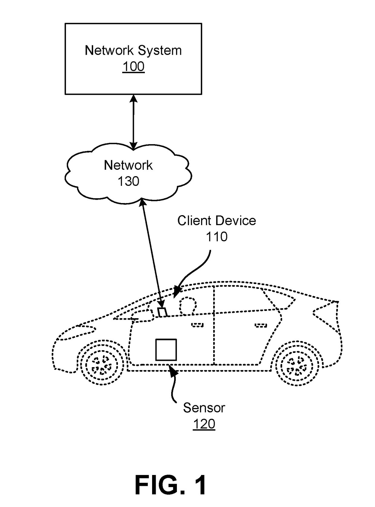
[0013]FIG. 1 is a diagram of a system environment for a network system 100 according to one embodiment. Users of the network system 100 may include providers that provide service to other users. Users may both receive service and provide service as providers of the network system 100. In an example use case, a provider operates a vehicle to transport a user from a first location, referred to herein as a “pickup location,” to a second location, referred to herein as a “destination location.” The network system 100 may determine pickup locations and coordinate providers to pick up users at the pickup locations. Other types of service include, for example, delivery of goods such as mail, packages, or consumable items. In addition to coordinating services between users, the network system 100 can also provide different tasks to providers or users. For example, the network system 100 provides mapping tasks for providers to collect sensor data, which the network system 1...


PUM


Abstract

A network system uses a hybrid passive and active method for aggregating sensor data. The network system processes the sensor data to generate or update map information, which is used to coordinate geographic based services between users of the network system. In an embodiment, to leverage the idle time of users not actively providing services, the network system provides tasks for the users to collect sensor data for roads or points of interest (POIs) within a geographic region for which the network system is missing map information. The network system may determine that a user is more likely to complete a certain task if the target location for sensor data collection is nearby the user's current location. Thus, the network system is able to micro-target users with specific tasks, resulting in a greater likelihood of efficiently matching tasks to users.

Description


Claims


Application Information

Patent Timeline
Owner UBER TECH INC
Why Eureka
Try Eureka