Method and apparatus for determining a geographical location of a mobile communication unit

a mobile communication unit and geographical location technology, applied in biochemistry apparatus and processes, instruments, transmission, etc., can solve the problems of complex calculations, limited gps system, and higher production and maintenance costs of the system

Inactive Publication Date: 2001-06-12
SUTTON GARY
View PDF11 Cites 104 Cited by
  • Summary
  • Abstract
  • Description
  • Claims
  • Application Information

AI Technical Summary

Problems solved by technology

However, GPS systems are limited in that the mobile unit must have unobstructed paths to at least three GPS satellites.
If substantially clear signals cannot be received from the required satellites by the mobile unit, the mobile unit cannot determine its position.
However, this technique is disadvantaged in that calculations are complex requiring higher production and maintenance costs of the system.
Further, the technique requires that the mobile unit process information and perform calculations, adding complexity, size and cost to mobile units.
In addition to the disadvantages discussed above, the positioning method described in the references patent does not allow for an accuracy suitable for locating a mobile unit in emergency situations.
Systems requiring the mobile unit to determine its location are further dis...

Method used


Image

  • Method and apparatus for determining a geographical location of a mobile communication unit
  • Method and apparatus for determining a geographical location of a mobile communication unit
  • Method and apparatus for determining a geographical location of a mobile communication unit

Examples


Embodiment Construction

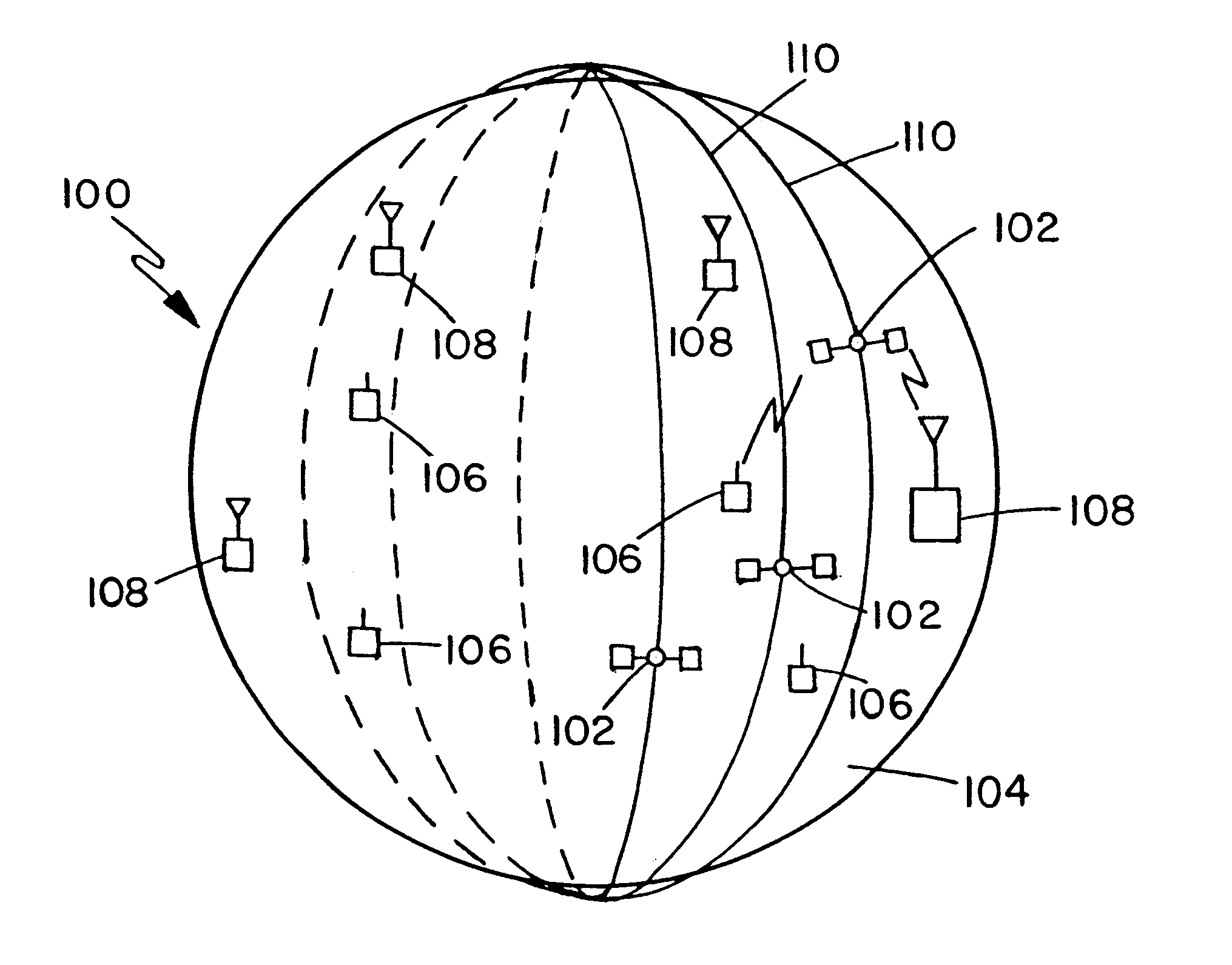
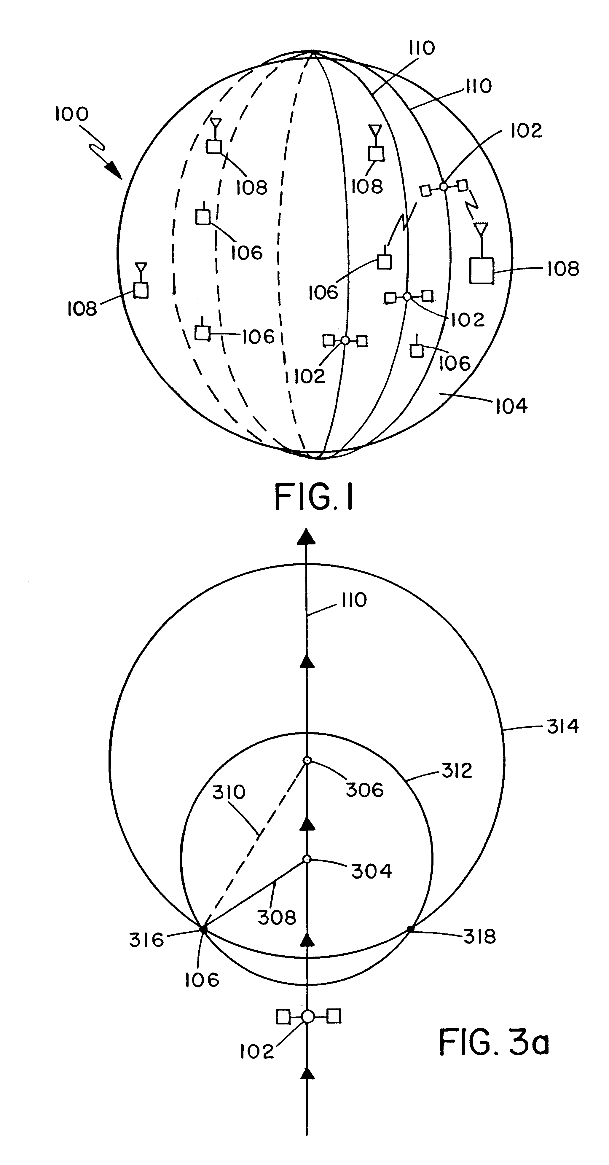
Computer simulations have been performed to assess the performance potential of the method of locating a mobile unit 106 in accordance with the preferred embodiment of the invention. Those skilled will recognize that the following results may not include all sources of error. The following conditions are assumed: The satellite 102 altitude is 800 km judged to be typical of LEO constellations). Two-way pulse (or wideband) instantaneous distance measurements 421-426 with an RMS error of 5 meters (judged a reasonable value, comparable to GPS) are performed every second, and the mobile unit 106 altitude uncertainty is 30 meters RMS. A 2000 km by 2000 km service area is assumed, which is centered at the satellite ground track 404 location at the time signal measurements are initiated.

Each of FIGS. 6, 7, and 8 show the probability (expressed in percent) that the position (x,y) of a mobile unit 106 randomly situated in the service area will be determined with less than the allowable RMS po...


PUM

PropertyMeasurementUnit
Timeaaaaaaaaaa
Speedaaaaaaaaaa
Transmissionaaaaaaaaaa

Abstract

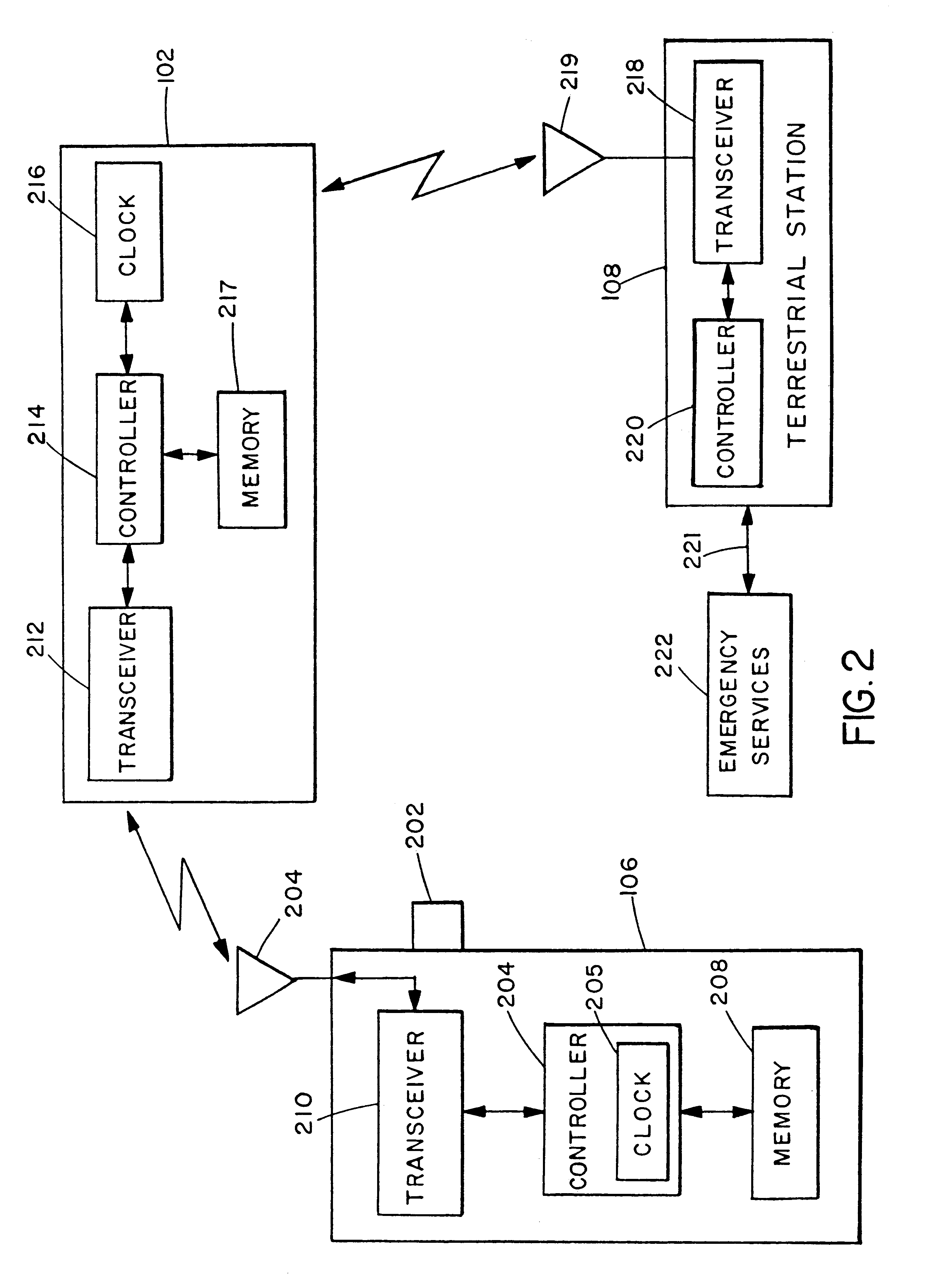
The location of a mobile unit is determined by evaluating the instantaneous distances between an apparatus traveling above the surface of the earth and the mobile unit. The instantaneous distances are determined by measuring the travel time of a plurality of signals and calculating the distance based on the speed of the signal. One of two possible location regions is identified as the region including the location of the mobile unit by observing the motion of the mobile unit resulting from the rotation of the Earth.

Description

1. Field of the InventionThe present invention relates in general to a method and apparatus for determining a geographical location of a mobile unit and more specifically to a method and apparatus for determining a geographical location of a mobile unit using an apparatus traveling above the surface of the Earth.2. Description of the Related Art Communication systems and techniques for determining the location of a mobile unit are known. Many techniques utilize Global Positioning Systems (GPS) which allow a mobile unit to determine its position based on signals from at least three satellites. GPS systems work well when the mobile unit is in an open area such on an ocean or in the air. However, GPS systems are limited in that the mobile unit must have unobstructed paths to at least three GPS satellites. Some GPS systems require a minimum of four satellites to determine the location of a mobile unit. If substantially clear signals cannot be received from the required satellites by the...

Claims


Application Information

Patent Timeline
IPC IPC(8): G01S5/00G01S5/14A01H5/10C12N9/90C12N15/82G01S19/19G01S19/48
CPCA01H5/10C12N9/90C12N15/8243C12N15/8245G01S5/0009G01S5/14G01S2205/006G01S5/0268
Inventor WEILL, LAWRENCE R.SUTTON, GARY
Owner SUTTON GARY
Why Eureka
Try Eureka