

Method and apparatus to generate driving guides
a technology of driving guide and routing information, applied in traffic control systems, navigation instruments, instruments, etc., can solve problems such as difficulty in reading, system not actually storing an image of a directed graph, and too crowded directed graphs
Inactive Publication Date: 2004-11-30
TELE ATLAS NORTH AMERICA
View PDF40 Cites 217 Cited by
- Summary
- Abstract
- Description
- Claims
- Application Information
AI Technical Summary
Problems solved by technology
If links are drawn for all nodes, the directed graph would become too crowded and would be difficult to read.
These systems do not actually store an image of a directed graph.
One general problem with navigation systems is that of how to search or determine the proper navigational route from the possible choices.
This problem is particularly difficult when presented with a large network having many possible routes within which to navigate.
However, in today's fast paced environment many people do not necessarily have the time to learn new navigation systems.
Even once learned, inputting starting locations and destinations can be time consuming and cumbersome.
Current routing, guidance, and map display systems only provide limited help to a driver who does not enter a destination.
Such information is generally too abundant to be effectively displayed for consideration by the driver.
She lives in San Jose and the user knows how to get to her house but doesn't know much about the overall road network in her neighborhood.
The user arrives at the house and finds out that they need to go to Oakland airport, not San Jose airport--and they are late.
This process is more efficient because if the user looked through all roads at all times, there would be too much data to consider and the path is not likely to be the most efficient path.
The traffic problems identified could be any problem, slow traffic, accident, ice conditions, construction, etc.
Method used
View moreImage
Smart ImageViewing Examples

Examples
Embodiment Construction
has been presented for purposes of illustration and description. It is not intended to be exhaustive or to limit the invention to the precise form disclosed, and obviously many modifications and variations are possible in light of the above teaching. The described embodiment was chosen in order to best explain the principles of the invention and its practical application to thereby enable others skilled in the art to best utilize the invention in various embodiments and with various modifications as are suited to the particular use contemplated. It is intended that the scope of the invention be defined by the claims appended hereto.
Login to View More PUM
 Abstract
A navigation device displays major routes and direction indications without a specific destination requirement. Where several possible destinations are presented, the device displays information for a destination at or when nearing decision points for traveling to the destination. Direction indicators can be presented on top of an appropriately scaled map having routes displayed which are integral to the indicators and directions. A destination displayed may be selected to retrieve detailed driving instructions to that specific destination. In one embodiment, the navigation device displays direction indications to major destinations, entrances, exits, and other important facilities in a "highway sign" fashion at major decision points.
Description
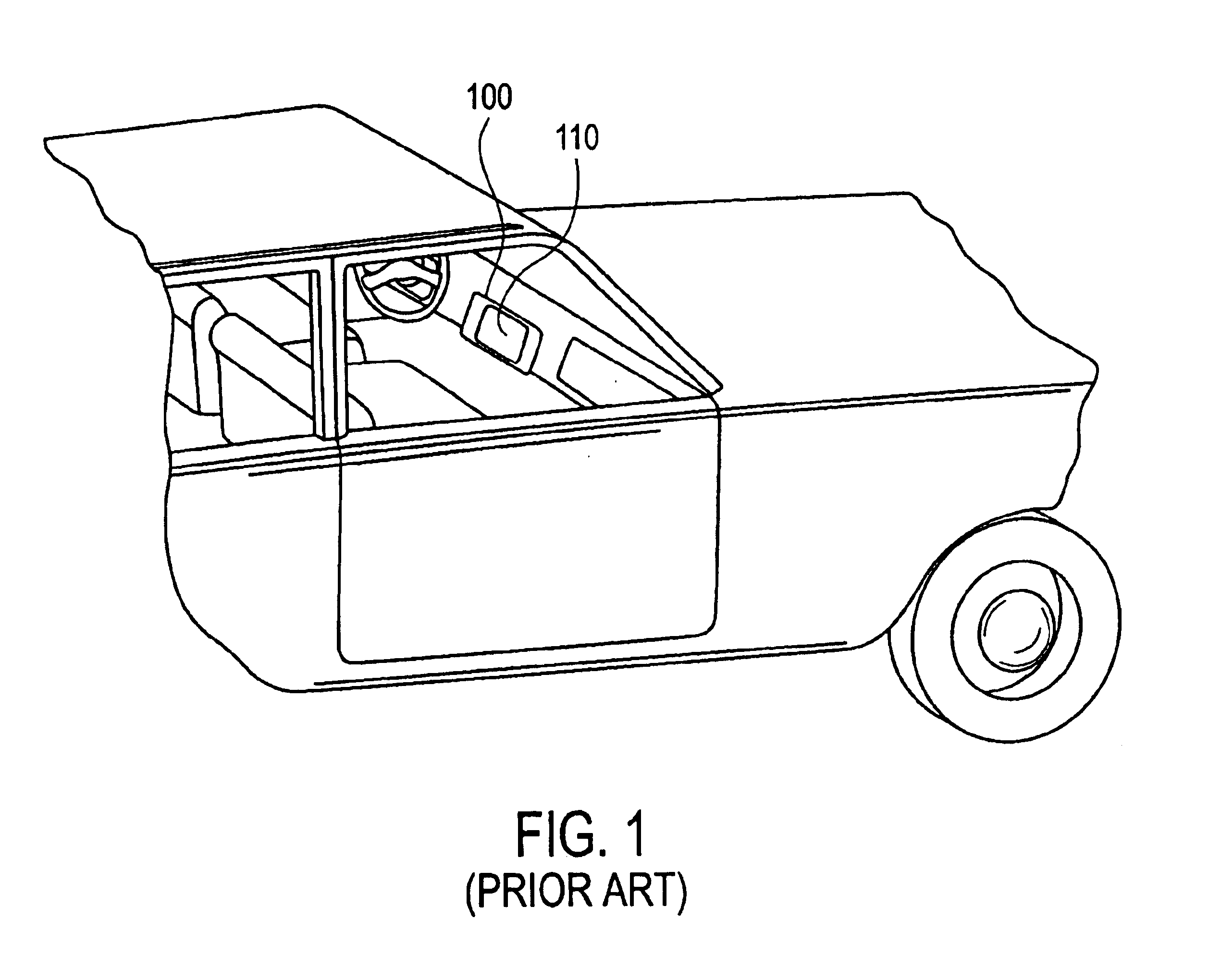
1. Field of the InventionThis invention relates to a method and apparatus for generating routing information, including the generation of driving guides for display to a user.2. Discussion of the BackgroundNavigational Aids built upon small portable, and powerful computers and specialized electronics have revolutionized the concept of maps and methods of finding routes from an origin to a specific destination. One recent breakthrough fueling this revolution is illustrated in FIG. 1, the concept of an automobile based map and direction finding system 100, as described in Loughmiller, Jr. et al., U.S. Pat. No. 4,914,605, issued Apr. 3, 1990, entitled "Apparatus and Method for Displaying a Map," incorporated herein by reference, in its entirety. Additional methods and navigation functionality are also described in Honey et al., U.S. Pat. No. 4,796,191, issued Jan. 03, 1989, entitled "VEHICLE NAVIGATION SYSTEM AND METHOD," also incorporated herein by reference, in its entirety.Such syst...
Claims
Login to View More Application Information
Patent Timeline
 Patent Type & AuthorityPatents(United States)
IPC IPC(8): G01C21/34
CPCG01C21/3605G01C21/3407
InventorKAMEI, ASAOSURANYI, EDWARD J.
OwnerTELE ATLAS NORTH AMERICA