
Method, system and program product for augmenting an image of a scene with information about the scene
a technology of information about the scene and image, applied in the field of image enhancement, can solve the problems of difficult to determine the position or find the path of the user, the problem is magnified, and the user is experienced, and achieve the effect of augmenting the imag
- Summary
- Abstract
- Description
- Claims
- Application Information
AI Technical Summary
Benefits of technology
Problems solved by technology
Method used
Image

Examples
Embodiment Construction
[0020]The present invention provides a user at one computing unit with a real-world image of a scene that has been registered with an elevation model of that scene at another computing unit and provided over a communications network. When the user identifies an area or point of interest in the image, the coordinates are reverse projected onto the elevation model to determine what area or point of interest was identified. Once the area or point of interest is determined, an indication of one or more known features at that location can be overlaid on the image the user sees, such as, for example, symbolic, graphic or textual cartographic data.
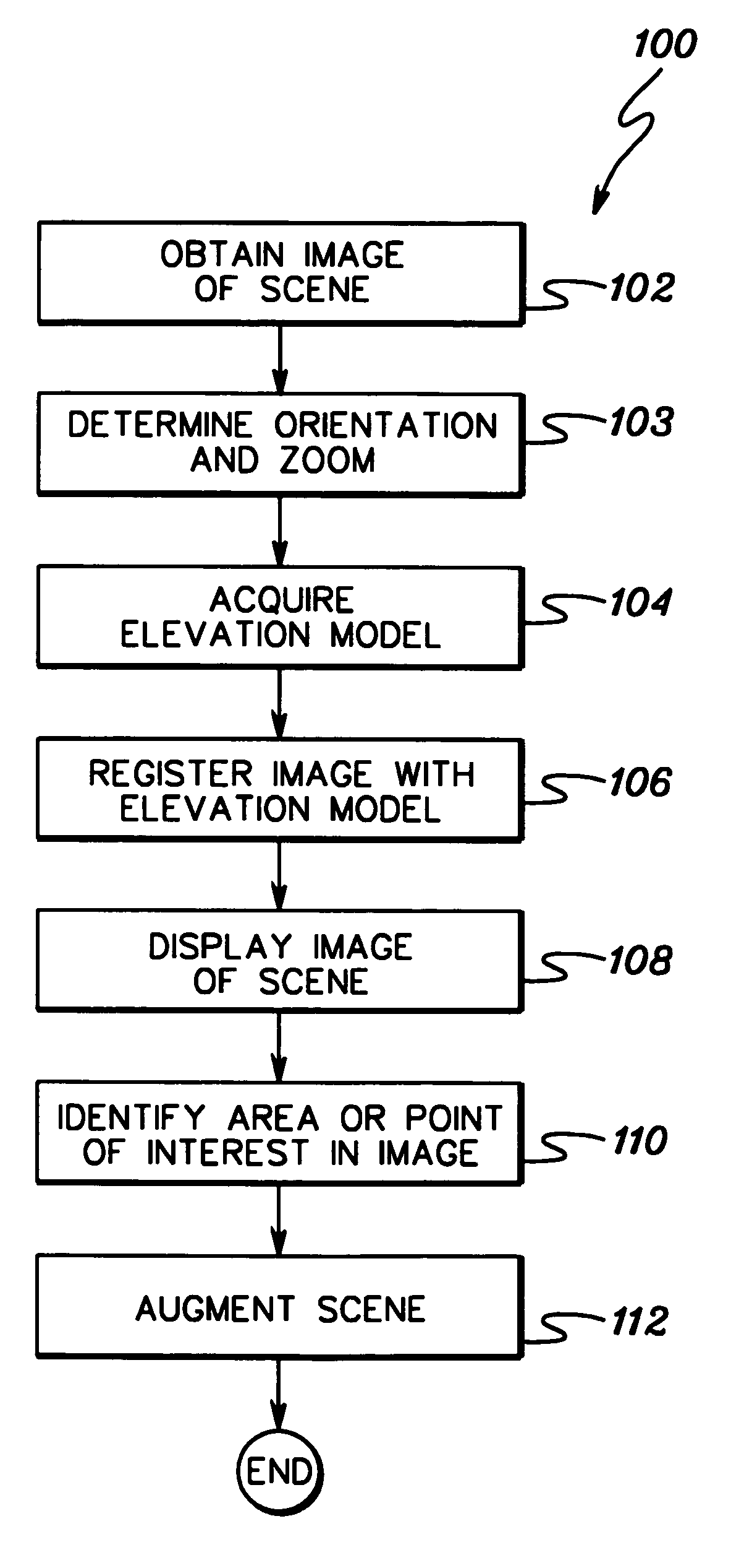
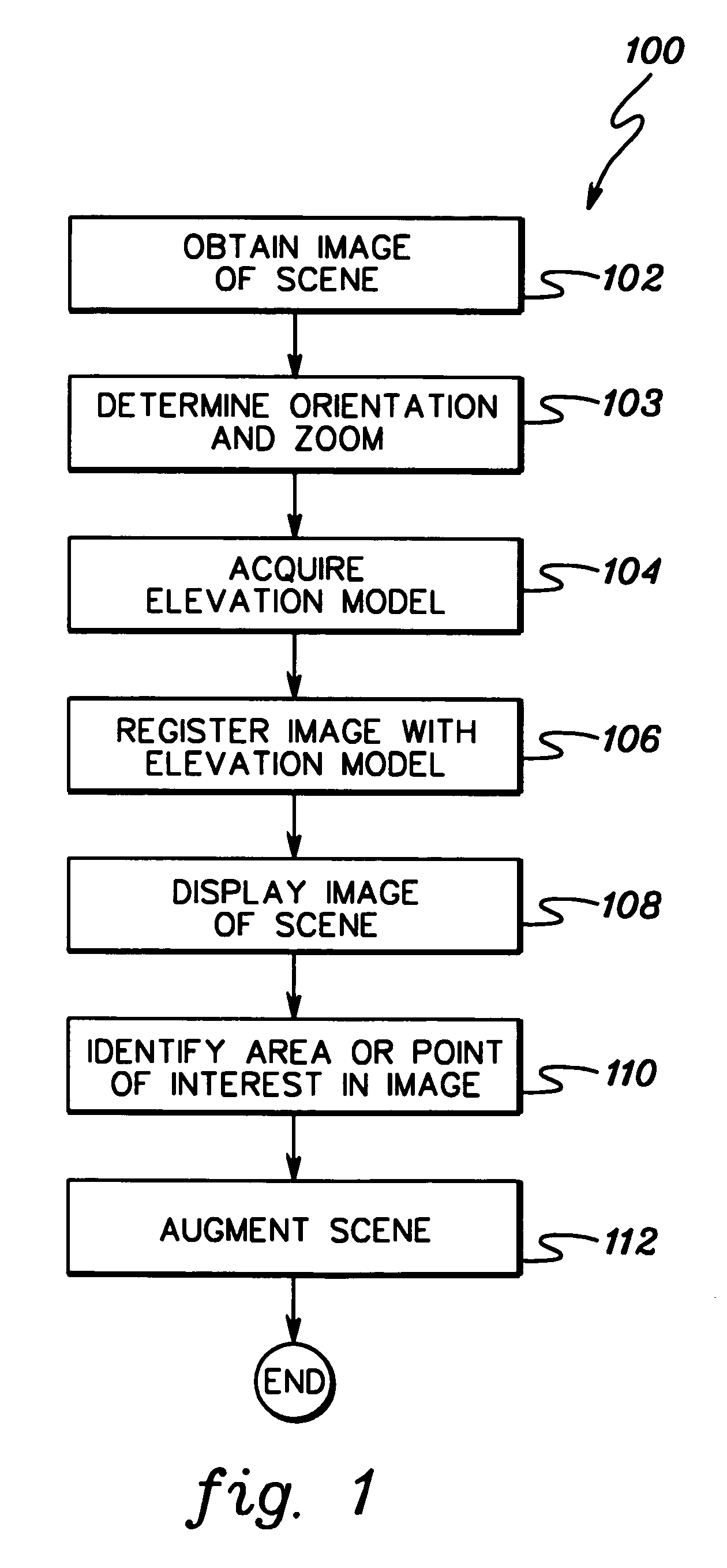
[0021]FIG. 1 is a flow diagram 100 showing one example of the logic used to implement a method of augmenting an image of a scene, in accordance with the present invention. A digital image of a scene is obtained (STEP 102). The image is obtained through the use of an image capturing device, such as, for example, a camera or a camcorder. Further, t...
PUM
 Abstract
Description
Claims
Application Information