

GPS enabled emergency messaging system
a technology of emergency message and gps, applied in the direction of signalling system, electric signalling details, instruments, etc., can solve the problems of lack of geographic control of emergency message dissemination, affecting the life of many people, and affecting the quality of emergency message, so as to minimize the investment in new infrastructure and long-term maintenance costs
- Summary
- Abstract
- Description
- Claims
- Application Information
AI Technical Summary
Benefits of technology
Problems solved by technology
Method used
Image

Examples
Embodiment Construction
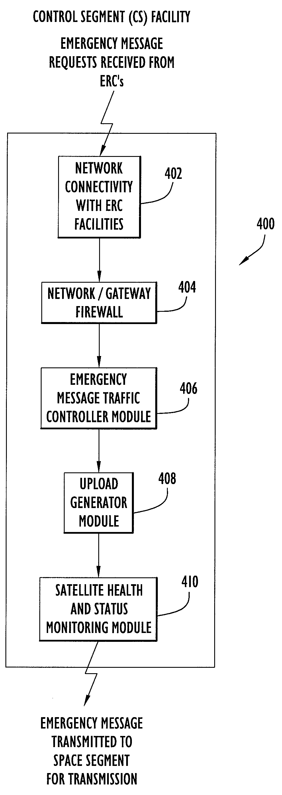
[0037]The following detailed explanation of the figures and of the preferred embodiments of the present invention reveal methods and apparatus for efficiently integrating an emergency message broadcast system capability within the presently deployed global positioning system (GPS) infrastructure.
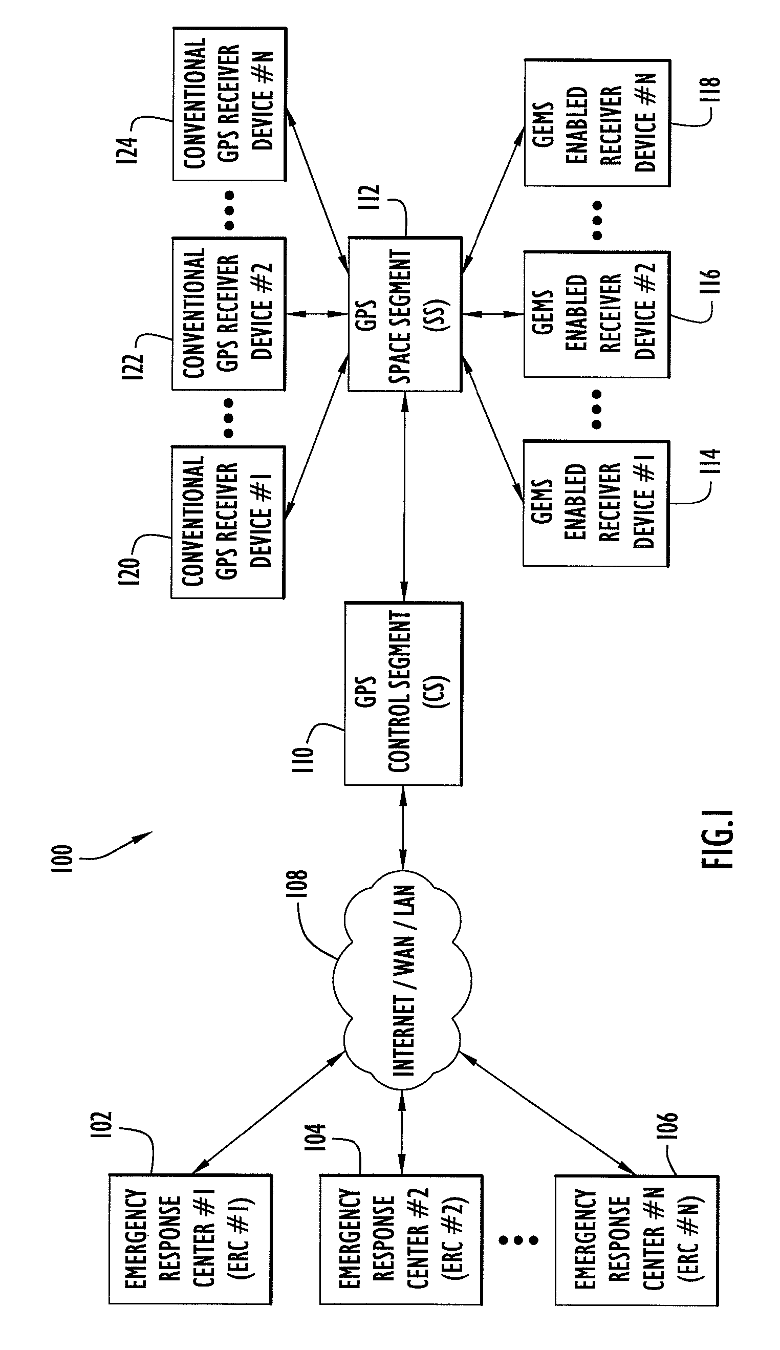
[0038]FIG. 1 is a non-limiting, representative system level diagram of a GPS enabled emergency message system (GEMS) environment in accordance with an exemplary embodiment of the present invention. The GEMS environment includes a plurality of emergency response centers (ERC's) (102, 104 and 106), each with a network connection 108 that can include multiple network components, including private local area network (LAN) segments, private wide area network (WAN) segments, and / or the Internet, by which emergency message requests, with broadcast request times and designated broadcast areas, are transmitted to a GPS ground-based control segment (CS) facility 110. The CS facility processes incoming...
PUM
 Abstract
Description
Claims
Application Information