Method and system for representation of geographical features in a computer-based system

a computer-based system and geographic feature technology, applied in the field of cartographic databases, can solve the problems of increasing the storage requirements of cartographic databases, and the read time of databases, and achieve the effect of improving the read time and storage requirements of databases

Active Publication Date: 2010-09-28
HERE GLOBAL BV
View PDF19 Cites 37 Cited by
  • Summary
  • Abstract
  • Description
  • Claims
  • Application Information

AI Technical Summary

Problems solved by technology

This increases the storage requirements of the carto

Method used


Image

  • Method and system for representation of geographical features in a computer-based system
  • Method and system for representation of geographical features in a computer-based system
  • Method and system for representation of geographical features in a computer-based system

Examples


Embodiment Construction

)

[0018]The present invention provides a polynomial spline based method for representing geographic features in cartographic databases. The use of polynomial splines reduces the amount of data needed to accurately represent geographic features in cartographic databases. This results in smaller database sizes and shorter database read times, while maintaining or enhancing the accuracy with which geographic features are depicted in the database.

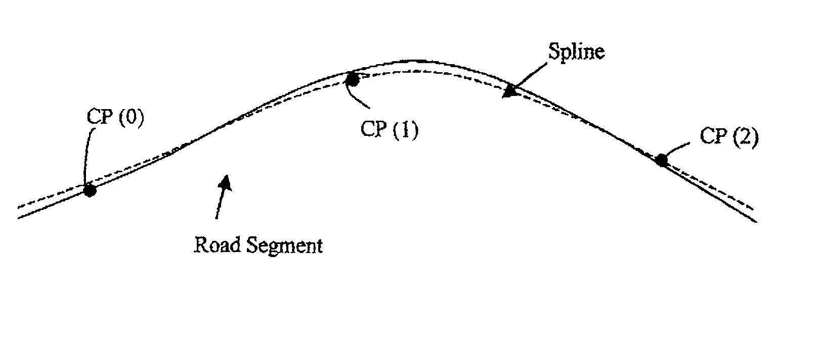
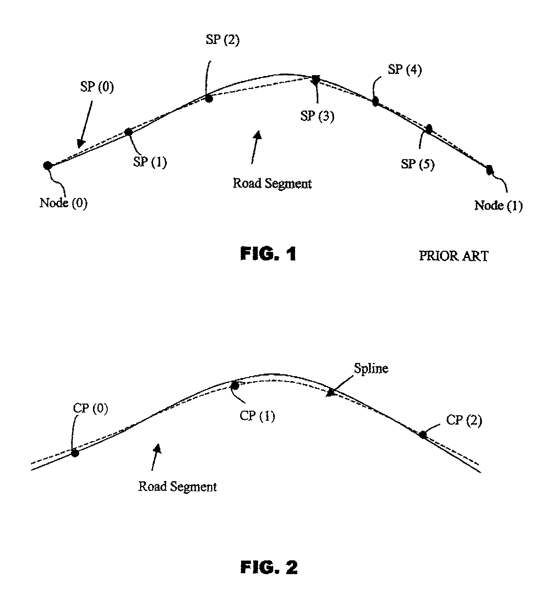
[0019]Turning now to the drawings, and in particular to FIG. 2, there is illustrated a polynomial spline representation of the geographic feature shown in FIG. 1. In FIG. 2, the spline is shown as a dashed line, while the actual geometry of the geographic feature is shown as a solid line.

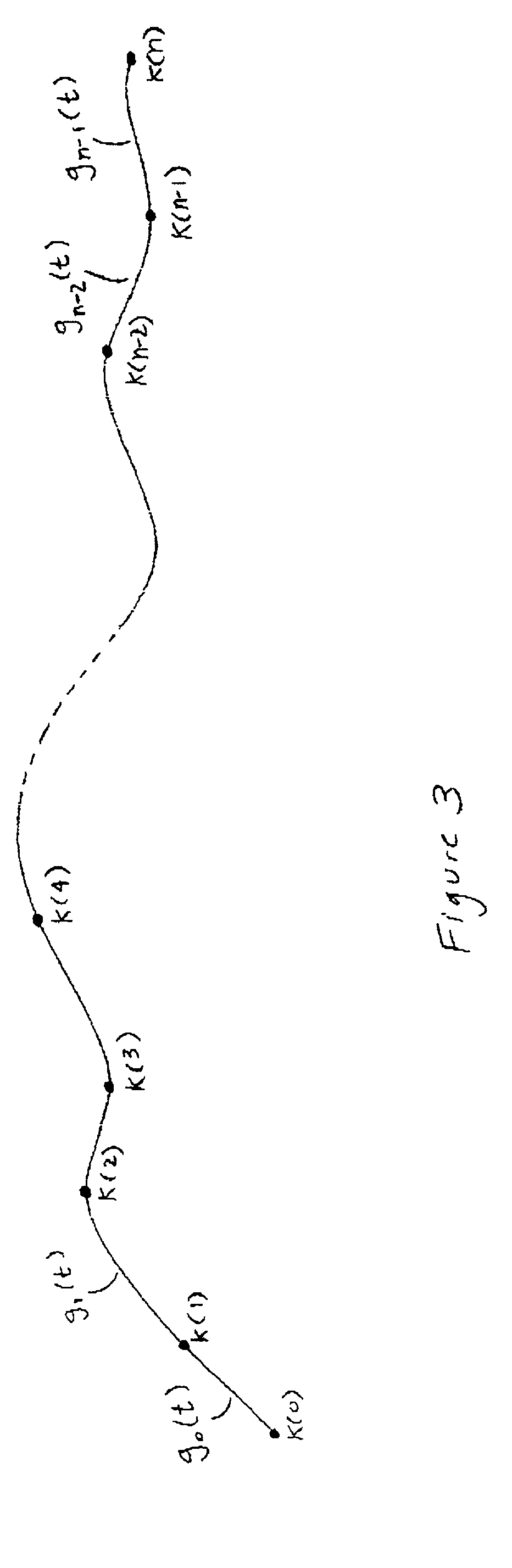
[0020]A polynomial spline consists of piecewise polynomial functions which are joined end to end with some continuity condition imposed at the join points. A polynomial spline is determined completely by a set of control points CP(0)-CP(N), and in some cases, ad...


PUM


Abstract

Cartographic data is represented using polynomial splines. To improve representation accuracy and reduce storage requirements, a database storing data points (shape points and nodes) is converted into a database of spline control points. The spline control points are computed by fitting a polynomial spline to the geographic features using a least squares approximation. The control points associated with each geographic feature are stored in a computer-usable database. The geographic features can be displayed by computing the spline functions using the stored control points.

Description

TECHNICAL FIELD OF THE INVENTION[0001]The present invention relates generally to cartographic databases, and in particular, to the representation of geographic features using polynomial splines.BACKGROUND OF THE INVENTION[0002]Computer-based systems that display graphical maps of geographic areas use cartographic databases that contain data that represent the geographic features in the areas. The geographic features represented by data in cartographic databases may include roads, intersections, points-of-interest, lakes, railroad tracks, buildings, airports, stadiums, parks, mountain ranges, bridges, and so on. To permit these features to be displayed, a cartographic database includes data that represent the geometry (e.g., size, shape and position) and character of these various geographic features.[0003]In order to represent roads (as well as other geographic features on a computer), it is necessary to use some form of discretization. In some cartographic databases, each road is r...

Claims


Application Information

Patent Timeline
IPC IPC(8): G06F7/00
CPCG01C21/32G06T11/203G08G1/096827G09B29/106G01C21/3867
Inventor JOSHI, RAJASHRIDORUM, OLE HENRYISRANI, VIJAYA
Owner HERE GLOBAL BV
Why Eureka
Try Eureka