Internet-enabled, auto-networking, wireless, sensor-capable, specific geographic location marker based communications network system

a communication network and network system technology, applied in the field of surveillance and photogrammetry, can solve the problems of low production efficiency, low production efficiency, and inability to meet the needs of large-scale, wide-scale, and large-scale data collection and delivery. achieve the effect of low manufacturing cost, low price of sale and economic availability

Inactive Publication Date: 2005-09-15
MINOR JOHN SCOTT JR
View PDF4 Cites 31 Cited by
  • Summary
  • Abstract
  • Description
  • Claims
  • Application Information

AI Technical Summary

Benefits of technology

[0047] An even further object of the present invention is to provide a new and improved Internet-enabled, auto-networking, wireless, sensor-capable, specific geographic location marker based communications network system that ha

Problems solved by technology

The issue is the related supporting data (meta data) about the three dimensional geographic data.
Now that they have become nano in scale and mobile, the issue is how to move their compiled data in real time to a computer for analysis.
It also lacks the granularity required for wide-spread (populated to un-populated) compilation and delivery of the data from these new nano-scale, ultra low power, sensor devices.
The system is on-board the autonomous vehicle, but is limited to any conditions that would inhibit the passage of light such as air born sand, dirt, snow or rain.
However, light interruption issues still remain, and the watermark is not flexible.
RADAR (examples include: U.S. Pat. Nos. 6,670,905 Radar warning receiver with position and velocity sensitive functions; 6,693,557 Vehicular traffic sensor; 6,691,074 System for three dimensional positioning and tracking; 6,691,018 Method and system for identifying a lane change) overcomes the light interruption issues of cameras and LIDAR, but it is difficult to make a differentiation between an animate and inanimate object.
As light is the medium, light quality and interruption inhibit the usefulness of this on-board tool.
However, this process must rely only on on-board equipment.
However, a limiting factor to their widespread use is their inability to “see” safely and in real-time in any environment.
It is manual, time consuming and costly, and the manual aspect requires data to be gathered, transferred to pap

Method used


Image

  • Internet-enabled, auto-networking, wireless, sensor-capable, specific geographic location marker based communications network system
  • Internet-enabled, auto-networking, wireless, sensor-capable, specific geographic location marker based communications network system
  • Internet-enabled, auto-networking, wireless, sensor-capable, specific geographic location marker based communications network system

Examples


Embodiment Construction

[0058] In the Background section of this document, I related the issues and problems with the current survey and photogrammetry systems as well as the larger or superset of issues related to the lack of an economical highly granular, ad hoc network, wireless, global communications infrastructure. Example areas within this superset were reviewed. I then reviewed specific needs and the current prior art and shortcomings in these areas. Finally, in this section, I will review my invention which addresses the novel, useful and non-obvious system that fills these needs.

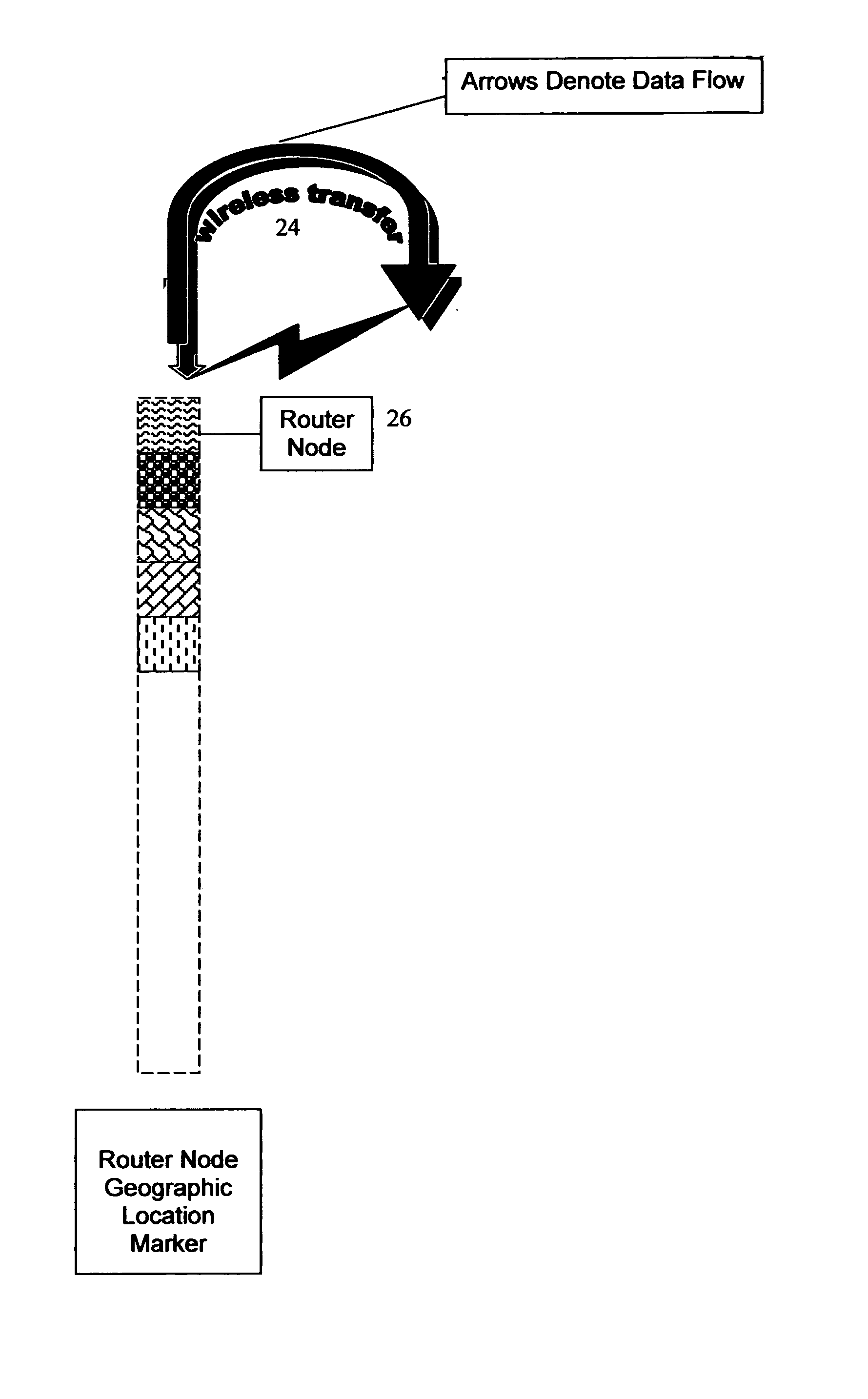
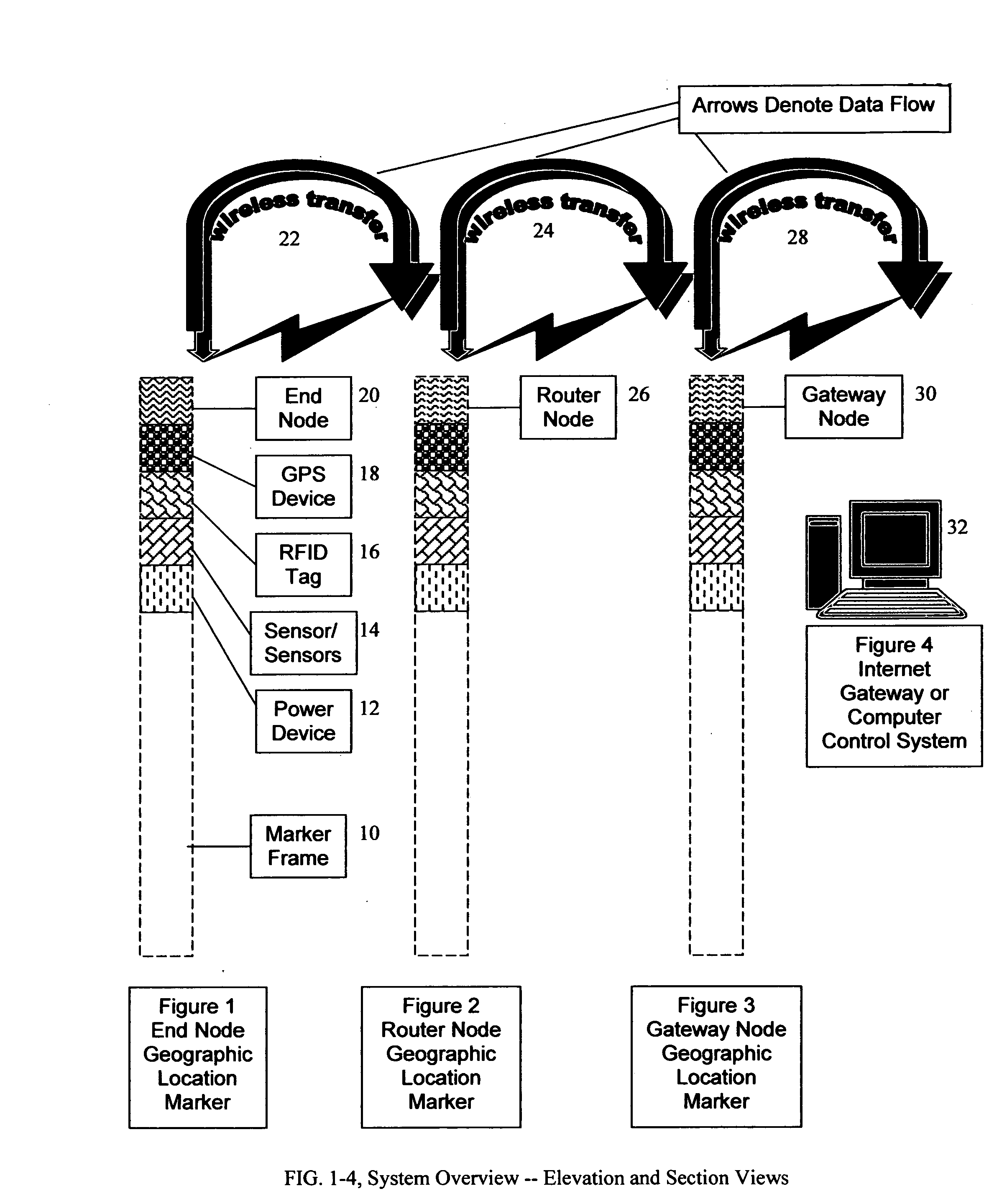
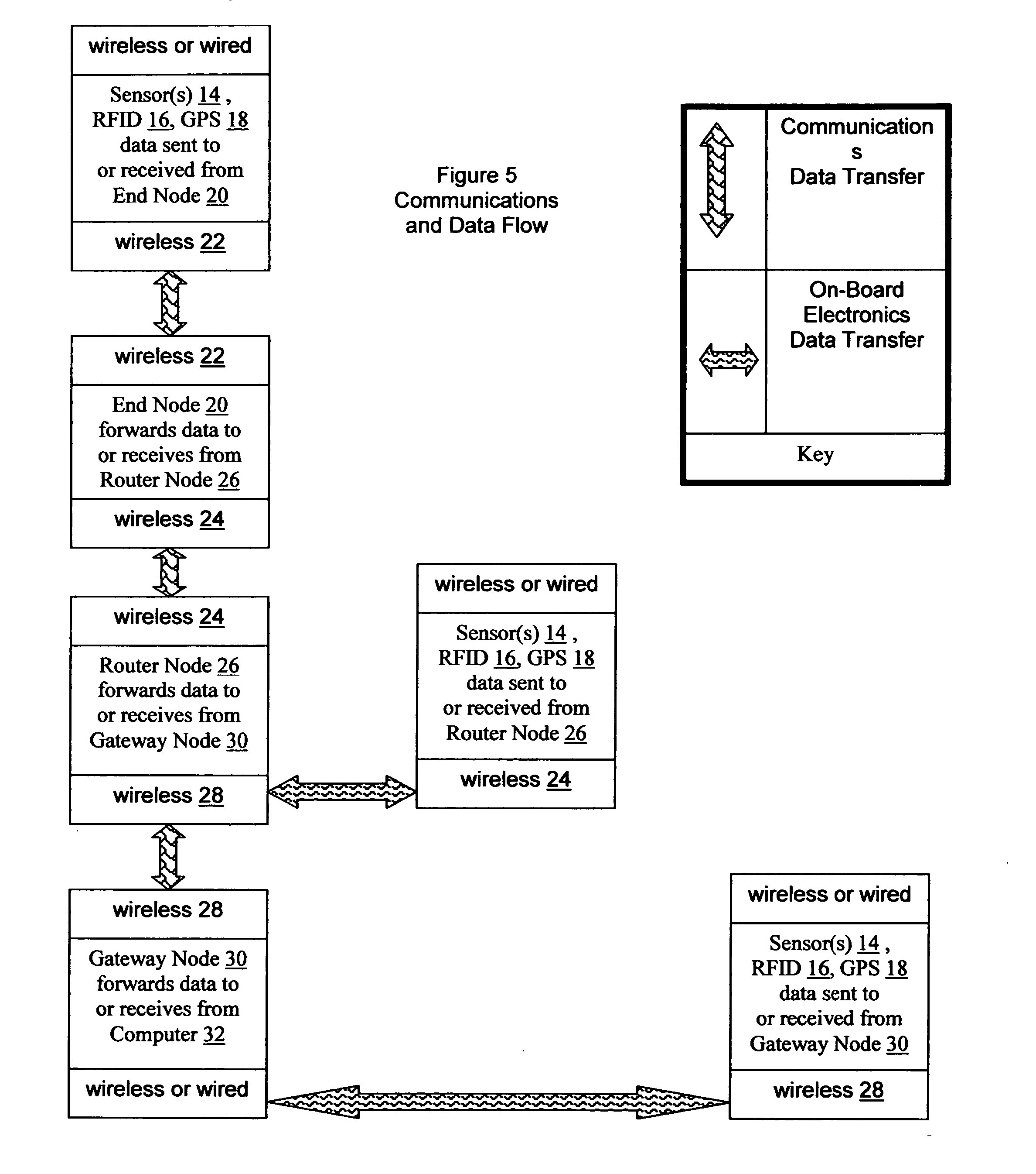
[0059] The Internet-enabled, auto-networking, wireless, sensor-capable, specific geographic location marker based communications network system, the preferred embodiment of which is shown in the elevation and section views of FIG. 1, FIG. 2, FIG. 3, and FIG. 4, electronically gathers and / or transmits wireless data with said data being dictated as to content and format by the customer. Examples of data and their communicat...


PUM


Abstract

The invention provides an Internet-enabled, auto-networking, wireless, sensor-capable, specific geographic location marker based communications network system which broadly and economically deploys a wired and wireless, geographic position specific marker based, communications network technology to form a framework or infrastructure through which a multitude of these marker systems can communicate globally. The invention gathers and transmits or receives: wireless bioinformatics data from living organisms in real time; route and environmental data for real time autonomous systems control; plat data for automating tax assessment; topographic and survey control point data for automating photogrammetry; intelligent survey monument deployment for Internet based land surveying; and environmental, industrial, commercial, residential, medical and security sensor based data in real time. The invention utilizes necessary sensor and position (GPS) electronics and units are deployed along natural and man-made geographic features. Deployment is via field survey or through attachment to a present survey boundary marker or roadside pole.

Description

CROSS-REFERENCE TO RELATED APPLICATIONS [0001] Not Applicable STATEMENT REGARDING FEDERALLY SPONSORED RESEARCH OR DEVELOPMENT [0002] Not Applicable REFERENCE TO SEQUENCE LISTING, TABLE, OR COMPUTER PROGRAM [0003] Not Applicable BACKGROUND OF THE INVENTION [0004] 1. Field of the Invention [0005] The surveying and photogrammetry industries have many problems with manual information gathering, flow, and analysis, with multiple redundant manual steps or stages in each process. Field monuments, which run the gambit of a pile of stones to a metal pin, can be lost over time. Surveyor notes are written in the field and kept with the surveyor, so they lose the link to their monument and spatial location. Plat and deed data are usually kept with a county auditor or recorder, so this presents a third location of critical information that is not directly tied to its spatial position. [0006] Photogrammetry requires control points and topographic information in order to develop maps from photos. ...

Claims


Application Information

Patent Timeline
IPC IPC(8): H04W4/02H04W4/70H04W84/18
CPCH04W4/005H04L67/12H04W84/18H04W4/02H04W4/70Y04S40/18
Inventor MINOR, JOHN SCOTT JR.
Owner MINOR JOHN SCOTT JR
Why Eureka
Try Eureka