
Method for assignment of point level address geocodes to street networks

a technology of point level address and street network, applied in the field of geocoding, can solve the problems of inability to tie a point geocode to its parent street segment, insufficient simple correction of address range, and inability to identify appropriate streets, etc., to achieve the effect of improving the accuracy of identifying appropriate streets

Active Publication Date: 2010-11-16
PRECISELY SOFTWARE INC
View PDF2 Cites 0 Cited by
  • Summary
  • Abstract
  • Description
  • Claims
  • Application Information

AI Technical Summary

Benefits of technology

[0009]The described method improves accuracy in identifying appropriate street centerlines for applications involving assignment of point level address geocodes to street networks.
[0011]The method also provides flexibility where appropriate street centerlines for applications involving assignment of point level address geocodes to street networks can be computed employing any mixture of street centerlines and point data, even with heterogeneous datasets, that is data sets of different vendors which may not be fully consistent with each other. The method may reduce ambiguity in identifying appropriate street centerlines for applications involving assignment of point level address geocodes to street networks.

Problems solved by technology

However, there are problems in which it is necessary to obtain a geocode on the centerline of the proper adjacent street.
However many examples exist where simply correcting the address range will not suffice since the segment address range may differ from the actual address range or not exist as may be the case, for example, with parks and certain commercial installations.
The problem may be further compounded because although a geocode is very accurate in terms of positioning, the accurate nature may introduce issues when these point geocodes are utilized in some solutions, for example in routing and dispatch applications.
The inability to tie a point geocode to its parent street segment is a major issue.
This impacts routing and dispatch applications as they rely on the street network underlying the point data and cannot determine which street is the parent street segment for a given point.
Solutions therefore may end up in an ambiguous routing or dispatch situation where accurate routes or directions cannot be created due to the vagaries inherent in using a point geocode.
Unfortunately, geographic searches such as this can be time consuming.
In addition, a purely geographic search is subject to error since many locations are closer to neighboring centerlines than to the street on which their address matches.

Method used


Image

  • Method for assignment of point level address geocodes to street networks
  • Method for assignment of point level address geocodes to street networks
  • Method for assignment of point level address geocodes to street networks

Examples


Embodiment Construction

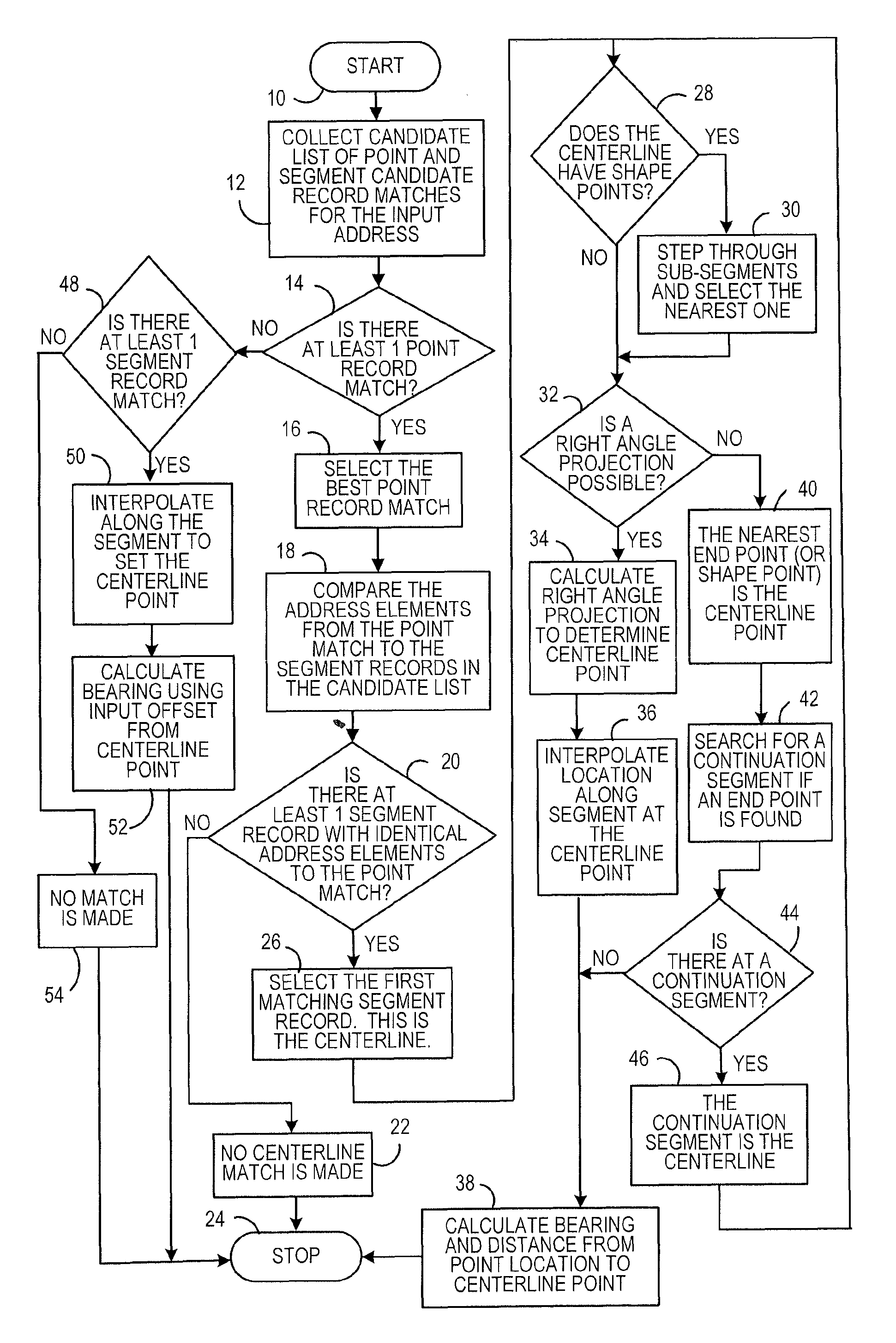
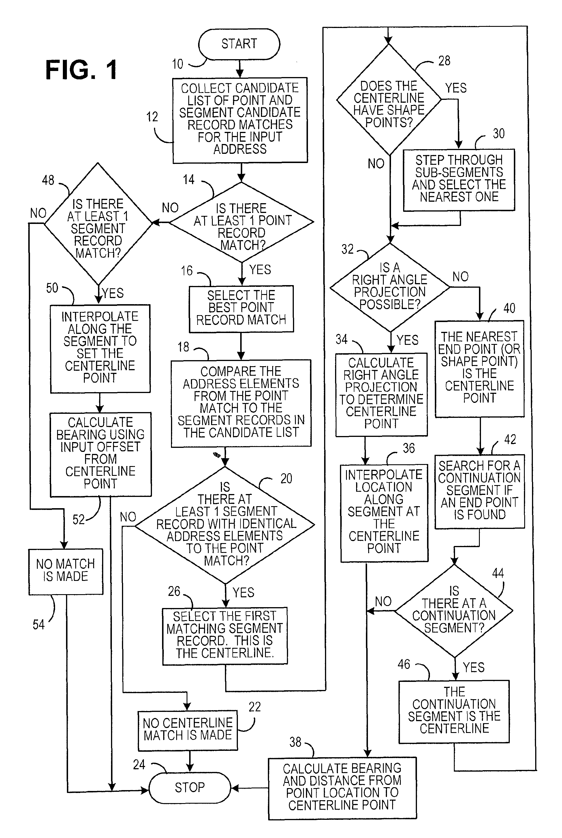
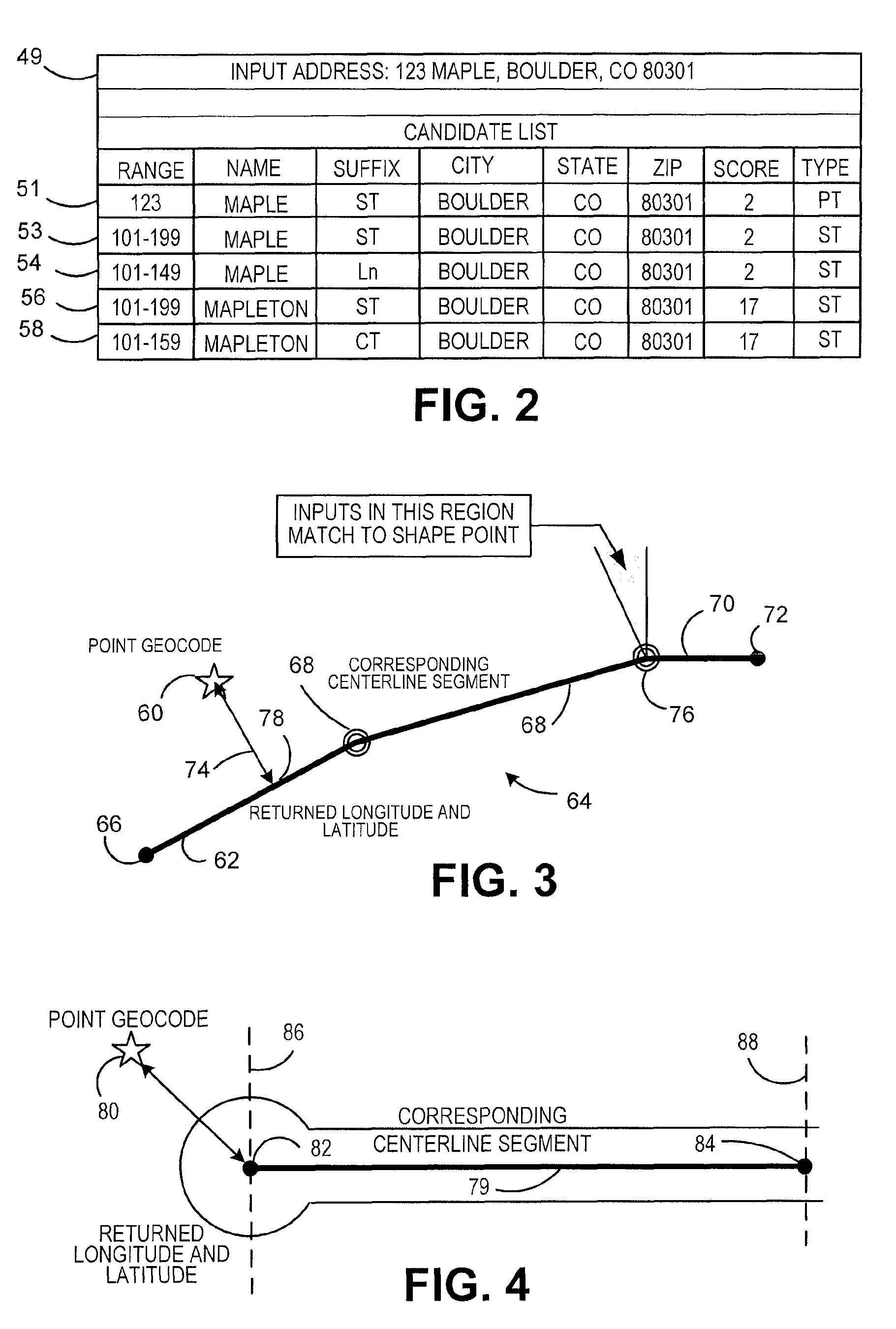
[0020]Reference is now made to FIG. 1. The flow chart illustrates the assignment of point level address geocodes to street networks. A solution is created that will enable a calling application to realize a latitude—longitude that lies on the centerline of the proper adjacent street segment. This will tie the point data back to the underlying street data set and allow integration with street-dependent solutions. To remove the ambiguity from these applications, the process enables, for example, a calling application to realize a latitude—longitude that lies on the centerline of the parent street segment. This will tie the point data back to the underlying street data set and allow integration with street-dependent solutions. A fast and accurate method is implemented to find the geocode on the street centerline that can be utilized in real time. By making the process dynamic, the method will work on any appropriate mix of point data and centerline data sets, even in the situation wher...


PUM


Abstract

Assignment of point level address geocodes to street networks include the steps of entering address data and collecting candidate point data records and segment data record matches for the entered address. Each point data record includes address elements and also includes a geocode. Each segment data record includes a centerline between segment record data points. A determination is made if there is at least one point data record match for the input address. The best point record match for the input address is selected when at least one point data record match is made. The address elements from the point record are compared to any collected segment data records. A determination is made of the best segment record match to the selected best point record and the best segment record match is selected. The selected best segment record is employed and the bearing and distance from the selected best point record is calculated to a point on the centerline of the selected best segment record to determine a geocode for the centerline point.

Description

FIELD OF THE INVENTION[0001]The present invention relates to geocoding and more particularly to a method for assignment of point level address geocodes to street networks.BACKGROUND OF THE INVENTION[0002]Systems have been developed that employ two geocoding data sets to attempt to provide the correct latitude and longitude as well as street when a given address for a specific location. These systems are employed where the geographic location of an address is needed, for example, to determine the address for purposes of routing and dispatch to the address.[0003]The geocoding data sets are processed by a geocoding engine. This is a specialized matching engine that utilizes a textual representation of an address as input. The engine matches the address against a data set of geographic data and uses algorithms to determine the location of the input address. The engine returns the location as a coordinate (longitude-latitude pair) referred to as a geocode and, depending on the particular...

Claims


Application Information

Patent Timeline
Patent Type & Authority Patents(United States)
IPC IPC(8): G06F7/00G06F17/30
CPCG06F17/30241G06F16/29Y10S707/919
Inventor BOURLAND, II, FREDDIE J.CARTIN, KEVIN F.CHARLTON, BERKLEY R.LOGAN, DAVID J.SEARIGHT, KEITH R.LOHER, CATHERINE J.
Owner PRECISELY SOFTWARE INC
Learn More