Automatic blade control system with integrated global navigation satellite system and inertial sensors
a global navigation satellite and control system technology, applied in the field of earthgrading machines, can solve problems such as specific wave-like patterns on the ground, certain limitations of other types of machines, such as dozers,
- Summary
- Abstract
- Description
- Claims
- Application Information
AI Technical Summary
Benefits of technology
Problems solved by technology
Method used
Image
Examples
Embodiment Construction
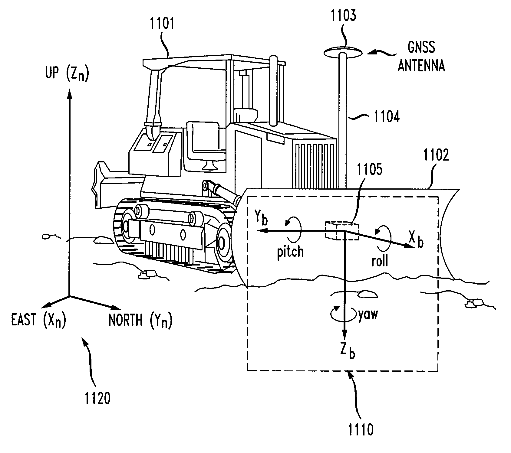
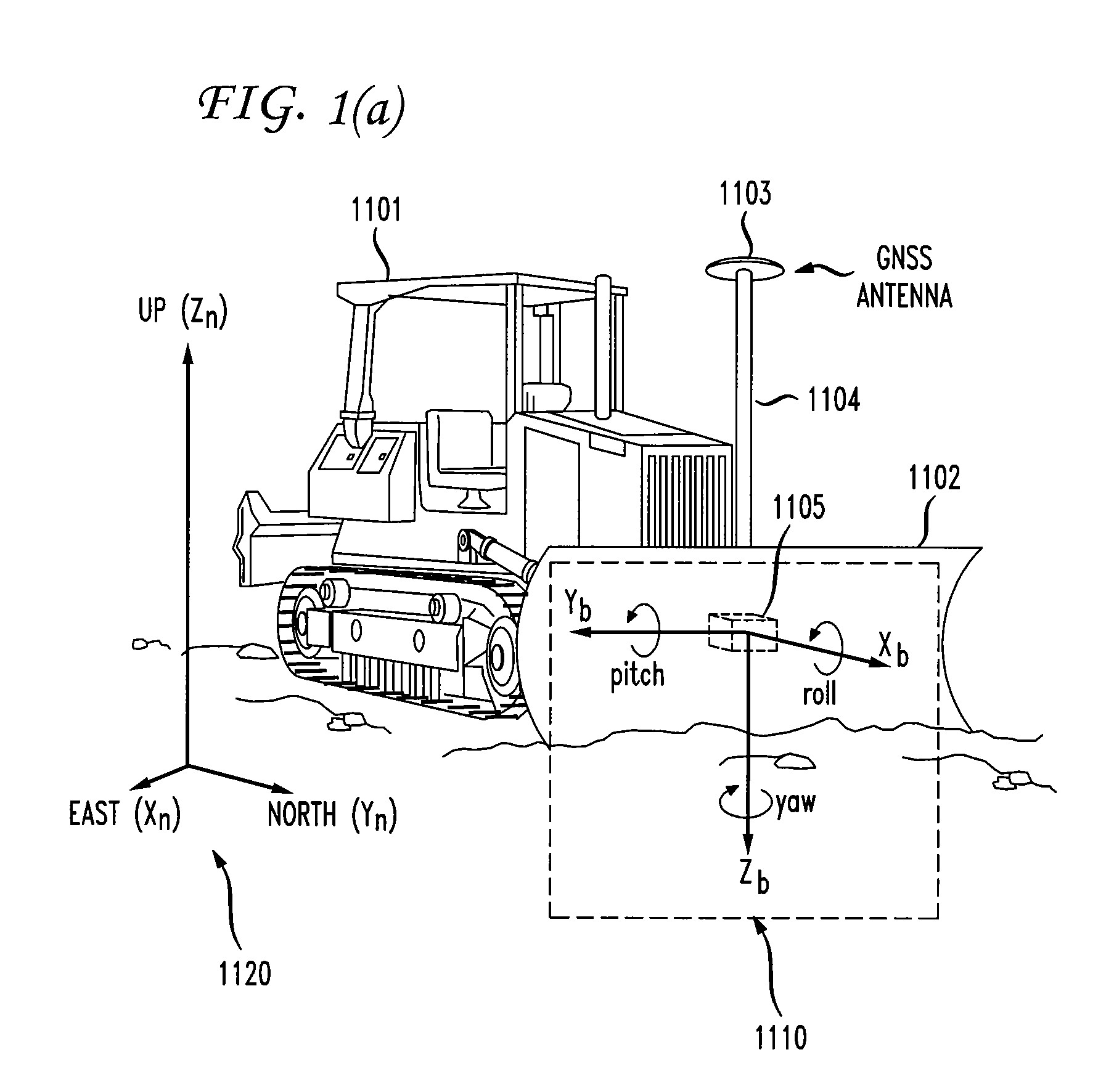
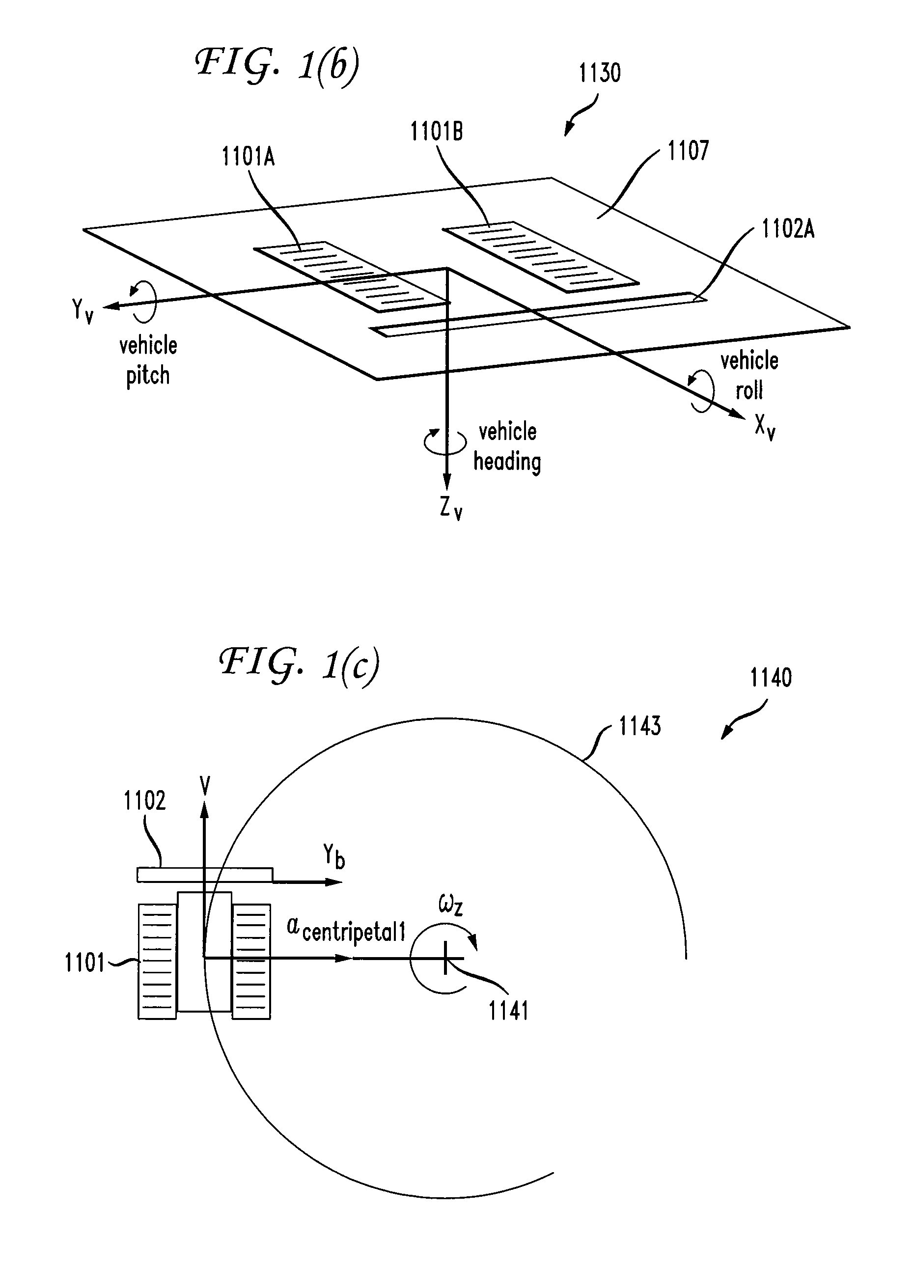
[0016]FIG. 1(a)-FIG. 1(d) illustrate the dozer configuration and reference frames used in the discussions below. In FIG. 1(a), dozer body 1101 is equipped with dozer blade 1102. The front side of dozer blade 1102 faces away from dozer body 1101. Global Navigation Satellite System (GNSS) antenna 1103 is mounted on pole 1104, which is fixed to dozer blade 1102. In an embodiment, a second GNSS antenna may be mounted on a pole fixed to dozer blade 1102. Inertial measurement unit IMU 1105 is installed on the rear side of dozer blade 1102 (facing towards dozer body 1101). A GNSS receiver (not shown) may be installed in the cabin of dozer body 1101. A control box (not shown) may also be installed in the cabin of dozer body 1101. Further details of the control box are discussed below.
[0017]In FIG. 1(a), the navigation frame 1120 is a Cartesian coordinate system used as a local navigation frame. The axes of the navigation frame 1120 are denoted ENU [East (Xn), North (Yn), Up (Zn)]. The Xn-Yn...
PUM
 Abstract
Description
Claims
Application Information
 - R&D
- Intellectual Property
- Life Sciences
- Materials
- Tech Scout
- Unparalleled Data Quality
- Higher Quality Content
- 60% Fewer Hallucinations
Browse by: Latest US Patents, China's latest patents, Technical Efficacy Thesaurus, Application Domain, Technology Topic, Popular Technical Reports.
© 2025 PatSnap. All rights reserved.Legal|Privacy policy|Modern Slavery Act Transparency Statement|Sitemap|About US| Contact US: help@patsnap.com


