

Method for fusing overhead imagery with automatic vessel reporting systems
- Summary
- Abstract
- Description
- Claims
- Application Information
AI Technical Summary
Benefits of technology
Problems solved by technology
Method used
Image

Examples
Embodiment Construction
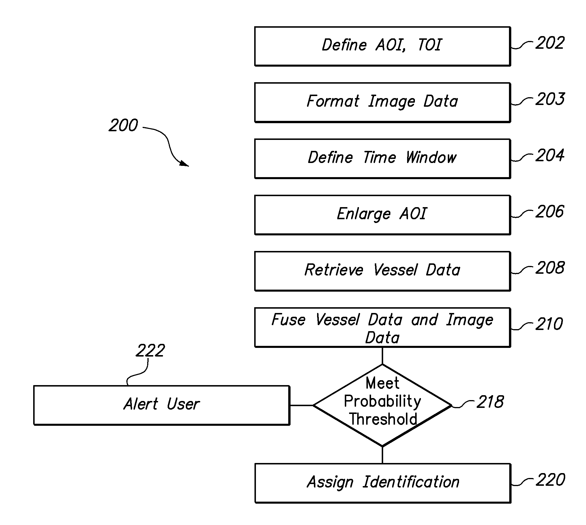
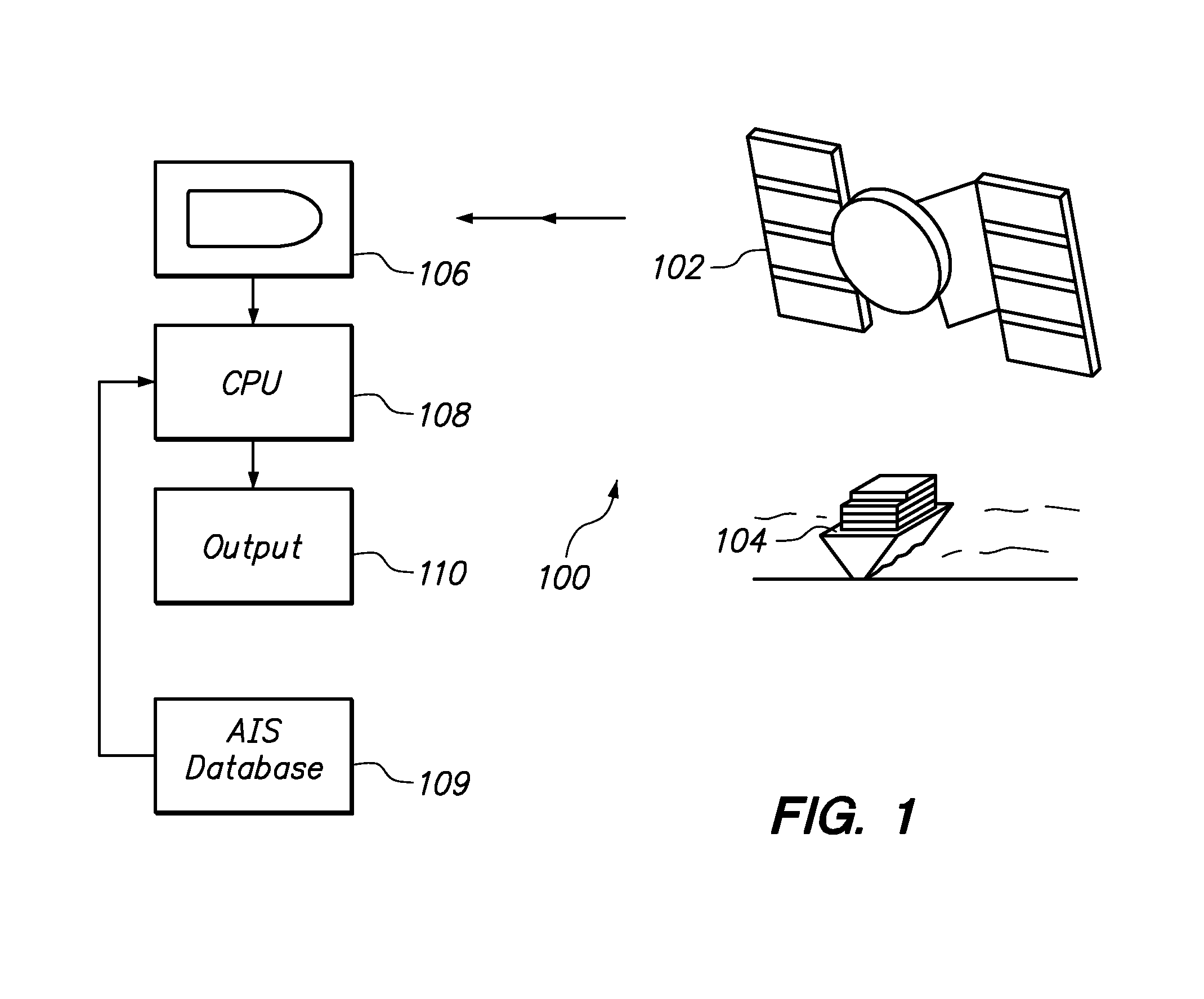
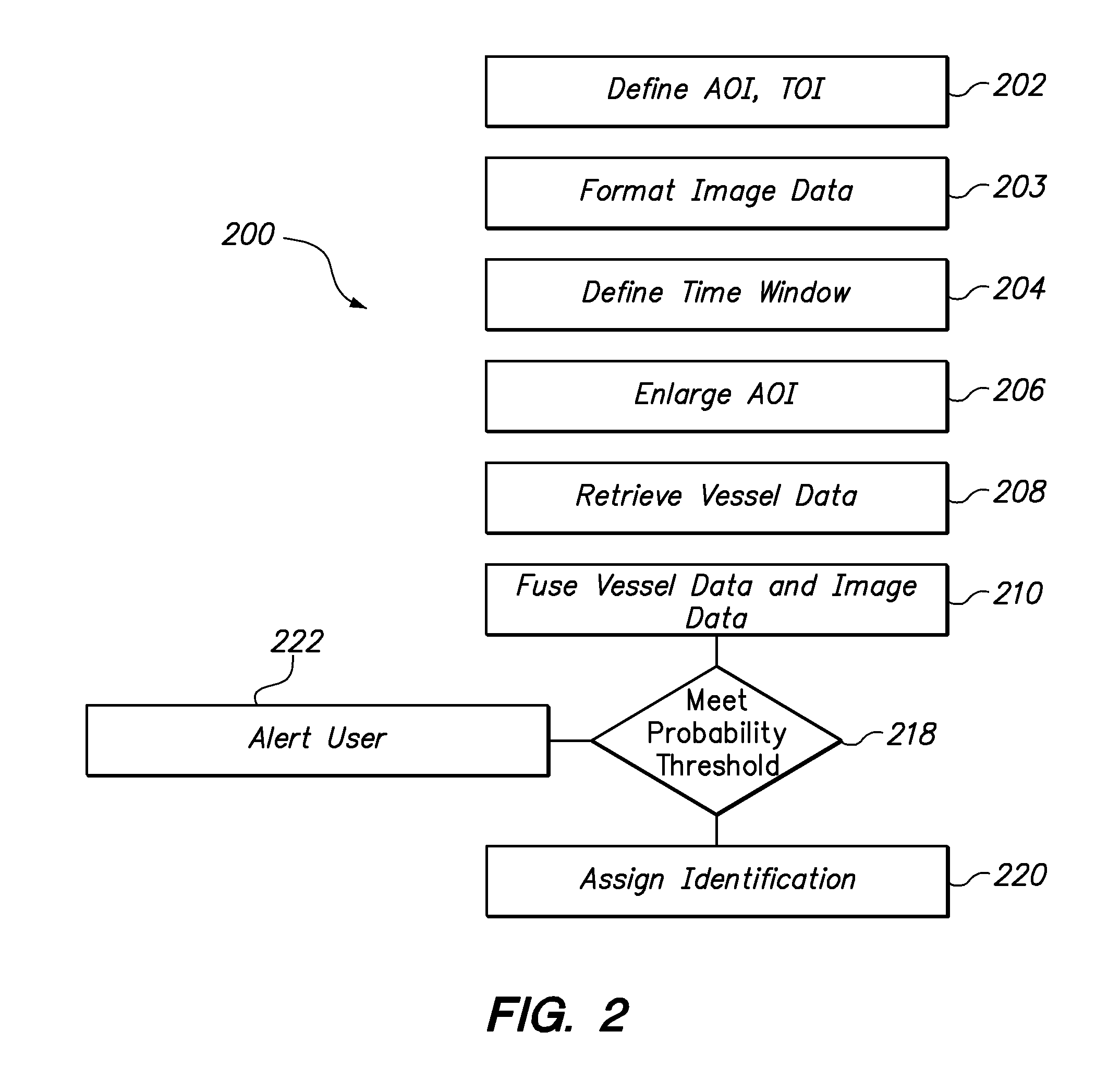
[0022]In brief overview, the invention can consist of satellite systems and methods of use therefor that fuse information from the Automatic Identification System (AIS) position reports with information obtained from satellite imagery. This is accomplished to determine which vessel detected in a time coincidental satellite image (defined herein as imagery taken at approximately the same time as the collection of AIS reports) corresponds to a reported AIS vessel position and track. The invention is designed to handle large satellite image area footprints and long tracks of AIS position reports. The invention according to several embodiments can apply statistical reasoning to determine which AIS and imagery positions are most likely the same vessel.
[0023]The output of the fusion of satellite imagery and AIS can be displayed in tabular form in any one of a number of formats that are easily observed by the user. One such format can be a GoogleEarth™ display. The GoogleEarth™ output can ...
PUM
 Abstract
Description
Claims
Application Information