Blending between street view and earth view

a technology of street view and earth view, applied in image analysis, instruments, computing, etc., can solve the problems of disorienting users from spatial awareness of the geographic region, difficult for users to maintain a sense of spatial context and direction,

Active Publication Date: 2016-08-16
GOOGLE LLC
View PDF60 Cites 14 Cited by
  • Summary
  • Abstract
  • Description
  • Claims
  • Application Information

AI Technical Summary

Problems solved by technology

However, map applications make it difficult for users to maintain a sense of spatial context and direction when viewing the street-level images.
For instance, when consecutively displaying two or more street-level images separated by relatively large distances, it may disorient users from spatial awareness of the geographic region.

Method used


Image

  • Blending between street view and earth view
  • Blending between street view and earth view
  • Blending between street view and earth view

Examples


Embodiment Construction
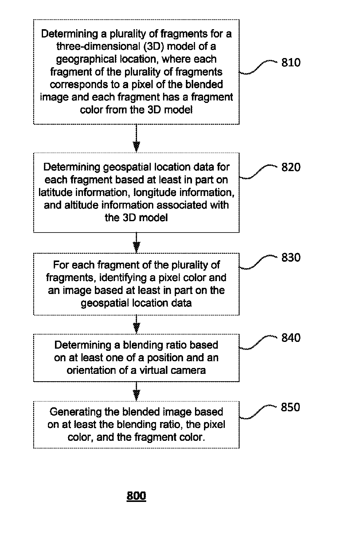
[0014]Overview

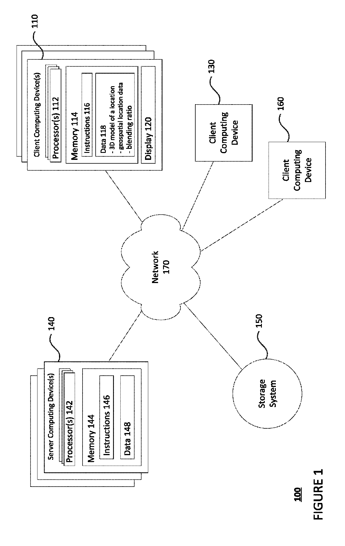
[0015]The present disclosure is directed to transitions between street-level images and 3D models of the same area. A transition may include changing from street-level imagery in one location to a 3D model view, and to street-level imagery in a second location. For example, a user may want to view on a client computing device a series of street-level images on a client computing device (e.g., smartphone, tablet, computer), each of which may be separated by various distances. In order to maintain a sense of spatial context and direction, the client computing device may transition the display of one street-level image to another street-level image via an intermediate aerial view of the 3D model that provides spatial context to both images. In this regard, the user has the feeling that a virtual camera is moving up and away from one street level image into an aerial view and then subsequently moving down and into a second street level image as if the user has “jumped” bet...


PUM


Abstract

In one aspect, computing device(s) may determine a plurality of fragments for a three-dimensional (3D) model of a geographical location. Each fragment of the plurality of fragments may correspond to a pixel of a blended image and each fragment has a fragment color from the 3D model. The one or more computing devices may determine geospatial location data for each fragment based at least in part on latitude information, longitude information, and altitude information associated with the 3D model. For each fragment of the plurality of fragments, the one or more computing devices may identify a pixel color and an image based at least in part on the geospatial location data, determine a blending ratio based on at least one of a position and an orientation of a virtual camera, and generate the blended image based on at least the blending ratio, the pixel color, and the fragment color.

Description

BACKGROUND[0001]Map applications may display street-level and aerial images of various geographic regions for users to view. In addition to viewing these images, users may be able to toggle between a street-level image and an aerial image (or vice versa), or view a series of connected or disconnected street-level images. However, map applications make it difficult for users to maintain a sense of spatial context and direction when viewing the street-level images. For instance, when consecutively displaying two or more street-level images separated by relatively large distances, it may disorient users from spatial awareness of the geographic region.BRIEF SUMMARY[0002]In one aspect, a method for generating a blended image comprises determining, by one or more computing devices, a plurality of fragments for a three-dimensional (3D) model of a geographical location, wherein each fragment of the plurality of fragments corresponds to a pixel of the blended image and each fragment has a fr...

Claims


Application Information

Patent Timeline
Patent Type & Authority Patents(United States)
IPC IPC(8): G06T15/50G06T17/05G06T7/40G16B45/00
CPCG06T15/503G06T7/408G06T17/05G06T7/90G06T15/005
Inventor DILLARD, SCOTT EDWARDPARKER, EVAN HARDESTYJONES, MICHAEL CAMERON
Owner GOOGLE LLC
Why Eureka
Try Eureka