Designation method of city address and designated city map and transit stop board

A city and map technology, applied in the directions of maps/plans/charts, instruments, educational appliances, etc., can solve problems such as poor adaptability of coordinate numbers and disconnection between bus stop names and geographic locations.

Inactive Publication Date: 2008-04-23
谢开章
View PDF6 Cites 1 Cited by
  • Summary
  • Abstract
  • Description
  • Claims
  • Application Information

AI Technical Summary

Problems solved by technology

[0004] The present invention provides a city map and a bus stop board to solve the problems that the coordinate value and the corresponding area in the existing city address label often change, the coordinate number has poor adaptability, and the station name of the bus stop board is out of touch with the geographical location

Method used


Image

  • Designation method of city address and designated city map and transit stop board
  • Designation method of city address and designated city map and transit stop board
  • Designation method of city address and designated city map and transit stop board

Examples


Embodiment Construction

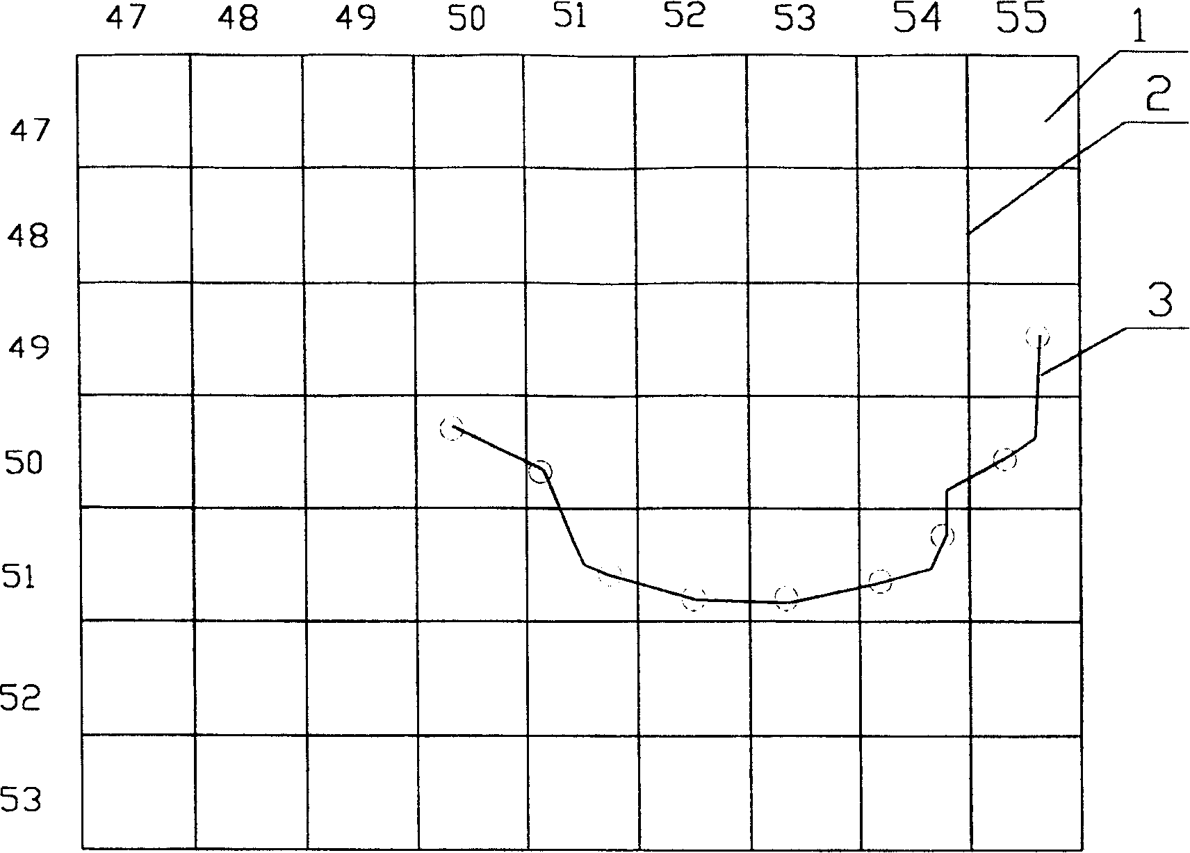
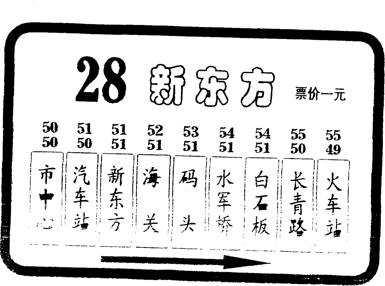
[0015] see figure 1 In this embodiment, the city map is divided into several equal parts 1 vertically and horizontally, which are marked with latitude and longitude lines 2 respectively, and marked with 50 between the two longitude lines where the city center is located on the upper edge of the map. Each grid increments by 1. On the left edge of the map, mark 50 between the two meridians where the city center is located, decrease by 1 upwards and increase by 1 downwards, similar to the horizontal markings; the route of a certain bus is shown in the figure image 3 .

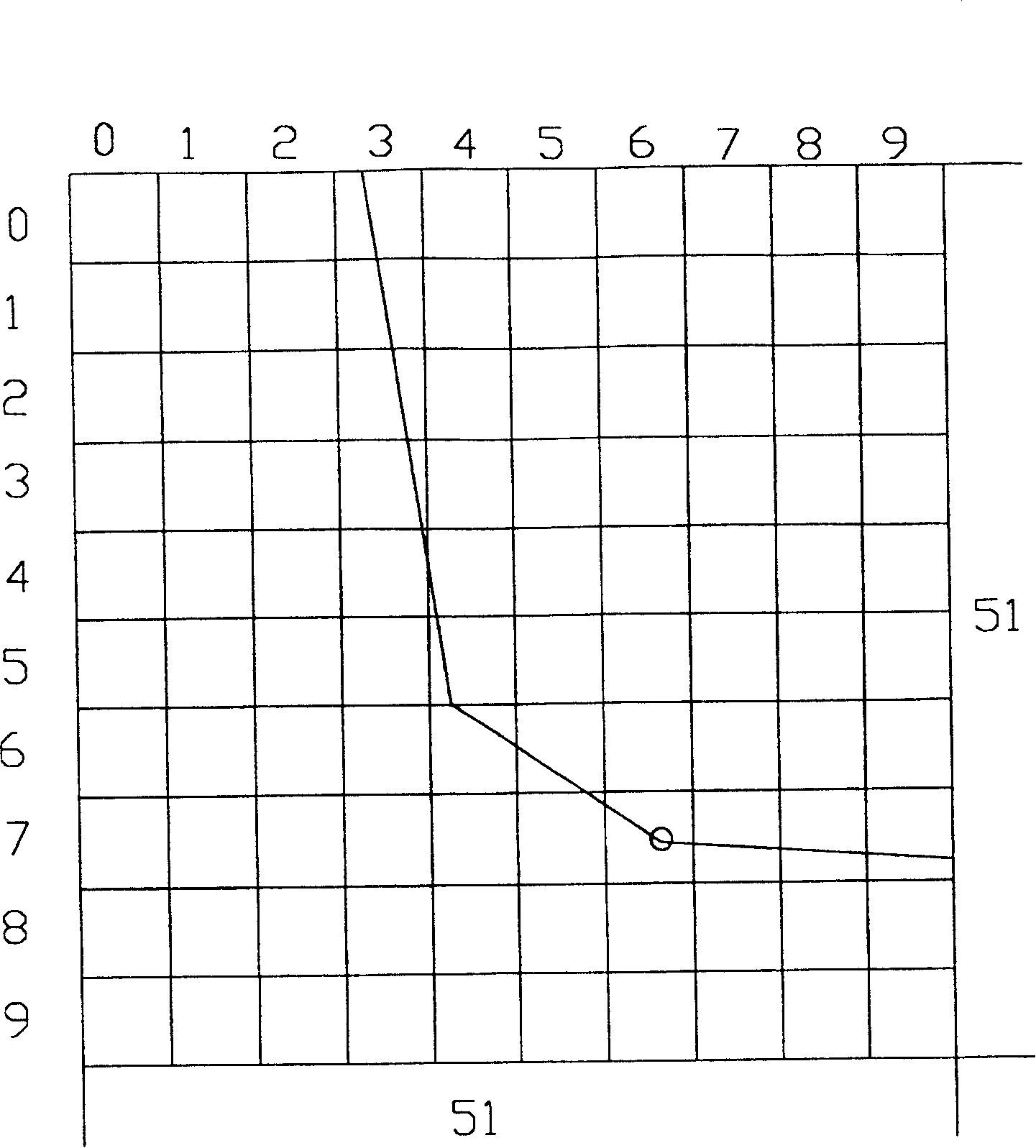
[0016] see figure 2 , corresponding to each partition to make an enlarged small partition map, which is figure 1 A small partition map of the 51 / 51 partition in . The division format is the same as the partition division format described above, compare image 3 Central 51 / 51 District has the station name of New Oriental, put figure 1 In the partition enlarged into figure 2 Look, New Oriental stands at...


PUM


Abstract

A method for marking the addresses on city map and bus stop plates features that an urban area is longitudinally and transersely divided into multiple rectangles which same areas, and each rectangular can be expressed by its longitudinal and transverse coordinates.

Description

field of invention [0001] The invention relates to a city map and a bus stop board. Background technique [0002] With the development of the economy, the urbanization process of many developing countries is accelerating, and the urban area is getting larger and larger. The method of marking city address mainly adopts district name, street (road, alley) at present, and this marking method is difficult to find concrete address on the map. On the existing city map, the city is divided into a plurality of equal regions according to the longitude and latitude lines, and the abscissa of each region is marked with 1, 2, 3...natural number integers from left to right in the horizontal direction, and the horizontal coordinates of each region are marked in the vertical direction from top to bottom. Ah, A, B, C... English letters represent the vertical coordinates of each area, and each area can be represented by a set of coordinates (similar to plane coordinates in mathematics) cons...

Claims


Application Information

Patent Timeline
Patent Type & Authority Patents(China)
IPC IPC(8): G09B29/00
Inventor 谢开章
Owner 谢开章
Why Eureka
Try Eureka