Geographic position locating method of location navigator
A geographic location positioning and geographic location technology, applied to road network navigators and other directions, can solve problems such as inconvenient use, wrong input of place names, repeated place names, etc., and achieve the effects of improving positioning efficiency, ensuring positioning accuracy, and being easy to remember and use
- Summary
- Abstract
- Description
- Claims
- Application Information
AI Technical Summary
Problems solved by technology
Method used
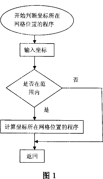
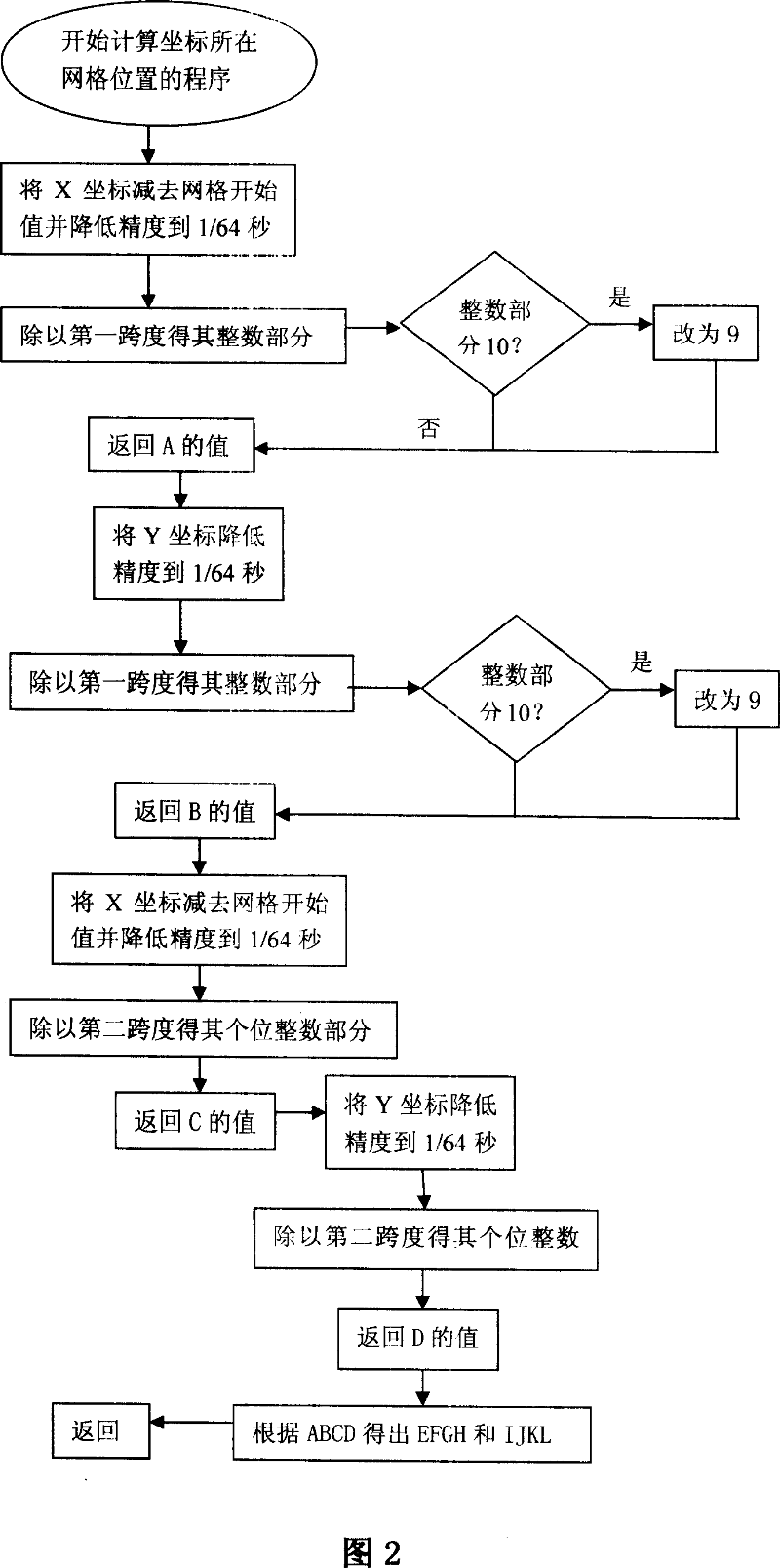
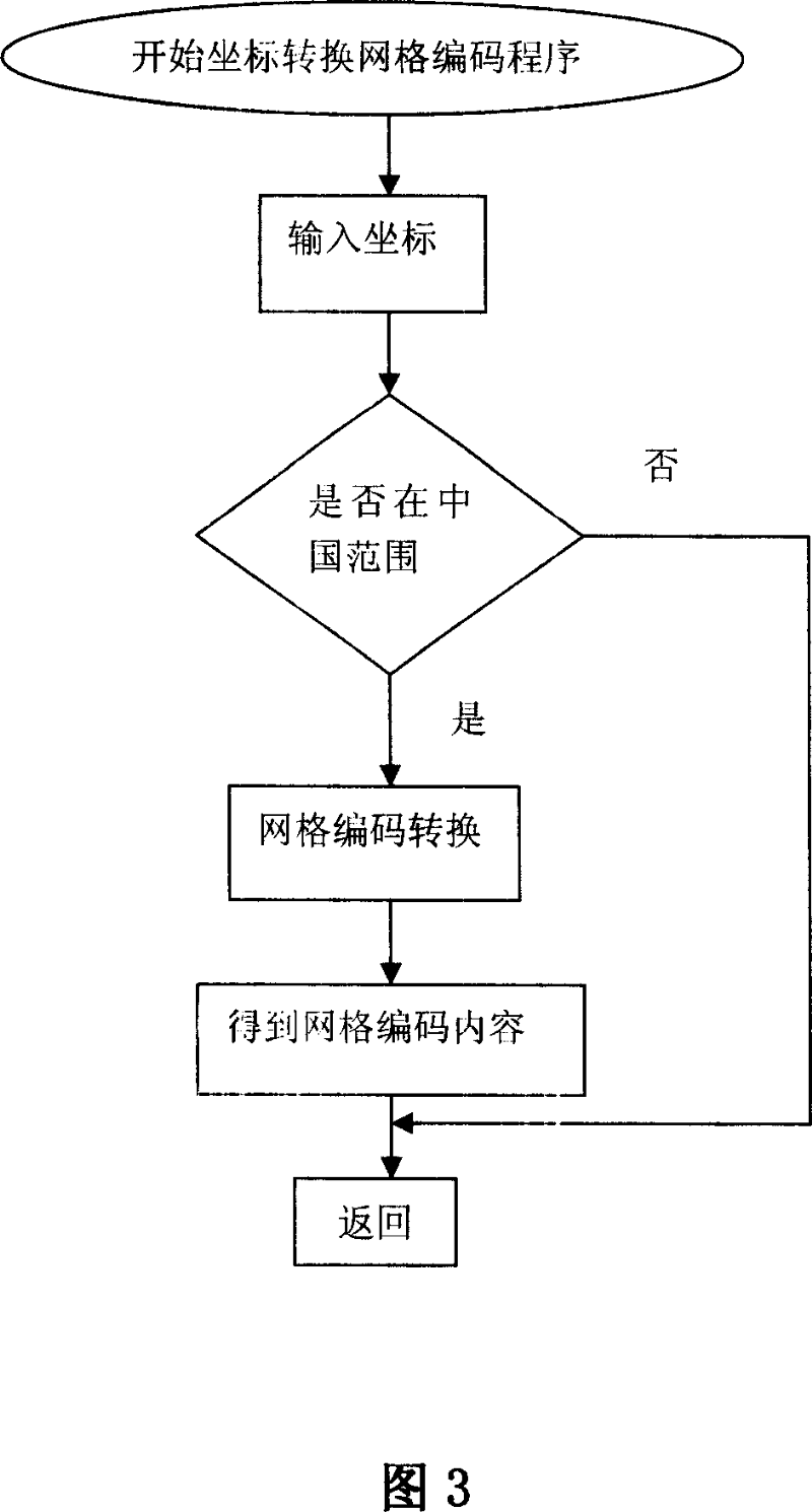
Image

Examples
Embodiment 1
[0025] The geographic location positioning method of the positioning navigator of the present embodiment comprises the following steps:
[0026] A. Divide the surface digital map of China (in other embodiments, it can be other countries or regions) territory and territorial waters into a network, and make each grid in the network be a square with the same size (in other In an embodiment, the polymorphism may be an equilateral triangle, a rectangle, a regular pentagon or a regular hexagon).
[0027] The corresponding length of the side length of the square grid on the actual surface is 10m (in other embodiments, it can be 5m, 8m or 15m), and calculates the coordinates of each grid on the surface digital map; the coordinates are The vertical and horizontal coordinates set on the surface digital map of China's territory and territorial sea (in other embodiments, the coordinates may be the latitude and longitude of the earth).
[0028] B. Giving each grid a different grid code; t...
PUM
| Property | Measurement | Unit |
|---|---|---|
| Length | aaaaa | aaaaa |
Abstract
Description
Claims
Application Information
 - R&D
- Intellectual Property
- Life Sciences
- Materials
- Tech Scout
- Unparalleled Data Quality
- Higher Quality Content
- 60% Fewer Hallucinations
Browse by: Latest US Patents, China's latest patents, Technical Efficacy Thesaurus, Application Domain, Technology Topic, Popular Technical Reports.
© 2025 PatSnap. All rights reserved.Legal|Privacy policy|Modern Slavery Act Transparency Statement|Sitemap|About US| Contact US: help@patsnap.com