
Method for constructing complex 2D seismic data flat spot control image

A technology of seismic data and structure, applied in the direction of seismic signal processing, etc., can solve problems such as incorrect structural maps, inability to determine trap area and structural amplitude, drilling errors, etc., achieve accurate spatial correction results, and solve the problem of excessive offset of results , The effect of improving the drilling success rate

Active Publication Date: 2008-06-18
BC P INC CHINA NAT PETROLEUM CORP +1
View PDF0 Cites 8 Cited by
  • Summary
  • Abstract
  • Description
  • Claims
  • Application Information

AI Technical Summary

Problems solved by technology

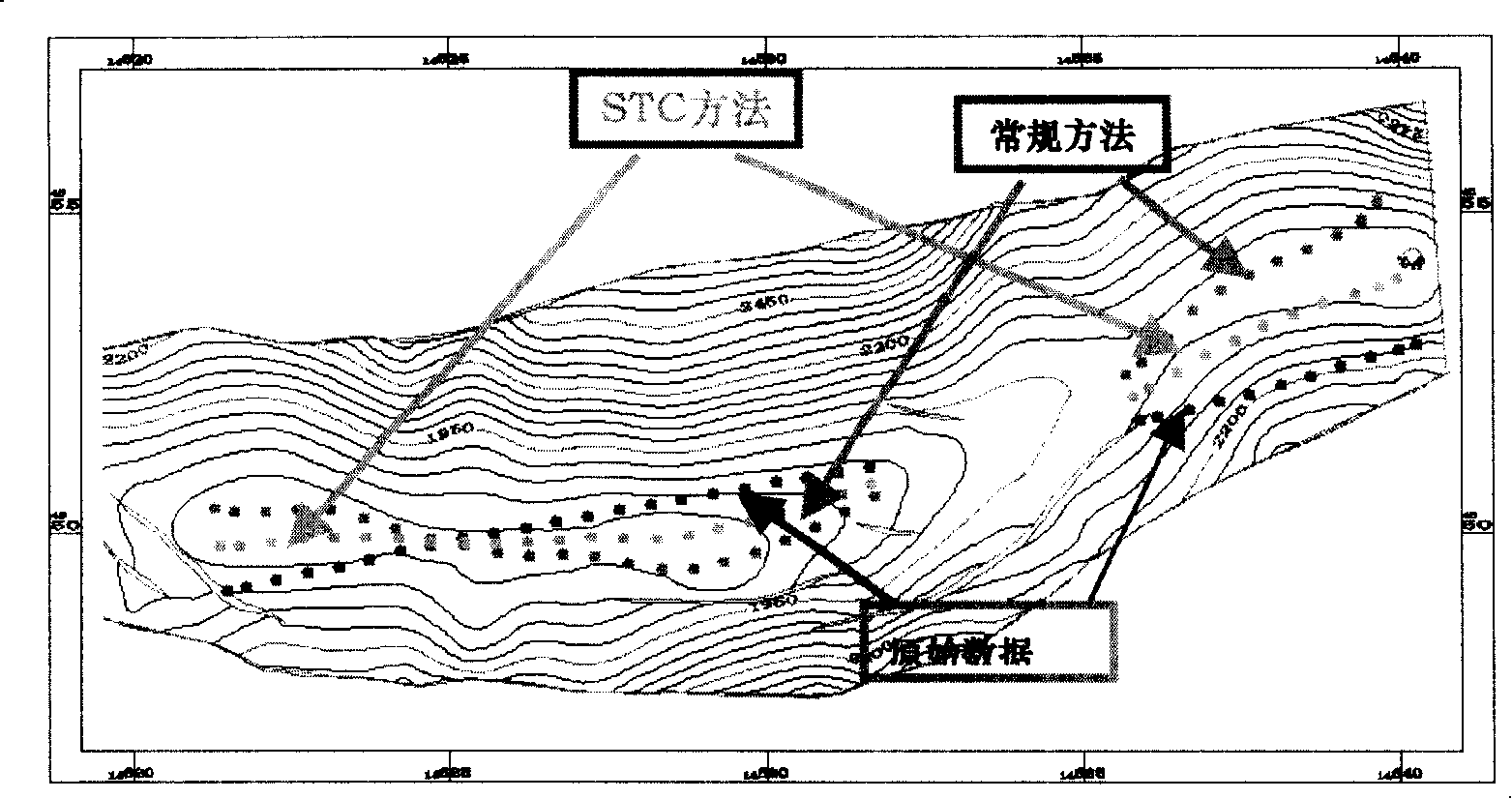
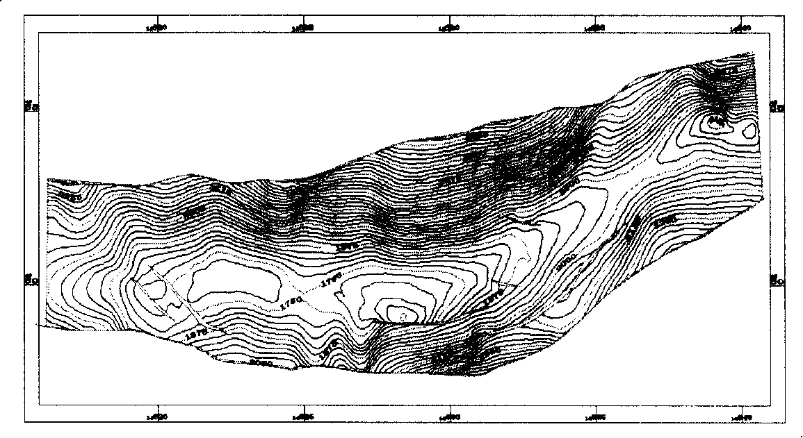
Especially in areas with complex structures and steep dips, the impact of excessive offset is more serious. In many cases, the reflection point data space will be corrected to the place where there is no horizon. Phenomena that move to construct another wing ( figure 2 ), the offset result is wrong
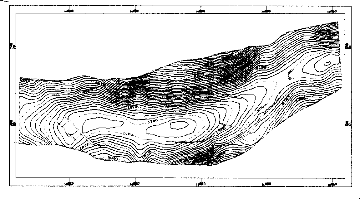
The structural map formed by the spatial correction results is also incorrect ( image 3 ) will cause distortion of the structural shape on the produced structural map, making it impossible to determine the trap area and structural amplitude, which will cause errors in later drilling

Method used


Image

  • Method for constructing complex 2D seismic data flat spot control image
  • Method for constructing complex 2D seismic data flat spot control image
  • Method for constructing complex 2D seismic data flat spot control image

Examples


Embodiment Construction

[0035] specific implementation plan

[0036] The present invention is a flat point control mapping method for two-dimensional seismic data of complex structures, which adopts the flat point control method (The method of Straight Top Control Map Migration) space correction, which is an improvement on the original straight line space correction method , that is, taking the time-varying map of a certain target layer formed by unmigrated data as the structural background, controlling the spatial correction results based on the non-displacement of the flat point, and solving the problems existing in conventional spatial correction methods in 2D seismic data interpretation.

[0037] Concrete realization process of the present invention is as follows:

[0038] 1) Acquire the data to be spatially corrected. Pick horizon data from the two-dimensional seismic data in the work area, and then interpolate on the plane to form uniformly distributed slice data; establish an initial model fo...


PUM


Abstract

The invention relates to a flat spot mapping method by using complex two dimensional seismic data which is processed by petroleum exploration. The process is that the data which requires the spatial correction is collected; the correction value of the initial space is obtained according to the level data; if the place with a complex structure before spatial correction is not located at the same wing part with the place after the spatial correction, a new spatial correction value is obtained. The speed variation parameter S of seismic migration is determined according to the inclination degree of the strata; the slope product of the projection points of the two points before and after spatial correction on the time level variation map along the migration direction is a positive number; When S is selected, the correction coefficient R parameter value of seismic migration speed of a certain underground point is determined. The invention greatly solves the excessive migration problem of the calculation result by using the original method; the whole spatial correction result is more accurate and reasonable, which can really reflect the shape of underground structure; the invention is favorable to comprehensive geological evaluation and oil and gas prediction.

Description

technical field [0001] The invention relates to petroleum exploration and development technology, in particular to a flat point control mapping method for two-dimensional seismic data of complex structures that satisfies the interpretation of seismic data of high and steep complex structures in mountain piedmont. Background technique [0002] Seismic methods are usually used in petroleum seismic exploration to collect two-dimensional seismic reflection information, and the seismic information is processed to form two-dimensional seismic data. The data formed in this way are arranged in traces in the horizontal direction, and there can be several traces in the vertical direction. There are several time-domain, discrete point data in each trace, which are displayed as seismic profiles. Two-dimensional seismic data interpretation is the process of identifying and tracking layers and faults from the obtained two-dimensional seismic data, processing and analyzing them to form a s...

Claims


Application Information

Patent Timeline
Patent Type & Authority Applications(China)
IPC IPC(8): G01V1/28G01V1/36
Inventor 岳伏生徐广民
Owner BC P INC CHINA NAT PETROLEUM CORP
Learn More