
Integral digital circumferentor

A digital and integrated technology, applied in the directions of compass, measuring device, surveying and mapping, and navigation, etc., can solve the problems of complex structure and operation of digital geological compass, large human error, cumbersome use, etc., to achieve simple structure and reduce volume. , the effect of improving reliability

Inactive Publication Date: 2009-03-25
黄铭 +2
View PDF1 Cites 3 Cited by
  • Summary
  • Abstract
  • Description
  • Claims
  • Application Information

AI Technical Summary

Problems solved by technology

[0003] The purpose of the present invention is to provide an integrated digital geological compass, which solves the technical problems of cumbersome use of the traditional geological compass and large human errors, as well as the complicated structure and operation of the existing digital geological compass

Method used


Image

  • Integral digital circumferentor
  • Integral digital circumferentor
  • Integral digital circumferentor

Examples


Embodiment Construction

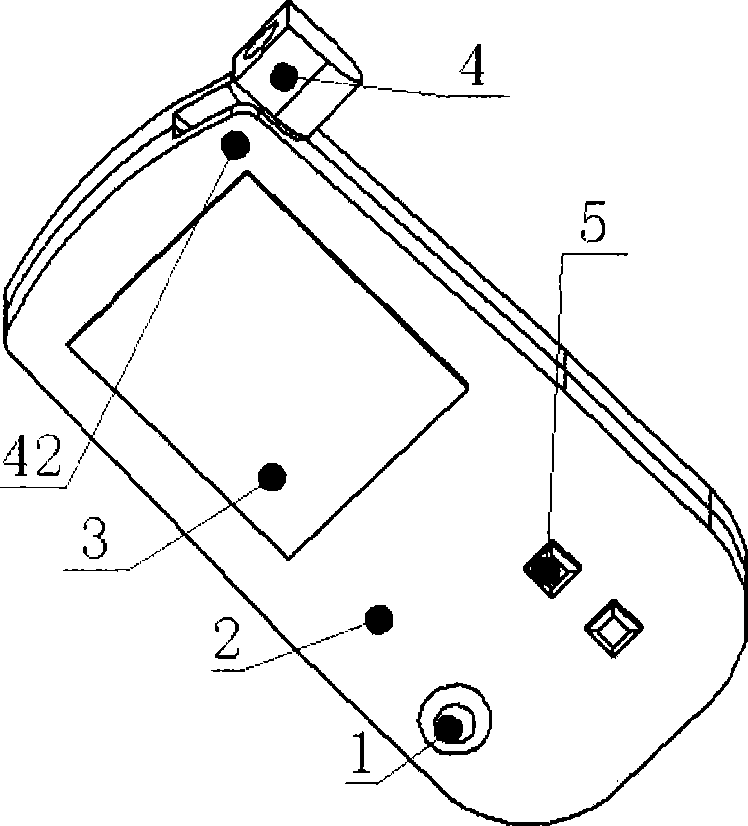
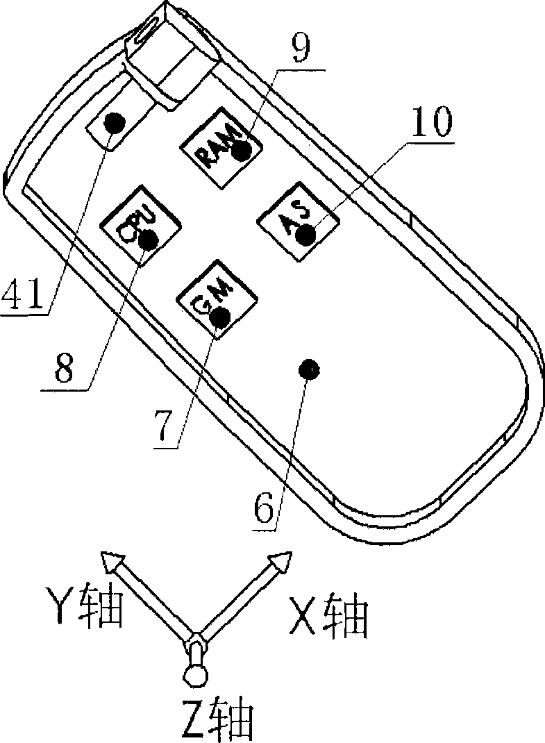
[0014] The digital geological compass of the present invention includes a body, a camera, a display screen, a rocker, an input button, a three-axis acceleration sensor, a magnetoresistive sensor, a processing unit, and a storage unit. The three-axis acceleration sensor (hereinafter referred to as AS) is installed in the body, and its X-axis and Y-axis are parallel to the corresponding X-axis and Y-axis of the magnetoresistive sensor (hereinafter referred to as GM) also installed in the body, and their Y-axis Parallel to the side of the compass of the present invention. The camera is linked to the upper right end of the compass through a camera shaft. The camera shaft remains parallel to the X-axis of the AS, and can rotate freely in a plane parallel to the Y, Z-axis of the AS. The input buttons include the confirm button and the exit button. The joystick is used to select the menu, and the four-way button or the five-way button can also be used to replace the joystick for menu sel...


PUM


Abstract

The invention relates to an integrated digital geological compass, which comprises a body, input keys, a triaxial acceleration transducer, a magnetic resistance sensor, a processing unit, a memory unit and a display unit, wherein the triaxial acceleration transducer, the magnetic resistance sensor, a rocker and a camera are arranged, and a display screen, the rocker and the input keys are arranged on the upper surface of the body; the camera is arranged on the outside of the body through a rotating shaft of the camera; and the rotating shaft of the camera is parallel to an X-shaft of the triaxial acceleration transducer. The integrated digital geological compass adopts the integrated structure, solves the technical problems in the prior geological compass of trivial use and large man-made error and the technical problem in the prior digital geological compass of complex structure and operation, and can measure the azimuth of any line (space positions for constructing surfaces / lines, such as a terrane surface, an axial fold surface, a fault surface, a divisional plane, a fold hinge line, a stretching lineation and so on.

Description

Technical field [0001] The invention relates to a geological compass, in particular to a digital geological compass. Background technique [0002] The compass is of great significance in geological work. It is called one of the three treasures of geological work. However, the use of traditional geological compass is very cumbersome, with large human errors, and cannot be used together with modern microcomputers. It is very useful for geological workers, especially The geologists who study the structure have brought a lot of trouble and time-consuming, which has not attracted much attention at home and abroad. With the development of automatic digitization technology, it is of great significance to develop a digital geological compass to reduce the burden of geologists and improve work efficiency. The applicant’s patent application "digital geological compass" (patent application number: 200710188556.8, publication number: CN101196567) discloses a digital geological compass with a...

Claims


Application Information

Patent Timeline
IPC IPC(8): G01C17/00
Inventor 金宠李三忠黄铭
Owner 黄铭
Learn More