Monitoring device and method for crop growth uniformity
A monitoring device and uniformity technology, which is applied in the field of crop growth uniformity monitoring devices, can solve the problems of increased measurement difficulty, long update cycle, and heavy workload.
- Summary
- Abstract
- Description
- Claims
- Application Information
AI Technical Summary
Problems solved by technology
Method used
Image
Examples
Embodiment 1
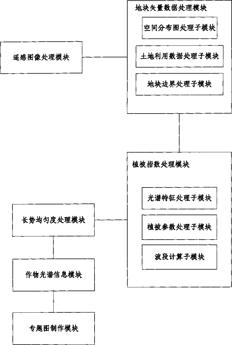
[0075] The first preferred embodiment of the present invention proposes a monitoring device for crop growth uniformity, its structure is as follows: figure 1 shown, including:
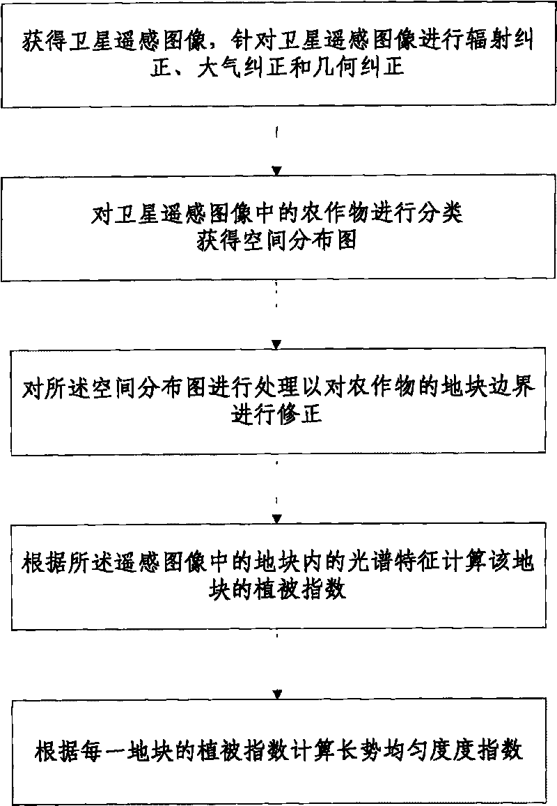
[0076] A remote sensing image processing module, the remote sensing image processing module performs radiometric correction, atmospheric correction and geometric correction on the remote sensing image according to the obtained remote sensing image;
[0077] A plot vector data processing module, the plot vector data processing module classifies the crops in the remote sensing images to obtain the spatial distribution map of the target crops; and transforms the raster classification results in the classified remote sensing images It is area vector data; then the plot boundaries of the spatial distribution map are corrected;
[0078] Vegetation index processing module, the vegetation parameter processing module calculates the vegetation index NDVI of the plot according to the spectral features in the plo...
Embodiment 2
[0088] The second preferred embodiment of the present invention is improved on the basis of the first preferred embodiment, that is, the block vector data processing module includes:
[0089] A spatial distribution map processing submodule, the spatial distribution map processing submodule classifies the crops in the remote sensing image to obtain a spatial distribution map of the target crops; and converts the grid classification of the spatial distribution map into a planar vector data;
[0090] The land use data processing submodule; the land use data processing submodule performs visual interpretation on the remote sensing image according to the satellite remote sensing image to obtain the reference time phase land use special data of the historical data;
[0091] A plot boundary processing sub-module, the plot boundary processing sub-module superimposes the surface vector data and the reference phase land use thematic data, and extracts the plot boundary after cutting thr...
Embodiment 3
[0095] The third preferred embodiment of the present invention is improved on the basis of the first preferred embodiment and the second preferred embodiment, that is, the vegetation index processing module includes:
[0096] The spectral feature processing sub-module, the spectral feature processing sub-module extracts the remote sensing data corresponding to the plot, and obtains the spectral feature information of different time phases and different bands of crops according to the remote sensing data;
[0097] Vegetation parameter processing sub-module, the vegetation parameter processing sub-module performs band operation on spectral feature information to obtain vegetation parameter NDVI;
[0098] NDVI = ( R nir - R red ) ( R nir ...
PUM
 Abstract
Description
Claims
Application Information
 - R&D
- Intellectual Property
- Life Sciences
- Materials
- Tech Scout
- Unparalleled Data Quality
- Higher Quality Content
- 60% Fewer Hallucinations
Browse by: Latest US Patents, China's latest patents, Technical Efficacy Thesaurus, Application Domain, Technology Topic, Popular Technical Reports.
© 2025 PatSnap. All rights reserved.Legal|Privacy policy|Modern Slavery Act Transparency Statement|Sitemap|About US| Contact US: help@patsnap.com


