Road live view navigation method

A navigation method and road technology, which are applied in directions such as road network navigators, instruments, registration/indication, etc., can solve the problems of inability to meet large-scale, difficult to update real-life electronic maps, and difficult to navigate in real scenes.

Inactive Publication Date: 2011-04-13
杭州妙影微电子有限公司
View PDF4 Cites 37 Cited by
  • Summary
  • Abstract
  • Description
  • Claims
  • Application Information

AI Technical Summary

Problems solved by technology

It is also very difficult to update real-scene electronic maps, and it is still unable to meet the tasks of large-scale and high-frequency real-scene collection and establishment of roads
[0005] Due to the lack of information and incompleteness of real-scene electronic maps, it is very difficult to conduct real-scene navigation based on real-scene electronic maps.

Method used


Image

  • Road live view navigation method
  • Road live view navigation method
  • Road live view navigation method

Examples


Embodiment Construction

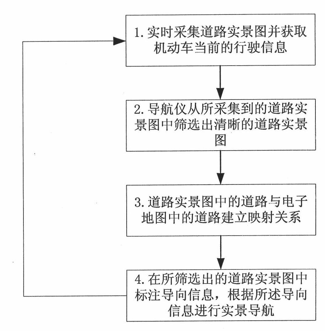
[0023] Such as figure 2 Shown, the road real scene navigation method of the present invention is carried out according to the following steps:

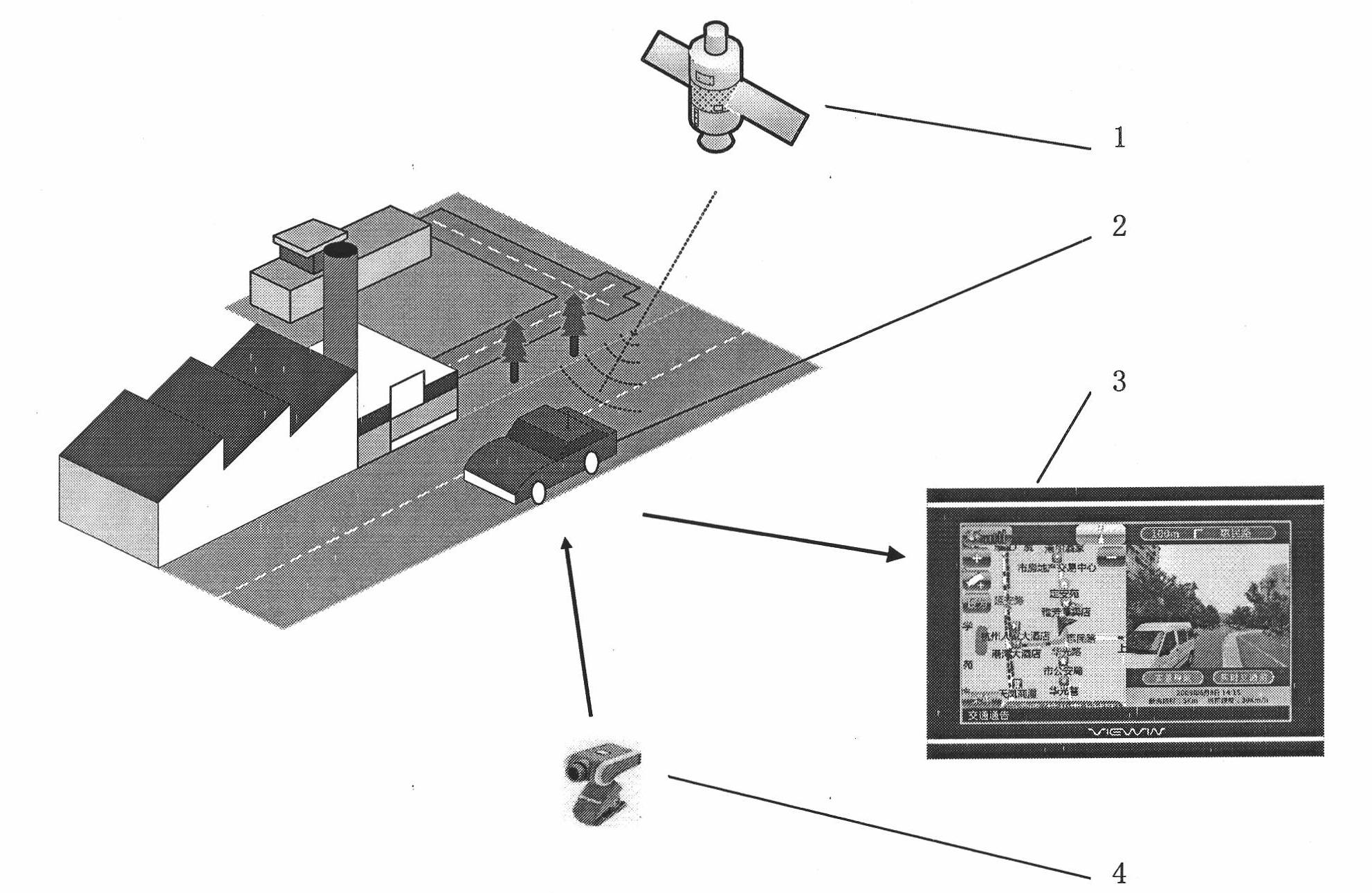
[0024] (1) if figure 1 As shown, the present invention collects the real road scene map in real time through the image acquisition device 4 installed on the driving motor vehicle 2, and utilizes the navigator 3 installed on the driving motor vehicle to obtain the current driving information of the motor vehicle. In the present invention, the current driving information mainly includes the longitude and latitude of the GPS 1 where the motor vehicle 2 is currently located, and further includes the current driving speed of the motor vehicle. The image acquisition device 4 is connected to the navigator 3 through a USB interface.

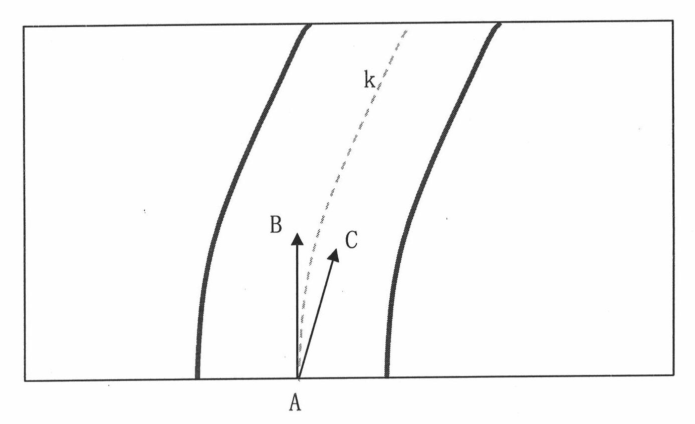
[0025] (2) The navigator 3 installed on the driving motor vehicle 2 screens out a clear road real scene map from the collected road real scene map. Such as image 3 As shown, the present invention requires ...


PUM


Abstract

The invention relates to a road live view navigation method, which comprises the following steps of: (1) acquiring a road live-view image by image acquisition equipment arranged on a running automotive vehicle and acquiring the current running information of the automotive vehicle by utilizing a navigator on the vehicle; (2) screening a clear road live-view image by the navigator on the vehicle, so that an included angle between a tangent line, which passes through a base point, of a road center line in the screened road live-view image and the running direction of the automotive vehicle is between 0 and 30 DEG C; (3) matching the screened road live-view image and an electronic map and establishing a mapping relationship; and (4) labeling guiding information in the screened road live-view image by the navigator on the vehicle according to navigating path planning information stored by the navigator and the mapping relationship between the road in the road live-view image and the road in the electronic map, and performing live-view navigation according to the guiding information. When the navigating method is used, the road live-view navigation is simplified, so that the ordinary electronic map also can be used as a carrier of the road live-view navigation, and the road live-view navigation is realized.

Description

technical field [0001] The invention relates to a road real-scene navigation method, in particular to a method of using ordinary vehicles to collect road real-scene, and matching and mapping with a traditional electronic map via a navigator to carry out road real-scene navigation. Background technique [0002] With the rapid growth of the urban economy and the continuous improvement of people's living standards, the number of private cars has increased rapidly. Although major cities have increased the pace of road infrastructure construction in recent years, traffic contradictions are still becoming increasingly prominent. Moreover, with the continuous advancement of urban construction, the traffic conditions on urban roads are very complicated. Traditional navigation products are guided by voice and electronic maps, and it is difficult to make the driver's awareness match the actual situation. The intersection is even a question of taking the wrong intersection. [0003] ...

Claims


Application Information

Patent Timeline
Patent Type & Authority Applications(China)
IPC IPC(8): G01C21/26G07C5/00
Inventor 董天阳蔡铭施振浩
Owner 杭州妙影微电子有限公司
Why Eureka
Try Eureka