

Foundation laser radar data registration method based on single tree position and surface information
A laser radar and data technology, applied in the direction of measuring devices, electromagnetic wave re-radiation, and utilization of re-radiation, can solve the problems of reduced probability of success, low stand density, difficult selection of control points, etc., and achieve the effect of reducing dependence
- Summary
- Abstract
- Description
- Claims
- Application Information
AI Technical Summary
Problems solved by technology
Method used
Image

Examples
Embodiment Construction
[0023] Hereinafter, typical embodiments for carrying out the present invention will be described in detail with reference to the accompanying drawings.
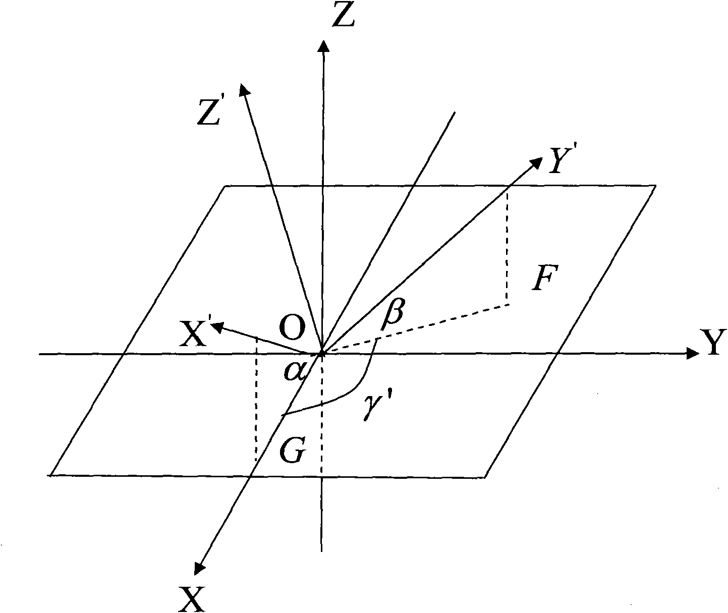
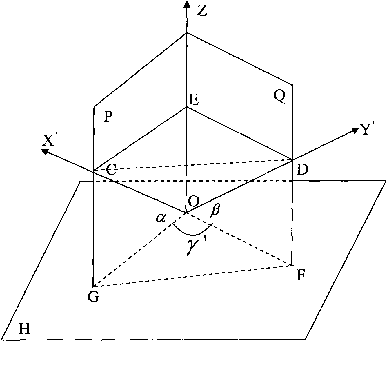
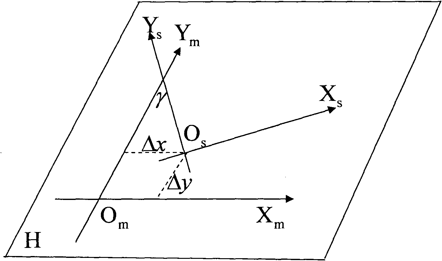
[0024] According to the principle of data registration, a total of 6 parameters need to be determined in the registration process. The present invention uses an inclination sensor to measure the attitude of the instrument along the X and Y axes of the ground-based laser radar. In this way, fewer parameters need to be determined, namely 4. The XOY plane can be rotated to the horizontal plane using the measured attitude parameters. For the lidar data, the ground point and the vegetation point are separated by the variable scale method first, and then the position of the single tree is identified through vertical filtering, and the single tree with the same name is automatically identified by using the relative position between the single trees, and the same list of trees is used as the control point, three of the parameters can...
PUM
 Abstract
Description
Claims
Application Information