Method for identifying characteristic land categories of ocean remote sensing images of coast on basis of semi-supervised learning

A semi-supervised learning, remote sensing image technology, used in character and pattern recognition, instruments, computer parts, etc.

Inactive Publication Date: 2011-05-25
NANJING UNIV
View PDF4 Cites 30 Cited by
  • Summary
  • Abstract
  • Description
  • Claims
  • Application Information

AI Technical Summary

Problems solved by technology

However, since there is no input of prior knowledge at all, the results o...

Method used


Image

  • Method for identifying characteristic land categories of ocean remote sensing images of coast on basis of semi-supervised learning
  • Method for identifying characteristic land categories of ocean remote sensing images of coast on basis of semi-supervised learning
  • Method for identifying characteristic land categories of ocean remote sensing images of coast on basis of semi-supervised learning

Examples


Embodiment Construction

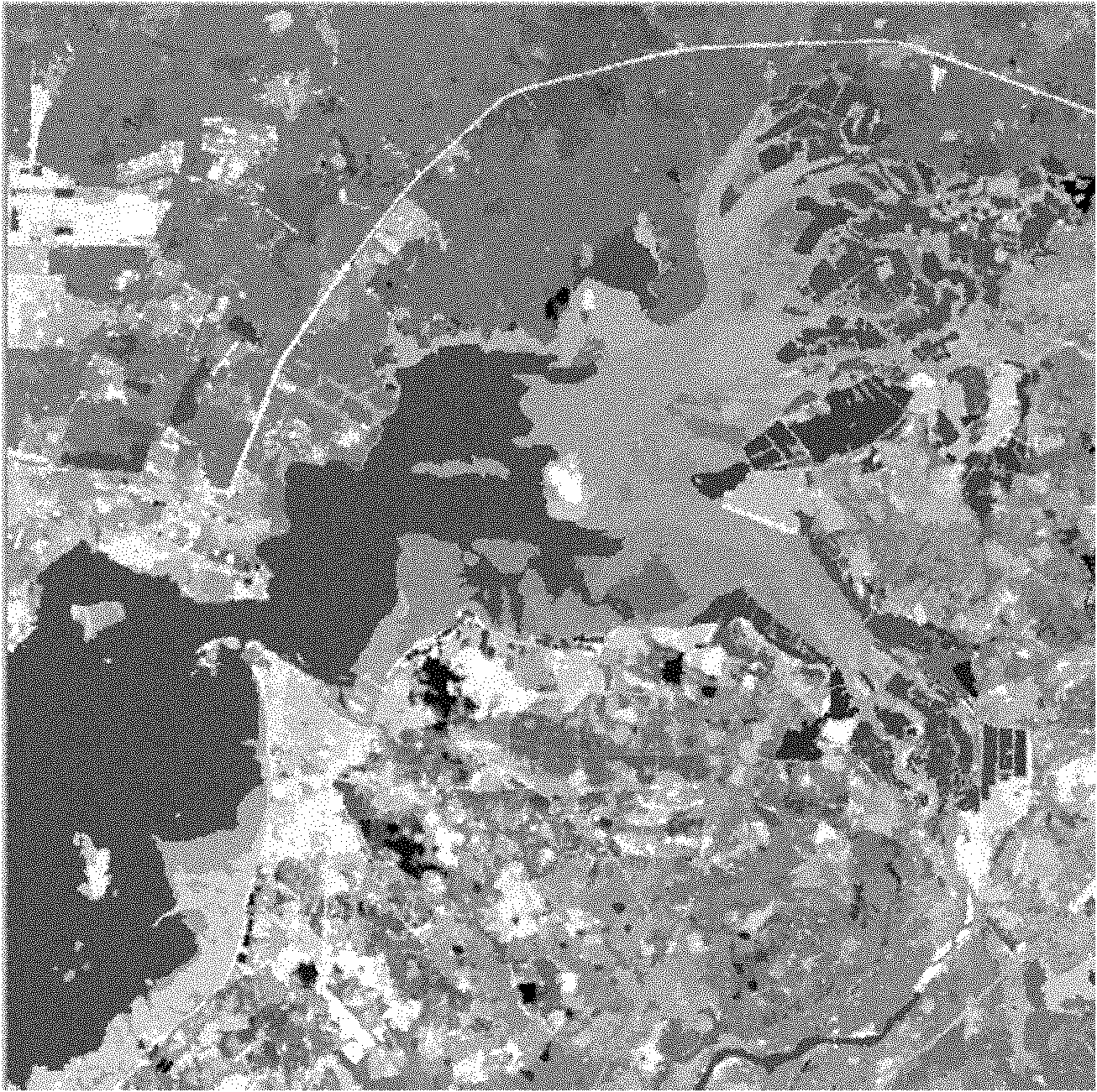
[0050] In this embodiment, the attached figure 2 The remote sensing image shown is used as the initial image for the identification of coastal ocean features and landforms. The remote sensing image data was taken by the TM theme imager of Landsat 5 satellite on January 2, 2007. The image size of the embodiment area is 500×500 pixels, and the area is located in the Xinying Bay Mangrove Nature Reserve in the northwest of Hainan Island. The specific implementation of this example adopts the standard C++ programming language to realize under the VC 6.0 platform, and the reading and writing operation of the remote sensing image data is realized through the open-source geographic data format conversion class library GDAL 1.60. The specific implementation steps are as follows:

[0051] Step 1: Use GDAL as the image data reading and writing tool, and use the GDAL.Open method to read remote sensing images. According to the marine and coastal characteristics of Hainan Island, the gro...


PUM


Abstract

The invention discloses a method for identifying characteristic land categories of ocean remote sensing images of a coast on the basis of semi-supervised learning and belongs to the field of identification of semi-automatic remote sensing images. The method comprises the following steps of: selecting a marking sample for each type of characteristic ground objects; constructing a dividing result facing to the remote sensing images of an object; computing an initial estimation value of probability that pixels of all samples are subordinate to the characteristic land categories and computing theprobability that sample data falls under components of the characteristic land categories; amending a probability image by using a characteristic space rule; judging the characteristic land categories which the remote sensing images belong to, realizing the identification of the characteristic land categories and outputting an identification result drawing. The method is combined with the priori knowledge and the statistical property of the data and can guide the data mining process by the topographical priori knowledge. Practice proves that the algorithm can effectively carry out classification of the remote sensing images to obtain a satisfying result, has the characteristics of high efficiency and high accuracy and can be directly used for maintaining and updating remote sensing thematic information of all levels of fundamental geographic information databases in China.

Description

technical field [0001] The invention relates to a method for identifying feature landforms of remote sensing image data, in particular to a method for identifying feature landforms of coastal ocean remote sensing images based on semi-supervised learning. Background technique [0002] As a non-contact observation technology, remote sensing has a long history. The remote sensing image data provided by it has the advantages of high timeliness, wide coverage, and rich information. It has been widely used in land use, resource exploration, and ecological environment. Monitoring, and the identification of coastal and marine features and land types are playing an increasingly important role in the development of society and economy. The coastal area is the core area of ​​social and economic development. With the strengthening of marine economic development, the land use, sea area use and environmental changes in the coastal area are also changing with each passing day. In order to...

Claims


Application Information

Patent Timeline
IPC IPC(8): G06K9/66
Inventor 刘永学李满春程亮陈振杰江冲亚陈焱明李真杨康刘成明
Owner NANJING UNIV
Why Eureka
Try Eureka