
Method for providing geographical position related information in a wireless network

A technology of geographic location and wireless signal, applied in the directions of location information-based services, wireless communication, radio wave measurement system, etc., it can solve the problems of restricted use, unusable measurement and positioning process, and no clear measurement, and achieves overhead signaling. low effect

Inactive Publication Date: 2011-05-25
TELEFON AB LM ERICSSON (PUBL)
View PDF6 Cites 3 Cited by
  • Summary
  • Abstract
  • Description
  • Claims
  • Application Information

AI Technical Summary

Problems solved by technology

Therefore, a common problem is that in order to allow the implementation of different improved positioning methods, the reporting of positioning data must be performed according to new manufacturer-specific non-standard protocols, which in turn limits the ability to use systems where all parts are supplied by the same manufacturer. use
[0007] Furthermore, there are no explicitly defined measurements for positioning in LTE
Since the modulation scheme and sequences used in LTE are different from WCDMA, the measurement and positioning procedures used in WCDMA cannot be used in LTE

Method used


Image

  • Method for providing geographical position related information in a wireless network
  • Method for providing geographical position related information in a wireless network
  • Method for providing geographical position related information in a wireless network

Examples


Embodiment Construction

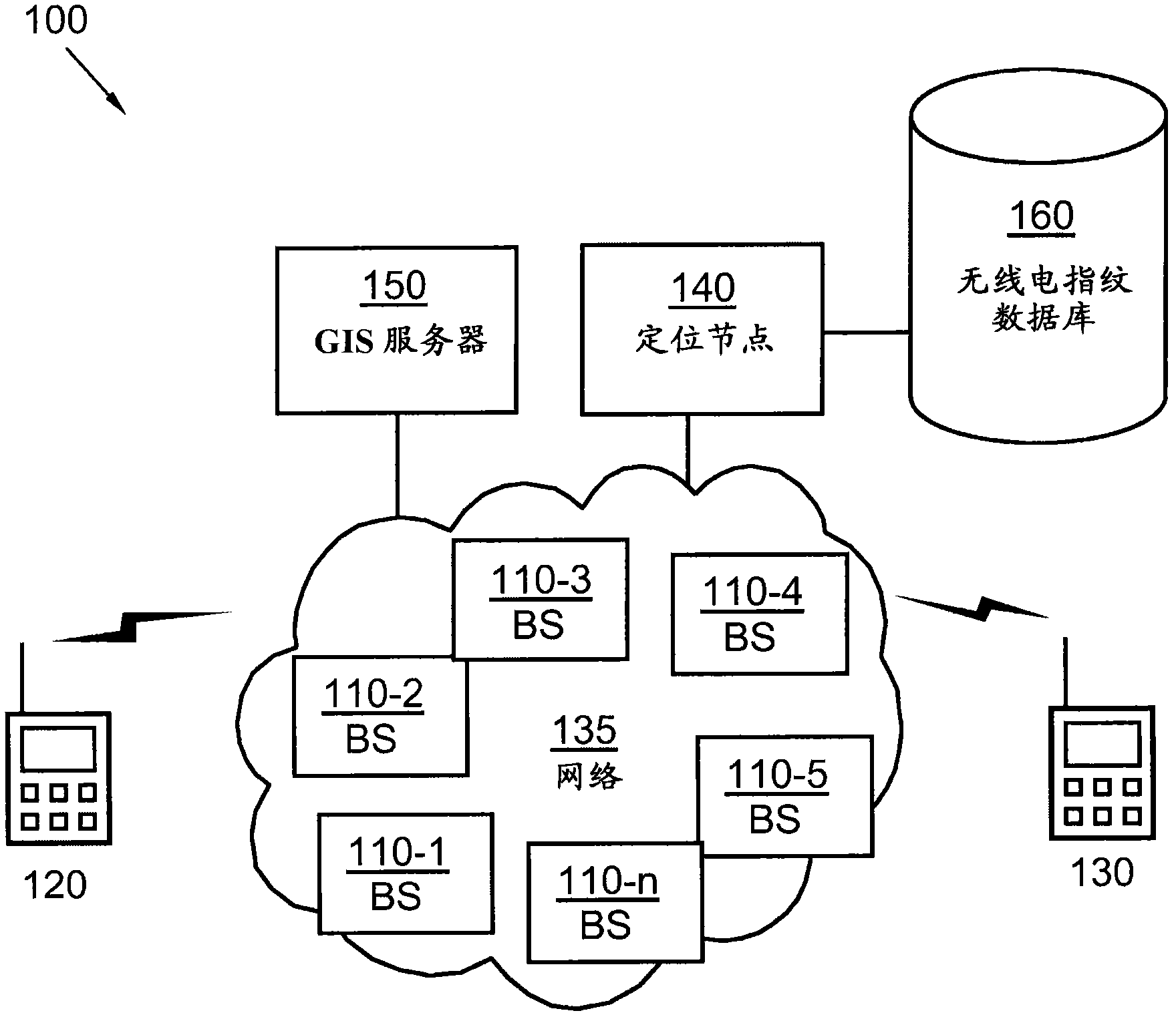
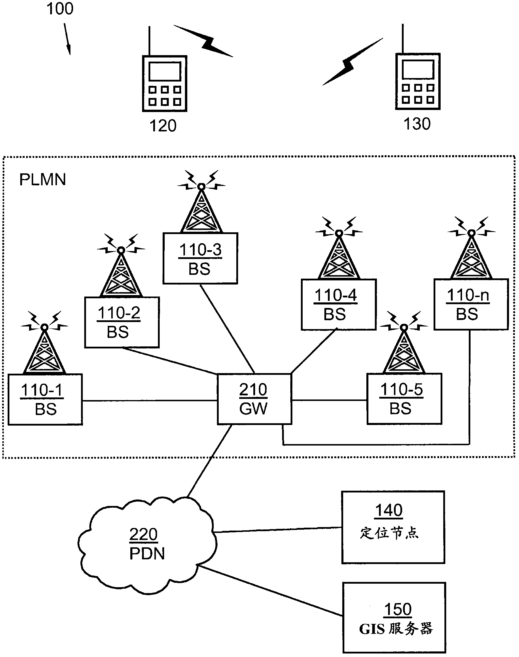
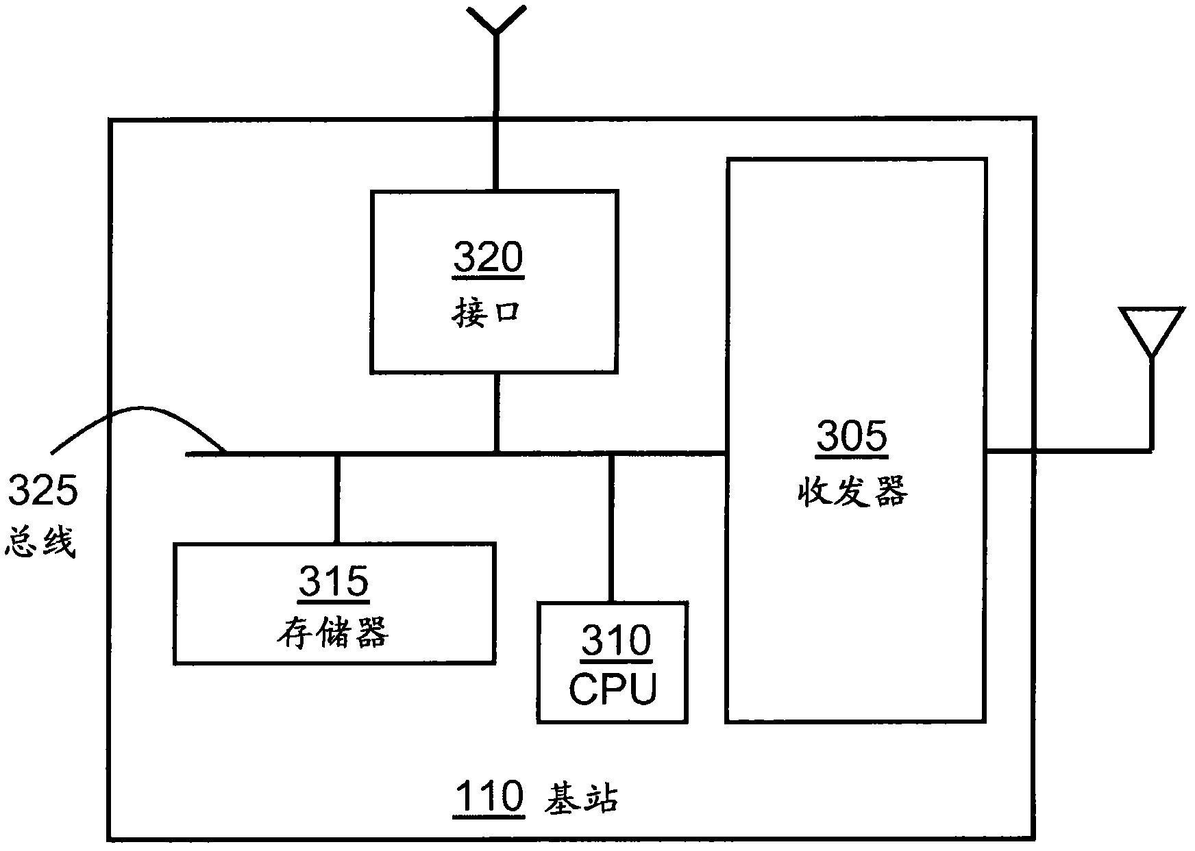
[0025] The present invention is defined as a method and a device in a positioning node, and a method and a device in a user equipment, which can be implemented in the following embodiments. However, this invention may be embodied in many different forms and should not be construed as limited to the embodiments set forth herein; rather, these embodiments are provided so that this disclosure will be thorough and complete, and will fully convey the scope of the invention to the Those skilled in the art. It should be understood that the present invention is not intended to limit the method and device in the positioning node and the method and device in the user equipment to any specific form disclosed, on the contrary, the method and device in the positioning node and the method in the user equipment and devices are intended to cover all modifications, equivalents and alternatives falling within the scope of the invention as defined by the claims.

[0026] Still other objects, ad...


PUM


Abstract

The invention provides a method and an arrangement in a first nodefor providing geographical position related information. The first node and a second node are comprised within a wireless communication system. The first node and the second node are adapted to exchange wireless signals. The method comprises receivinga signal from the second node. Apart of the received signal that has propagated through a first channel path from the second node is detected by using a circular correlator. A timing estimate associated with the propagation time of the part of the signal which is received over the first channel path from the second node is calculated. Thus the calculated timing estimateis provided, which timing estimate is to be used when determining the geographical position.

Description

technical field [0001] The invention relates to methods and devices in a first node. More specifically, the present invention relates to improved mechanisms for obtaining timing estimates in wireless communication systems. Background technique [0002] Currently, standardized and commercially deployed radio access technologies are proliferating. Such radio access technologies include Global System for Mobile Communications (GSM), Enhanced Data Rates for GSM Evolution (EDGE), General Packet Radio System (GPRS) and Code Division Multiple Access (WCDMA), Long Term Evolution (LTE) systems, wireless Local Area Network (WLAN), CDMA 2000 and others. [0003] Positioning in wireless communication systems including these or other techniques can be performed in many different ways. A typical scenario is to provide location requests. If positioning information is not yet available, some kind of measurement can be performed and the positioning data can be reported to the node respon...

Claims


Application Information

Patent Timeline
IPC IPC(8): H04W64/00H04B17/00H04W4/02H04W4/029
CPCG01S5/0284G01S5/0252H04B17/0072H04W64/00G01S5/0009H04W4/02H04B17/27G01S5/02522H04W4/029
Inventor R·巴尔德迈尔M·伊斯拉尔森D·格斯坦伯格M·卡兹米T·维格伦
Owner TELEFON AB LM ERICSSON (PUBL)
Learn More