Method for classifying multi-spectral remote sensing data land use based on semi-supervisor manifold learning

A technology of manifold learning and classification method, which is applied in the direction of instrumentation, computing, character and pattern recognition, etc., and can solve problems such as high cost, limited number of samples, and poor classification effect

Inactive Publication Date: 2011-07-20
CHONGQING UNIV
View PDF2 Cites 35 Cited by
  • Summary
  • Abstract
  • Description
  • Claims
  • Application Information

AI Technical Summary

Problems solved by technology

Since the cost of obtaining training samples with class labels in multispectral images is relatively high and the number of samples is very limited, the effect of using supervised

Method used


Image

  • Method for classifying multi-spectral remote sensing data land use based on semi-supervisor manifold learning
  • Method for classifying multi-spectral remote sensing data land use based on semi-supervisor manifold learning
  • Method for classifying multi-spectral remote sensing data land use based on semi-supervisor manifold learning

Examples


Embodiment 1

[0088] figure 1 It is a flowchart of land use classification method for multispectral remote sensing data based on semi-supervised manifold learning; figure 2 The data distribution situation before the projection of the algorithm classification accuracy map sample data; the multi-spectral image land use classification method based on semi-supervised manifold learning provided by the invention, comprises the following steps:

[0089] (1) Read in multispectral remote sensing data;

[0090](2) Read in each sample data point in the selected multispectral remote sensing image, and generate a vector according to its band, so that the selected samples in the multispectral remote sensing image are represented by a matrix as a training sample set;

[0091] (3) Select part of the sample data from the training sample set according to the prior knowledge to mark the known object categories, and generate sample category labels;

[0092] (4) On the premise that part of the data category ...

Embodiment 2

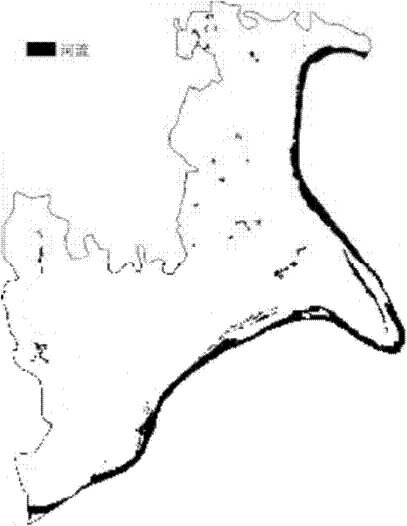
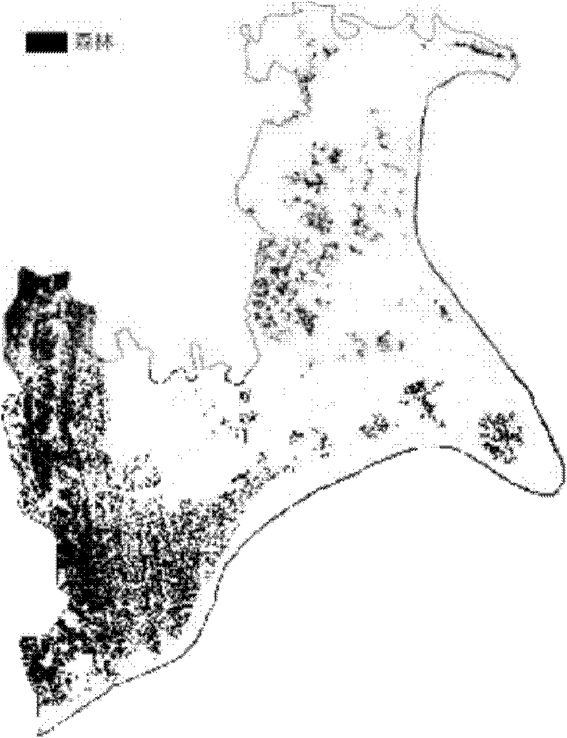
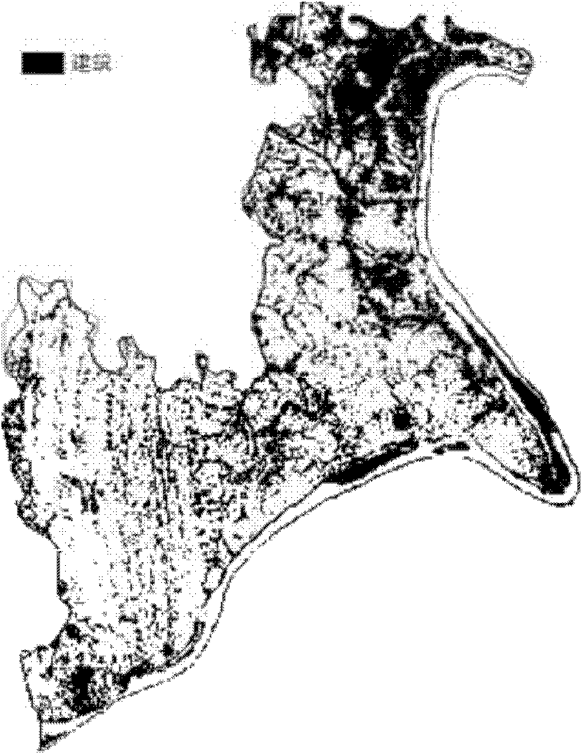
[0149] The multi-spectral remote sensing image data of Dadukou District in Chongqing City contains three bands with a resolution of 14.25m, and mainly includes five types of ground objects: buildings, forest land, grassland, water area, cultivated land and paddy fields. The realization process of the present invention is as figure 1 As shown, the specific implementation is carried out in the following steps:

[0150] (1) Reading in multispectral remote sensing data: read in multispectral remote sensing image data in Dadukou area, the bands are band1, band2 to band3;

[0151] (2) Select multi-spectral remote sensing image training sample data: select 50 sample points with known category information for each category, convert them into a matrix with 300 rows and 3 columns, and randomly select 600 sample points with unknown categories, expressed as X= {x 1 , x 2 ,...,x 300 , x 301 ,...x 900} T ;

[0152] (3) The user uses prior knowledge to mark some samples: 50 data poin...


PUM


Abstract

The invention discloses a method for classifying multi-spectral remote sensing data land use based on semi-supervisor manifold learning, relating to a land use classification method. The method comprises the following steps of: taking the multi-spectral remote sensing data as a sample data set according to a wave band generator matrix of the data; selecting a part of sample data from the sample data set, marking sample class labels according to priori knowledge, and randomly selecting a part of sample data as unmarked data from the sample data set; establishing a similarity graph and a difference graph to measure the similarity and the difference of data points, and calculating a weight matrix; calculating according to an optimal target function to obtain a projection matrix; projecting the whole multi-spectral remote sensing data; and executing the land use classification by using a K-adjacent classification algorithm. The invention adds the randomly selected unmarked sample data by utilizing a semi-supervisor manifold learning method, calculates the projection matrix by the optimal target function so as to increase the precision of the land use classification and effectively saves the cost of marking the training sample classes at the same time.

Description

technical field [0001] The invention relates to a land use classification method based on multispectral remote sensing data, in particular to a semi-supervised manifold learning method suitable for multispectral data land use classification. Background technique [0002] Since the 1960s, people have used multispectral technology to obtain information on the earth's surface. Multispectral imaging is a remote sensing technology that uses a multispectral photography system or a multispectral scanning system to perform simultaneous photographic remote sensing on different spectral bands of the electromagnetic spectrum, and obtain images of vegetation and other ground objects in different spectral bands. A multi-spectral scanner (Multi-spectral Scanner, MSS) is a spectral measurement sensor, which obtains ground object information by recording the response of ground objects to different spectral bands. Multispectral imaging is accomplished by scanning. For each ground area with...

Claims


Application Information

Patent Timeline
IPC IPC(8): G06K9/66
Inventor 黄鸿冯海亮秦高峰王立志何同弟
Owner CHONGQING UNIV
Why Eureka
Try Eureka