

Geo-synchronous orbit synthetic aperture radar (GEO SAR) frequency modulation changeable standard imaging method under curve track model
A technology of curve trajectory and imaging method, applied in the field of communication, can solve the problems of long synthetic aperture time, large amount of calculation and high height, and achieve the effect of wide imaging surveying and mapping bandwidth, improving imaging accuracy and complete motion information.
- Summary
- Abstract
- Description
- Claims
- Application Information
AI Technical Summary
Problems solved by technology
Method used
Image

Examples
Embodiment Construction
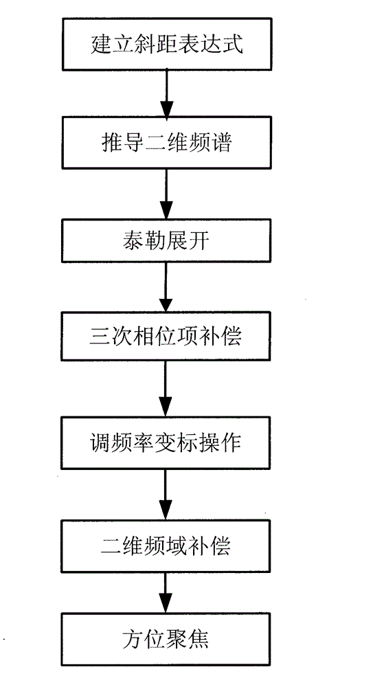
[0034] The present invention will be further described below with reference to the accompanying drawings.
[0035] refer to figure 1 , the specific implementation steps of the present invention are as follows:
[0036] Step 1. Establish the slope distance expression.
[0037] The orbital equation of a geostationary satellite is as follows:
[0038] x s y s z s = R cos L 0 [ 1 + ( cos i ...
PUM
 Abstract
Description
Claims
Application Information