Digital vector sea and land map fusion method and system

A fusion method and vector technology, applied in the direction of electrical digital data processing, special data processing applications, instruments, etc., can solve problems such as staying in method discussion and prototype implementation, not entering practical application, and not involving geographic information service semantic research, etc. Achieve the effect of integrated management and data fusion, high data utilization rate, and elimination of differences in spatial geometric positions

Inactive Publication Date: 2012-01-04
国家测绘局卫星测绘应用中心 +1
View PDF0 Cites 17 Cited by
  • Summary
  • Abstract
  • Description
  • Claims
  • Application Information

AI Technical Summary

Problems solved by technology

[0013] GIS semantic interoperability is still a difficult point in GIS interoperability. It is still in the stage of method discussion and prototype implementation, and has not entered into practical applica

Method used


Image

  • Digital vector sea and land map fusion method and system
  • Digital vector sea and land map fusion method and system
  • Digital vector sea and land map fusion method and system

Examples


Embodiment Construction

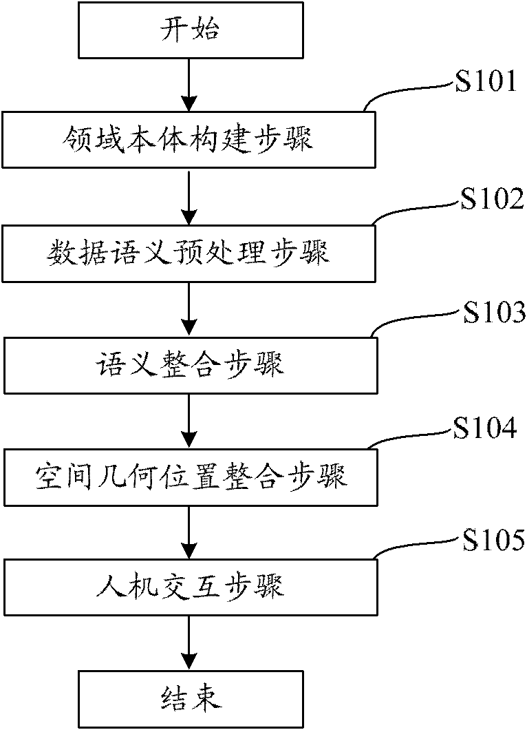
[0042] Hereinafter, the present invention will be described more fully with reference to the accompanying drawings, and preferred embodiments for realizing aspects of the present invention will be shown.

[0043] First, some technical terms involved in this manual are introduced.

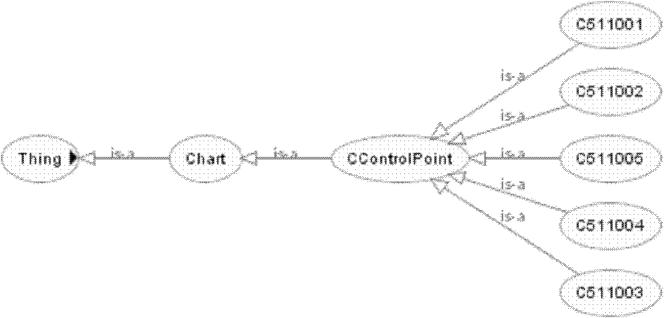
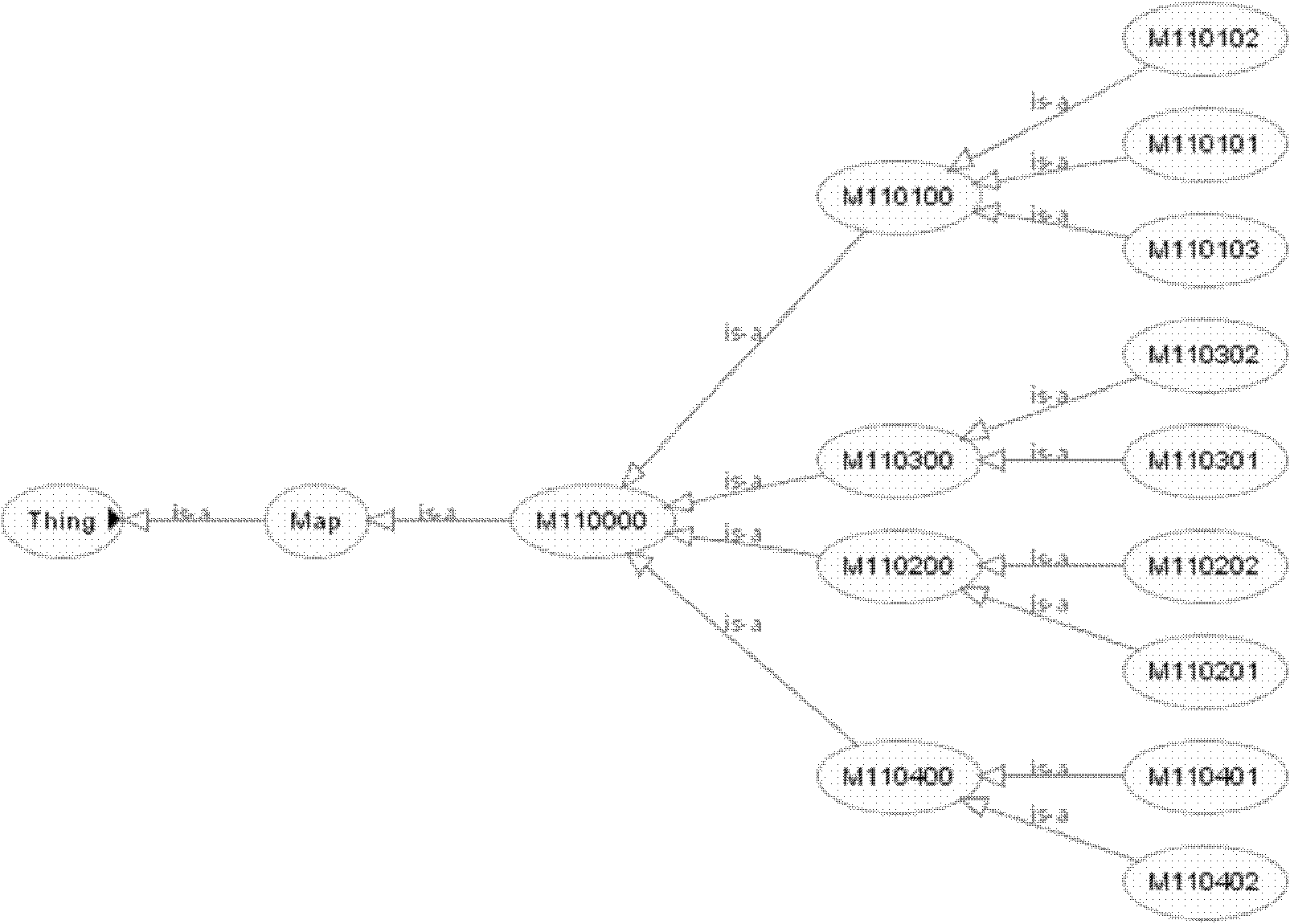
[0044] 1) Sea and land integration

[0045] The sea-land integration according to the present invention is to convert the geographical elements in the national standard sea chart and the standard land map to the unified standard of sea and land elements. For sea and land vector data, it includes unification of data format, unification of spatial reference, unification of element semantic information, unification of spatial geometric position, etc. For example, the unification of the data format includes conversion from Txt format to Shp format, DWG format to Shp format, and Coverage format to Shp format; the unification of the spatial reference includes geographic coordinate system integration and ...


PUM


Abstract

The invention discloses a digital vector sea and land map fusion method and a digital vector sea and land map fusion system. The digital vector sea and land map fusion system comprises a domain ontology construction part and a semantic fusion part, wherein the domain ontology construction part is used for constructing geographic ontologies in various domains in a sea map, a land map and a sea and land integrated map and constructing a mapping relation among the geographic ontologies in the various domains; and the semantic fusion part is used for performing semantic fusion on the sea map, the land map and the sea and land integrated map based on the ontologies and the mapping relation thereof which are constructed by the domain ontology construction part to realize the classification, hierarchical fusion and semantic intercommunication of geographic elements among the domains, and providing cross-semantic query of the geographic elements, geographic ontology query and browse, and free fusion and conversion among the sea map, the land map and the sea and land integrated map. By the digital vector sea and land map fusion method and the digital vector sea and land map fusion system, sea and land integrated management is realized.

Description

technical field [0001] The invention relates to a digital vector sea and land map fusion method and system. More specifically, the present invention relates to a digital vector sea and land map fusion method and system capable of realizing integrated management of sea and land. Background technique [0002] In recent years, with the rapid development of social economy and the commercialization, popularization and globalization of Geographical Information System (GIS) applications, the society's demand for geospatial information is increasing, and different sectors and industries of society often need To obtain a large amount of geospatial data, they will use different data production software according to their own needs, and produce data according to the corresponding data standards. This will not only generate geospatial data in different data formats, but also cause the same area. Geospatial data of the same scale is repeatedly acquired many times, which leads to multi-s...

Claims


Application Information

Patent Timeline
IPC IPC(8): G06F17/30
Inventor 唐新明史绍雨汪汇兵文敏申传庆贺江莉姚春雨
Owner 国家测绘局卫星测绘应用中心
Why Eureka
Try Eureka