Multitemporal remote sensing image-based subpixel positioning method

A remote sensing image and positioning method technology, applied in the field of remote sensing information processing, can solve the problems of sub-pixel positioning solution process under-constrained, single constraints, etc., to achieve high sub-pixel positioning accuracy and increase the effect of constraints

Inactive Publication Date: 2012-05-09
HARBIN ENG UNIV
View PDF0 Cites 15 Cited by
  • Summary
  • Abstract
  • Description
  • Claims
  • Application Information

AI Technical Summary

Problems solved by technology

However, only the spectral information of low-resolution remote sensing images to be located is used in MRF, and the spectral constraints are partially restricted, and the sub-pixel positioning solution process is under-constrained

Method used


Image

  • Multitemporal remote sensing image-based subpixel positioning method
  • Multitemporal remote sensing image-based subpixel positioning method
  • Multitemporal remote sensing image-based subpixel positioning method

Examples


Embodiment Construction

[0024] The present invention is described in more detail below in conjunction with accompanying drawing example:

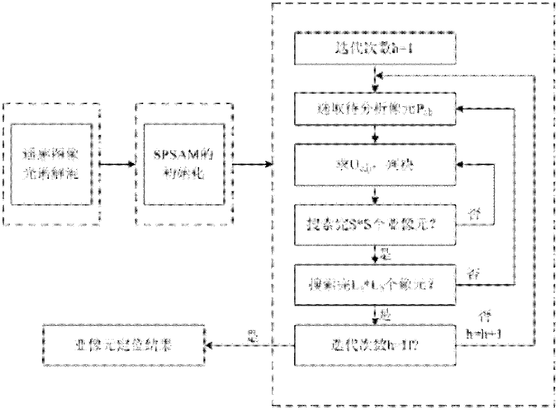
[0025] combine Figure 1-8 , the invention is a sub-pixel positioning method based on multi-temporal remote sensing images. Provide the detailed process of the present invention below:

[0026] Step 1: Spectral unmixing of remote sensing images:

[0027] Input the low-resolution remote sensing image, and through the spectral unmixing technology, obtain the mixed proportion of various types of mixed pixels in the remote sensing image, that is, the component map.

[0028] Step 2: Initialization of the SPSAM method:

[0029] According to various component maps, the deterministic initial spatial distribution of sub-pixels is obtained by using the SPSAM method.

[0030] Step 3: Using the sub-pixel positioning method of multi-temporal remote sensing images:

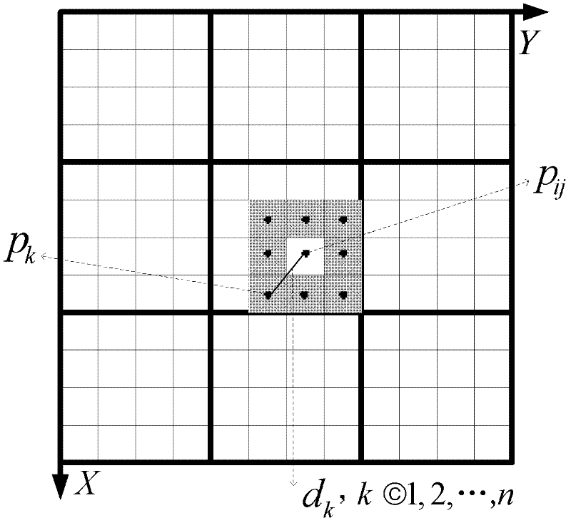
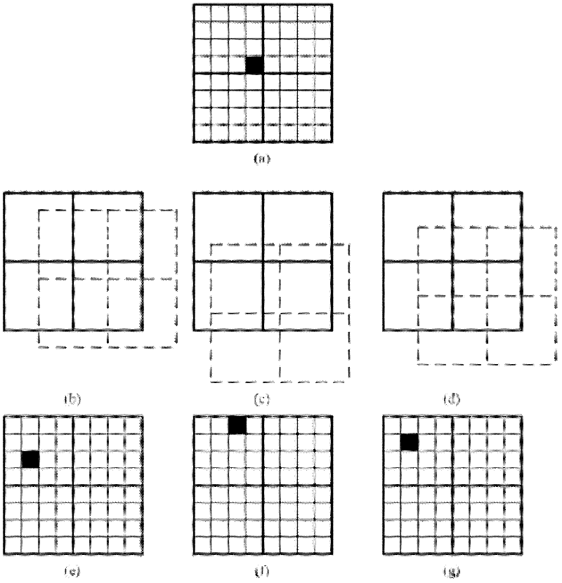
[0031] 1. Select the pixel P to be analyzed from the low-resolution remote sensing image ab ( L a and...


PUM


Abstract

The invention aims at providing a multitemporal remote sensing image-based subpixel positioning method, which comprises the following steps of: inputting a remote sensing image with low resolution, obtaining various component diagrams of the remote sensing image through a spectral unmixing technology, and obtaining an initial space distribution of subpixels by using an SPSAM (Sub-Pixel Spatial Attraction Model) method according to component diagrams; selecting pixels Pab to be analyzed from the remote sensing image with low resolution, calculating an energy function Uc,ij of a Pij when the Pij belongs to each category c, finding out the category corresponding to a minimal Uc,ij, and judging that the Pij belongs the category; carrying out the above operations on each subpixel Pij in the Pab; carrying out the above operations on each mixed pixel to be analyzed in the remote sensing image with low resolution; and repeating the above steps until the difference of the number of different pixels of a front output subpixel positioned image and a rear output subpixel positioned image is less than 1%. The method provided by the invention has higher accuracy for positioning the subpixels, and the SPSAM is adopted for initializing, so that uncertainty resulting from random initialization does not exist in the output positioning result.

Description

technical field [0001] The invention relates to a positioning method in the technical field of remote sensing information processing. Background technique [0002] Mixed pixels are ubiquitous in remote sensing images, and these pixels are usually a mixture of several categories. The spectral unmixing (also known as soft classification) technique solves the components of each category in the mixed pixels, but fails to give their spatial distribution. Sub-pixel positioning is just a technology to solve various spatial distributions of mixed pixel classes. This technology divides each original pixel into multiple sub-pixels according to the required magnification ratio, and solves the spatial distribution of the sub-pixels corresponding to each category, so that various ground objects in low-resolution remote sensing images have a more detailed visual display , so as to improve the spatial resolution of remote sensing images. [0003] Since Atkinson proposed the theoretical ...

Claims


Application Information

Patent Timeline
Patent Type & Authority Applications(China)
IPC IPC(8): G06K9/80
Inventor 王立国王群明刘丹凤
Owner HARBIN ENG UNIV
Why Eureka
Try Eureka