
Traffic routing using intelligent traffic signals, GPS and mobile data devices

A technology of traffic signals and traffic data, which is used in traffic control systems, traffic control systems, instruments, etc. of road vehicles

Inactive Publication Date: 2012-07-11
TIME SYST
View PDF5 Cites 28 Cited by
  • Summary
  • Abstract
  • Description
  • Claims
  • Application Information

AI Technical Summary

Problems solved by technology

[0006] There is no known method that fully integrates the technologies available to report traffic information to drivers and suggest routes based on that information, to communicate with traffic signals, and to collect traffic information from drivers

Method used


Image

  • Traffic routing using intelligent traffic signals, GPS and mobile data devices
  • Traffic routing using intelligent traffic signals, GPS and mobile data devices
  • Traffic routing using intelligent traffic signals, GPS and mobile data devices

Examples


Embodiment Construction

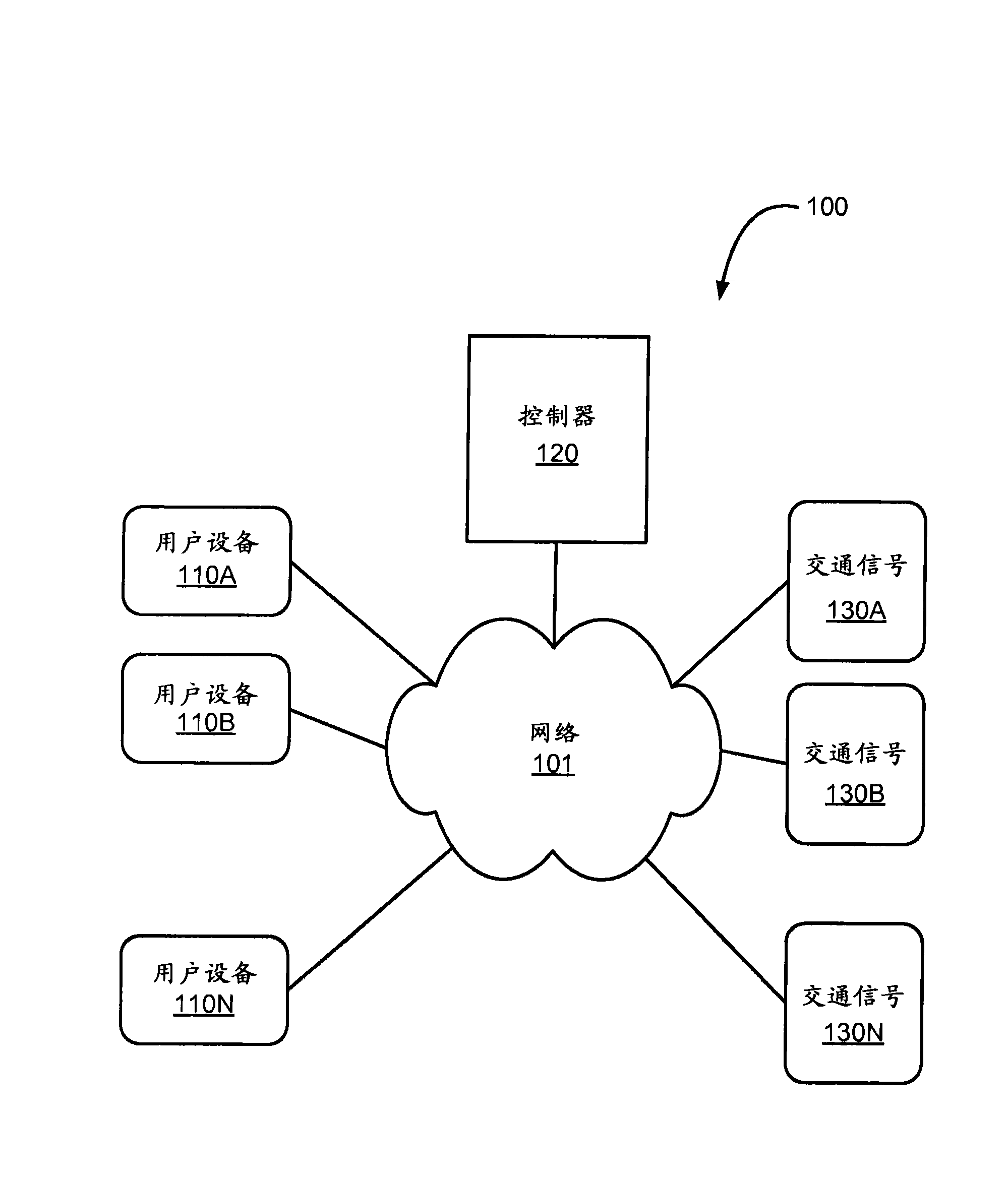
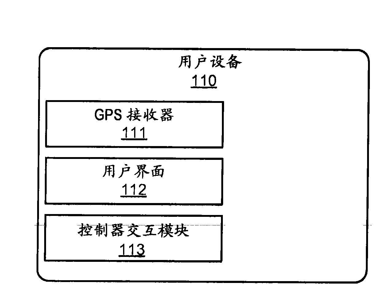
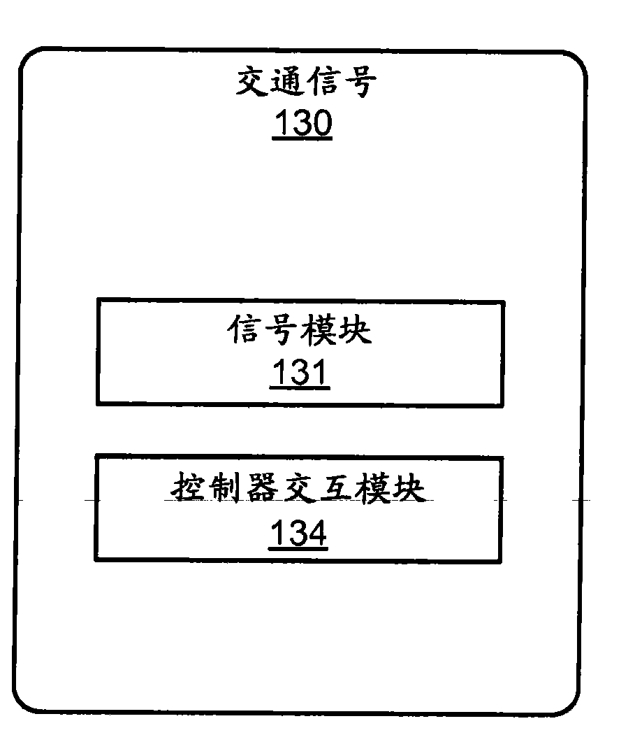
[0015] Embodiments of the present invention provide systems, methods, and computer-readable storage media that provide improved traffic routing using location-based technologies, such as GPS or cellular. Embodiments include one-way or two-way communication between traffic signals and drivers, and drivers and traffic databases. Drivers are equipped with user equipment that reports their location to the controller for at least one traffic signal and optionally also the driver's destination. The controller controls the traffic signals to advantageously cycle green and red lights according to a desired effect on traffic conditions for vehicles passing through the controlled intersection. In one embodiment, the controller may also send information to the user device to suggest the fastest route to the driver's destination, the time until the traffic signal turns green or red, the time to reach the controlled location when the light is green Suggested travel speeds at intersections...


PUM


Abstract

A traffic routing system reduces emissions from commuter and other traffic, eases congestion on roadways, and decreases transit time by use of communications among vehicles and traffic controls, such as traffic lights. In one aspect, a traffic light receives a signal that a vehicle is approaching and in response turns green to allow the vehicle to pass without impairment. In another aspect, a vehicle receives a signal to adjust a current rate of speed to arrive when a traffic signal allows vehicles to pass. In still another aspect, a combination of congestion, emergency traffic, roadwork and similar factors influence proposed routes sent to vehicles.

Description

technical field [0001] The present invention relates generally to traffic control systems and traffic routing. Background technique [0002] By helping commuters and other drivers choose non-congested routes to their destinations, vehicle emissions can be significantly reduced, congestion can be limited, safety can be enhanced and travel times reduced. Several schemes have been proposed in the past for informing drivers of traffic conditions and presenting them with suggested alternatives when congestion is found. For example, radio stations have used traffic helicopters for decades to identify areas of congestion and suggest alternative routes that drivers may wish to consider. [0003] As GPS and handheld computing devices, especially those connected to cellular networks or the Internet, have grown in popularity, other approaches have been adopted, such as color-coding graphical representations of maps with routes to indicate congestion s level. [0004] Another approac...

Claims


Application Information

Patent Timeline
IPC IPC(8): G08G1/095
CPCG08G1/081G08G1/096805G08G1/096844
Inventor M·L·金斯伯格M·M·奥斯汀P·A·C·常S·C·玛蒂森
Owner TIME SYST
Learn More