Remote-sensing aerial surveying elevation fitting method
An elevation and aerial survey technology, applied in the field of remote sensing aerial survey elevation fitting, can solve problems such as low elevation accuracy, large elevation error, and inability to meet the requirements of large-scale topographic map measurement specifications
- Summary
- Abstract
- Description
- Claims
- Application Information
AI Technical Summary
Problems solved by technology
Method used
Image
Examples
Embodiment Construction
[0039] Below in conjunction with accompanying drawing and specific embodiment the present invention is described in further detail:
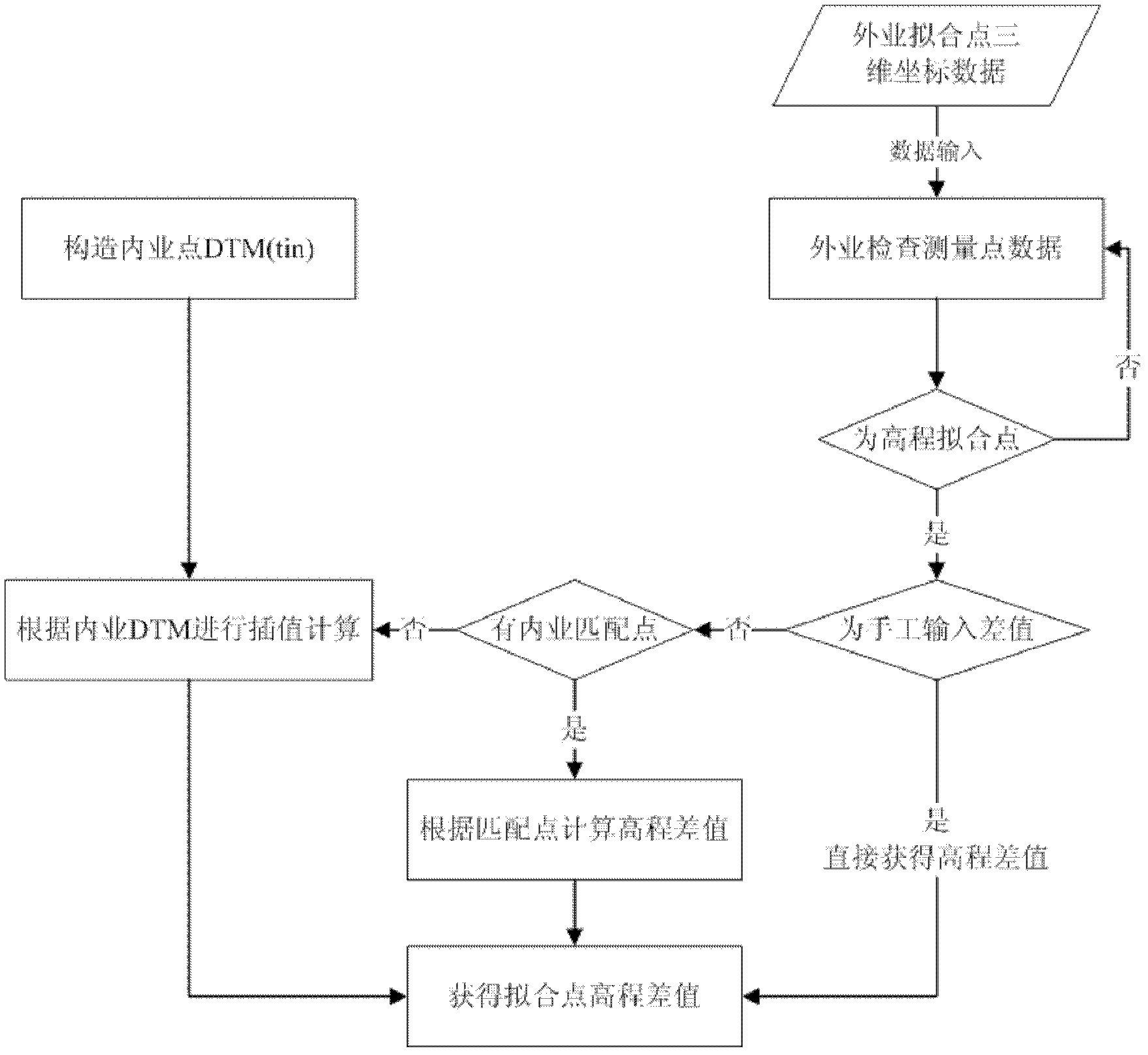
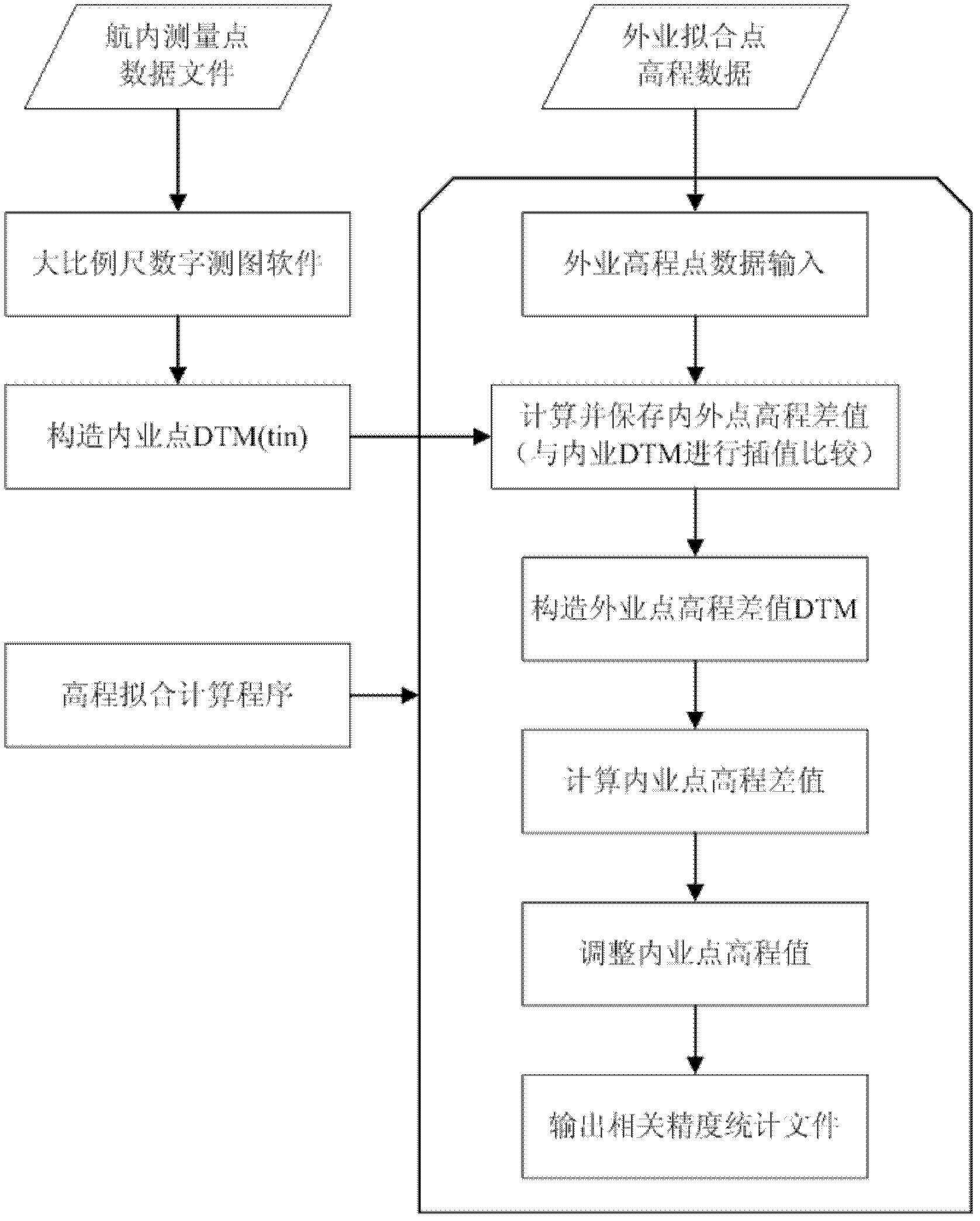
[0040] refer to figure 1 As shown, the remote sensing aerial survey elevation fitting method includes the following steps:
[0041] Step 1: Set up field-measured detection points, and use the three-dimensional coordinate data of field-measured detection points to determine the field-measured elevation surface;
[0042] The second step: use the remote sensing aerial survey platform to measure the large-scale topographic map and extract the three-dimensional coordinate data of the large-scale topographic map;
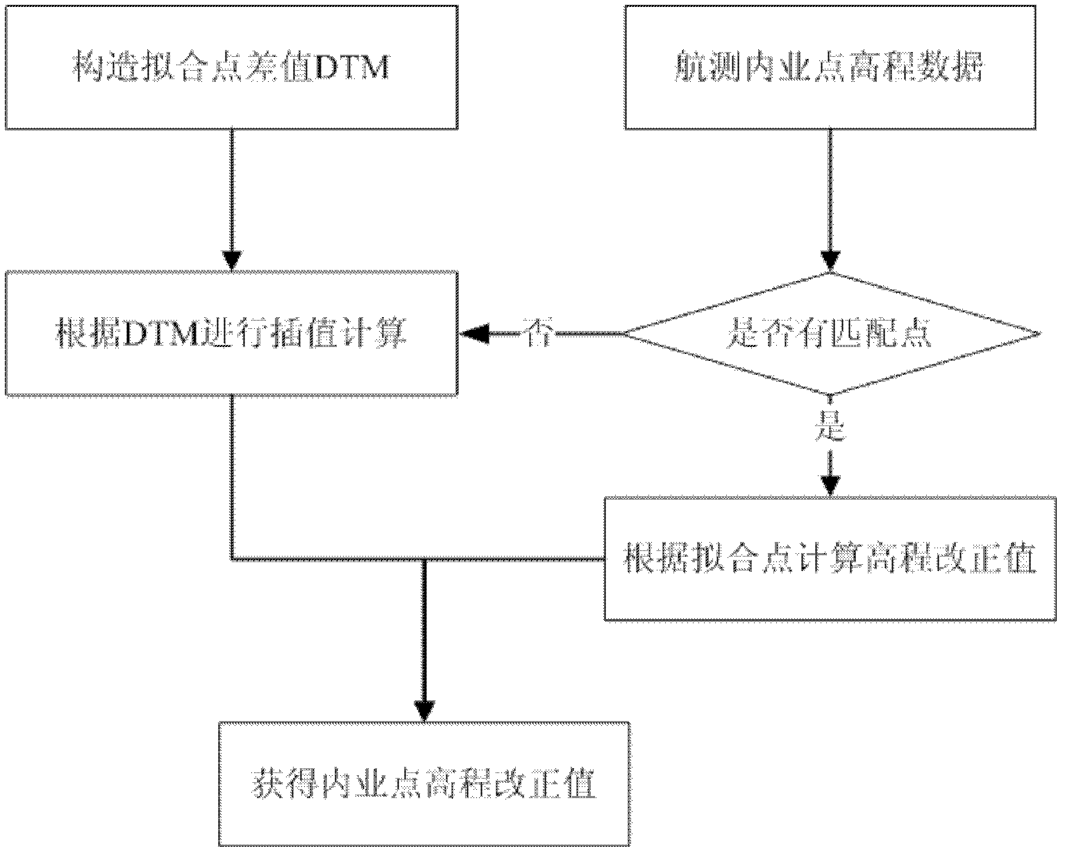
[0043] The third step: combined with the data value of the elevation surface measured in the field, adopt the polynomial fitting model to the elevation fitting of the three-dimensional coordinate data in the large-scale topographic map, and obtain the elevation correction value of each point in the large-scale topographic map;
[0044] St...
PUM
 Abstract
Description
Claims
Application Information
 - R&D
- Intellectual Property
- Life Sciences
- Materials
- Tech Scout
- Unparalleled Data Quality
- Higher Quality Content
- 60% Fewer Hallucinations
Browse by: Latest US Patents, China's latest patents, Technical Efficacy Thesaurus, Application Domain, Technology Topic, Popular Technical Reports.
© 2025 PatSnap. All rights reserved.Legal|Privacy policy|Modern Slavery Act Transparency Statement|Sitemap|About US| Contact US: help@patsnap.com


