Air supervision internet of things system with low-altitude aircraft

An Internet of Things system and aircraft technology, applied in transmission systems, traffic control systems, instruments, etc., can solve problems such as the inability to formulate routes, the uncertainty of low-altitude aircraft flight routes, and the inability to detect radars to monitor low-altitude aircraft flights, etc., to meet the requirements of reliability sexual effect

Active Publication Date: 2013-02-27
郭建国 +1
View PDF3 Cites 25 Cited by
  • Summary
  • Abstract
  • Description
  • Claims
  • Application Information

AI Technical Summary

Problems solved by technology

[0004] The supervision of the flight of low-altitude aircraft in my country is still blank. The flight route of low-altitude aircraft is uncertain, and it is impossible to formulate routes. It is impossible to deploy a large number of detection radars throughout the country to monitor the flight of low-altitude aircraft.

Method used


Image

  • Air supervision internet of things system with low-altitude aircraft
  • Air supervision internet of things system with low-altitude aircraft
  • Air supervision internet of things system with low-altitude aircraft

Examples


Embodiment Construction

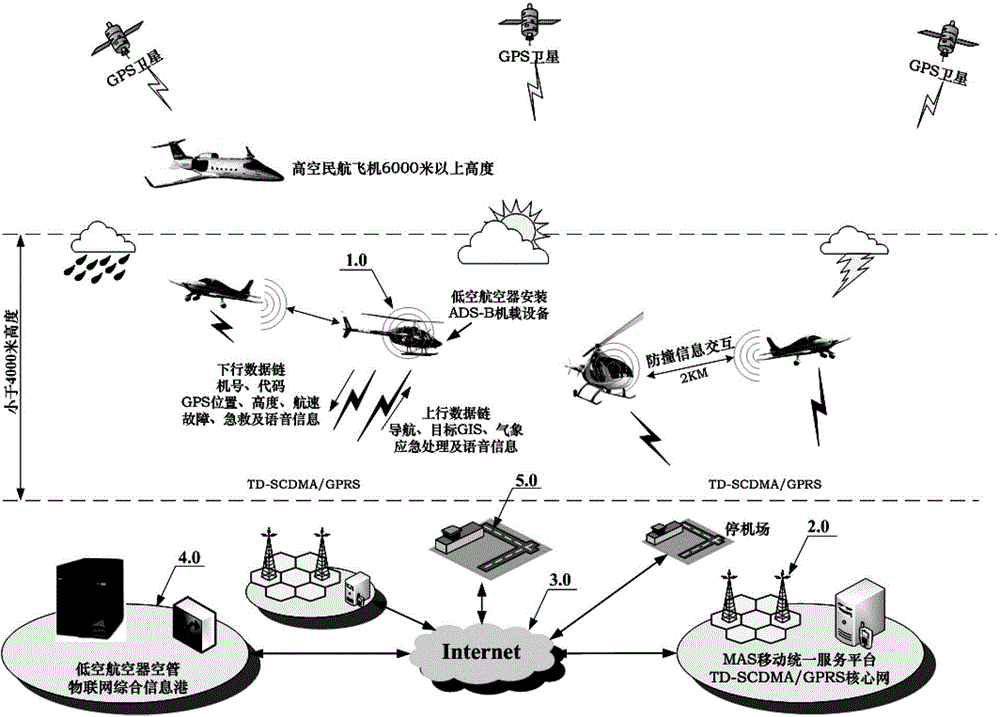
[0021] Refer to attached figure 1 As shown, a kind of low-altitude aircraft air supervision Internet of Things system in the embodiment of the present invention includes: GPS satellites, low-altitude aircraft 1.0 with ADS-M transceiver airborne equipment installed, mobile communication cellular cluster base station 2.0, ground mobile communication cellular base station cluster service platform, It is composed of Internet 3.0, low-altitude aircraft air traffic control Internet of Things comprehensive information port 4.0 and parking airport 5.0. Among them, the mobile communication cellular cluster base station 2.0 and the MAS mobile unified service platform (ground mobile communication cellular base station cluster service platform) constitute the wireless communication information platform of the mobile company. The Internet of Things integrated information port 4.0 is connected.

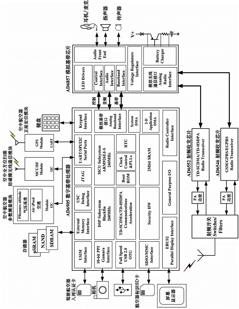
[0022] The low-altitude aircraft 1.0 equipped with ADS-M transceiver airborne equipment perfor...


PUM


Abstract

The invention relates to an air supervision internet of things system with a low-altitude aircraft, which comprises a global positioning system (GPS) satellite, the low-altitude aircraft provided with ADS-M transceiver airborne equipment, a mobile communication cellular cluster base station, a ground mobile communication cellular cluster base station cluster service platform, an internet and a low-altitude aircraft air traffic control center; and the ADS-M transceiver airborne equipment is installed in the low-altitude aircraft, carries out upper and lower data link data communication with the mobile communication cellular cluster base station by adopting a TD-SCSMA/TD-HSDPA or GSM/GPRS/EGPRS or WCDMA/CDMA2000 or GSM/GPRS communication mode and is connected with the low-altitude aircraft air traffic control center through the ground mobile communication cellular cluster base station cluster service platform and the internet.

Description

technical field [0001] The invention relates to an ADS-M transceiver airborne equipment installed on a low-altitude aircraft. During the low-altitude flight, it adopts my country Mobile TD-SCDMA / GPRS (or WCDMA, CDMA2000) ground cellular cluster communication and GPS satellite positioning in the form of the Internet of Things. , the omni-directional scanning anti-collision communication system in the air, and the ADS-M transceiver airborne equipment composed of it form an Internet of Things system platform for ground supervision of low-altitude aircraft in the air. Low-altitude aircraft refers to: private small aircraft, commercial small aircraft, helicopters, etc. flying at an altitude of less than 4,000 meters. [0002] Background technique [0003] At present, high-altitude civil aviation aircraft fly in the designated route area for air traffic control flight. High-altitude civil aviation aircraft ADS-B technology is used in air traffic control, which can provide aircraft...

Claims


Application Information

Patent Timeline
Patent Type & Authority Applications(China)
IPC IPC(8): H04L29/08H04W84/06G08G5/00
Inventor 郭建国毛星原
Owner 郭建国
Why Eureka
Try Eureka