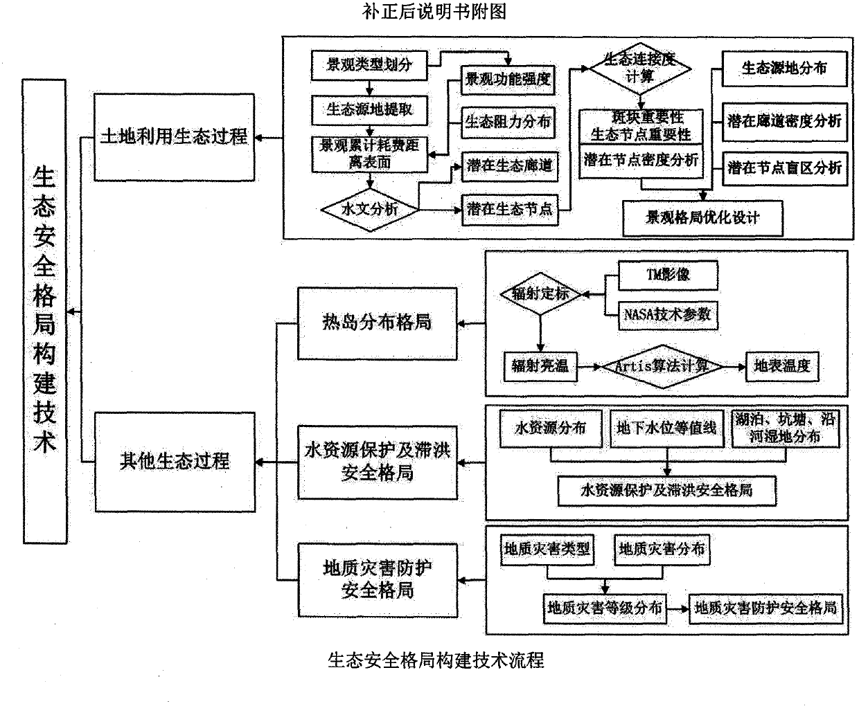
Technology of construction of urban-rural integration ecological security pattern
A technology of ecological safety and pattern, applied in the field of environmental ecology, to reduce surface runoff, alleviate urban water pressure, and realize the effect of rain and flood resources
- Summary
- Abstract
- Description
- Claims
- Application Information
AI Technical Summary
Problems solved by technology
Method used
Image
Examples
Embodiment Construction
[0022] The principle and process of this technology are described in detail below with examples:
[0023] 1 Classification of urban and rural landscape types
[0024] In ArcGIS, the remote sensing images of Chaoyang District, Beijing were visually interpreted. With the support of GPS, field surveys were carried out at the control points to determine the types of objects on the ground and improve the accuracy of remote sensing interpretation. Establish the classification rules of landscape types in Chaoyang District, Beijing. The six types of landscapes and their corresponding land use types are: building land, cultivated land, grassland, water area, forest land and other land use.
[0025] 2 Urban and rural landscape pattern analysis and function evaluation
[0026] Through the interpretation and classification of remote sensing images, the landscape index of the study area is calculated at the landscape level and patch level respectively. Analysis based on remote sensing da...
PUM
 Abstract
Description
Claims
Application Information
 - R&D
- Intellectual Property
- Life Sciences
- Materials
- Tech Scout
- Unparalleled Data Quality
- Higher Quality Content
- 60% Fewer Hallucinations
Browse by: Latest US Patents, China's latest patents, Technical Efficacy Thesaurus, Application Domain, Technology Topic, Popular Technical Reports.
© 2025 PatSnap. All rights reserved.Legal|Privacy policy|Modern Slavery Act Transparency Statement|Sitemap|About US| Contact US: help@patsnap.com

