
System for movement planning on map

A technology for making systems and plans, applied in the directions of maps/plans/charts, calculations, special data processing applications, etc., and can solve problems such as non-existence

Inactive Publication Date: 2013-09-18
KK TOSHIBA +1
View PDF1 Cites 3 Cited by
  • Summary
  • Abstract
  • Description
  • Claims
  • Application Information

AI Technical Summary

Problems solved by technology

For example, if it is a resource that can travel regardless of the route like a bus, it is important to establish a transportation plan covering a wide area. It is most appropriate to create a transportation plan (operation table data) on a map, but this is It is different from the existing operation table data creation method in the opposite direction, so the creation method did not exist in the past

Method used


Image

  • System for movement planning on map
  • System for movement planning on map
  • System for movement planning on map

Examples


Embodiment Construction

[0032] Hereinafter, embodiments of the present invention will be described in detail using the drawings.

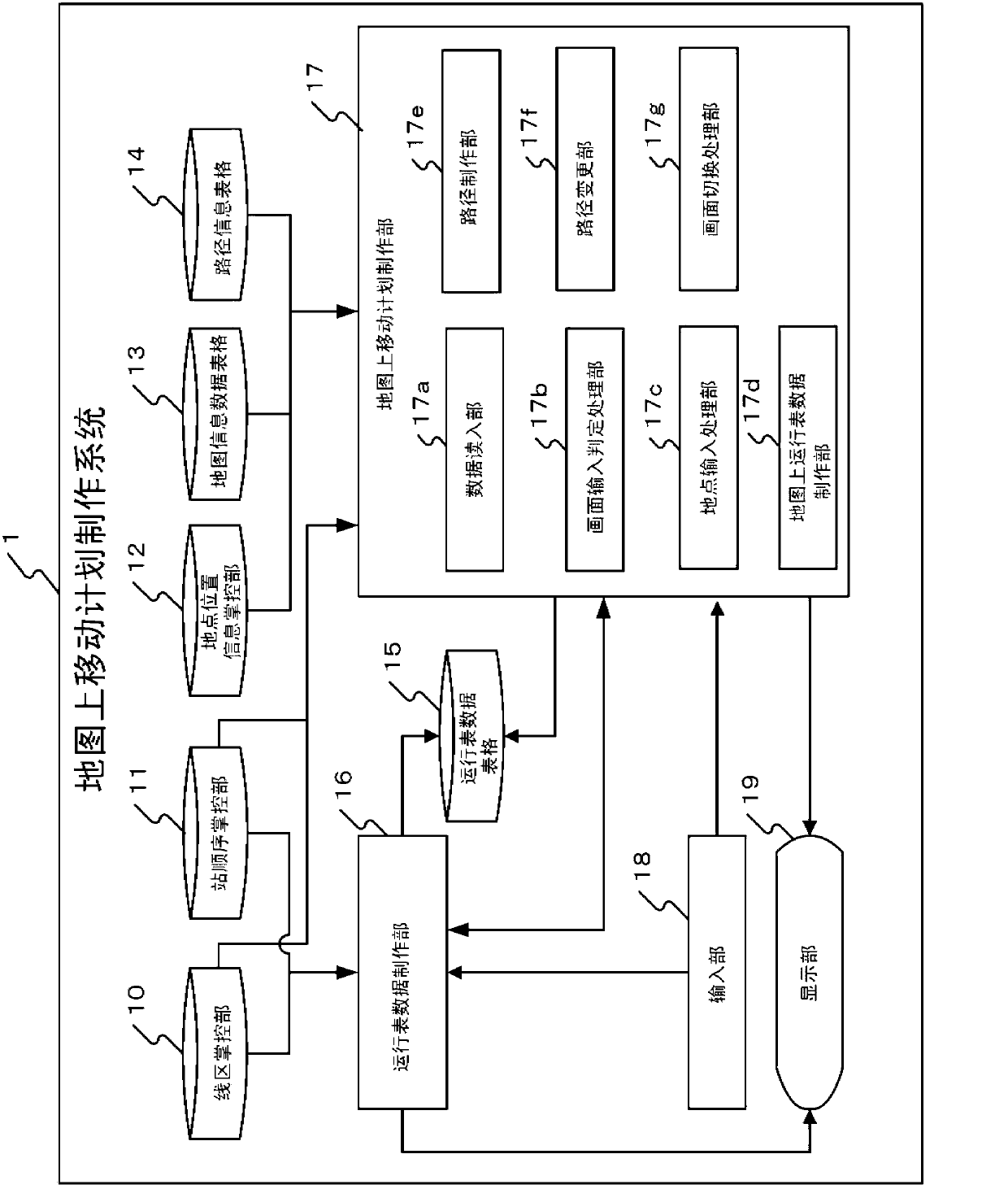
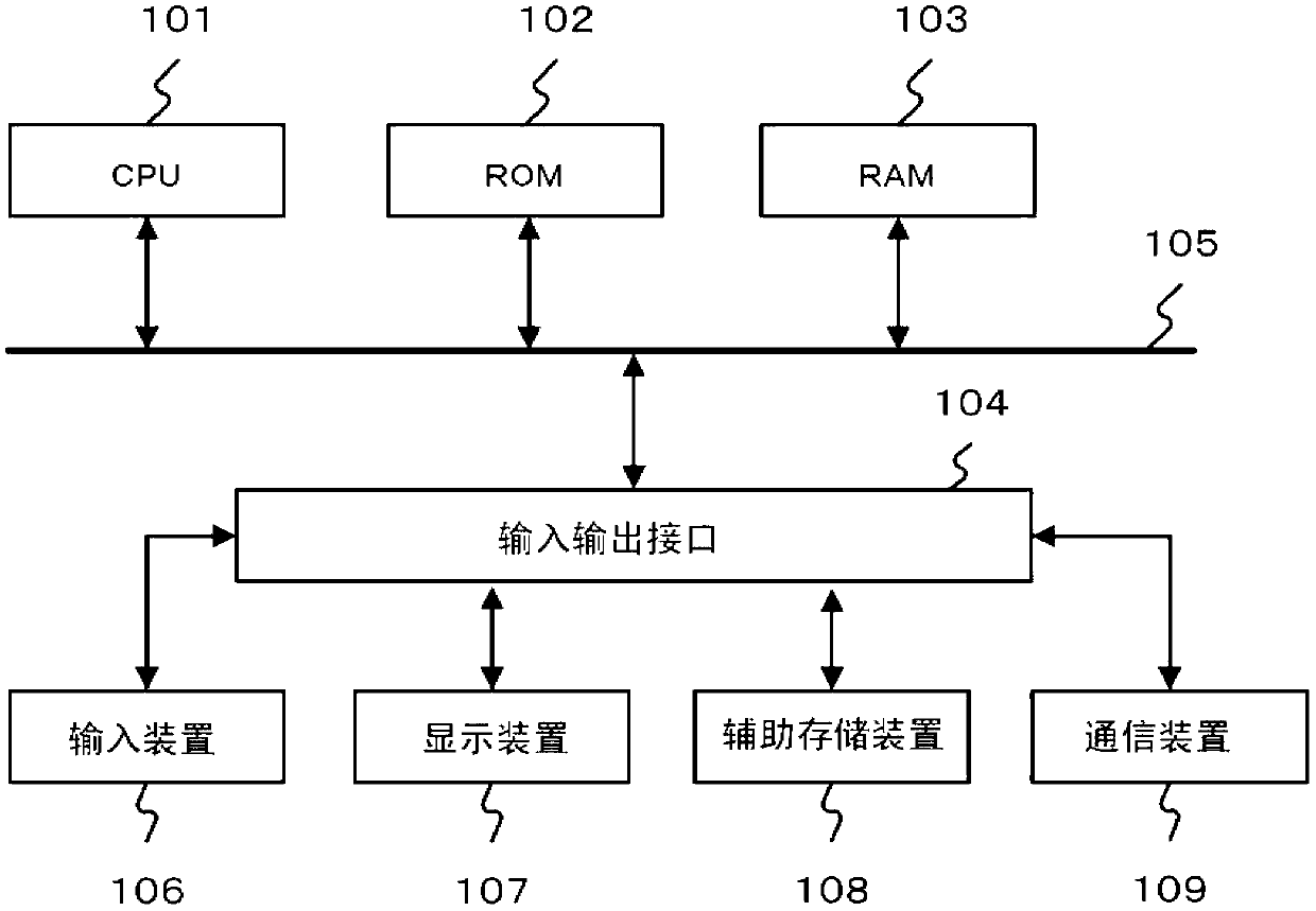
[0033] figure 1 It is a block diagram showing an example of the overall configuration of the on-map movement plan preparation system 1 according to the embodiment of the present invention. As shown in the figure, this system is a computer system including a line area master (master) 10 stored in a large-capacity storage device, a station sequence master 11, a location information master 12, Map information data table 13, route information table 14 and schedule data table 15; use these data to generate schedule data production unit 16 and travel plan production unit 17 on the map; the user operates the schedule data by GUI operation The input unit 18 for inputting data by the creation unit 16 and the on-map movement plan creation unit 17 ; Here, it is configured by a separate computer, but a system configuration using a Web or cloud system via a network (not shown) such ...


PUM


Abstract

A user processes running chart data directly on a map through designating sites, moving sequential and time information. A system for movement planning on a map comprises a map information data sheet for storing map images and the latitude / longitude information of sites in the images; a site information control portion for storing and identifying the relation among the site codes, site names and latitude / longitude information of optional moving destinations; an image displaying unit for displaying a horizontal line running chart showing site names, moving sequence, arrival and departure time of planned moving sites selected from the optional sites on a time axis and map images moving planning figures, and a site selection and display unit which selects planned moving sites in the map image based on GUI operation, displaying site names, moving sequence, arrival and departure time of planned moving sites on a horizontal line running chart by correlating the planned moving sites and a bar running chart, and displaying moving sequence on the map images.

Description

technical field [0001] Embodiments of the present invention relate to an on-map travel plan creation system for creating a travel plan through GUI operations on a map. Background technique [0002] Transportation agencies such as railways and buses create transportation plans based on the determined route or route. For example, railway operating companies create timetable data by inputting departure and arrival times of trains at each station and the distance mileage (kilometer mileage) between adjacent stations into the timetable (also called timetable (diagram)) creation system. Then, the timetable data is displayed on the screen as a timetable (hereinafter referred to as "timetable diagram"), thereby managing the operation of the train. The mileage table graph is displayed in the shape of a graph with the distance in kilometers from the departure station (base station) as the vertical axis and the time as the horizontal axis, and the names of the driving stations are arr...

Claims


Application Information

Patent Timeline
IPC IPC(8): G06F17/30G09B29/00
Inventor 久保英树
Owner KK TOSHIBA
Learn More