
Aerial image-based determination method of three-dimensional information of traffic accident scene based on s

A traffic accident and three-dimensional information technology, which is applied in image analysis, image data processing, and photo interpretation, etc., can solve problems such as large errors and a single image can only reflect two-dimensional information, and achieve efficient and accurate display and accurate vision Effects of photogrammetry, accurate measurement

Inactive Publication Date: 2013-10-23
THE THIRD AFFILIATED HOSPITAL OF THIRD MILITARY MEDICAL UNIV OF PLA
View PDF3 Cites 11 Cited by
  • Summary
  • Abstract
  • Description
  • Claims
  • Application Information

AI Technical Summary

Problems solved by technology

[0002] Aerial images play an important role in traffic accident scene surveys. The two-dimensional equal-scale real scene map obtained through geometric correction and coordinate transformation can efficiently restore the various elements of the accident scene, but a single image can only reflect two-dimensional information. Accurate image measurement can be accurately performed on a surface
In some accidents, the elements of the accident are not necessarily on the same plane, such as gates, roadsides, and slope protection, and a single aerial image is insufficient to reflect these information
In addition, although the road surface can be approximated as a plane, in some road sections with slope changes, the error introduced by using a single aerial image for image measurement is often relatively large

Method used


Image

  • Aerial image-based determination method of three-dimensional information of traffic accident scene based on s
  • Aerial image-based determination method of three-dimensional information of traffic accident scene based on s
  • Aerial image-based determination method of three-dimensional information of traffic accident scene based on s

Examples


Embodiment Construction

[0029] Embodiments of the present invention are described in detail below, examples of which are shown in the drawings, wherein the same or similar reference numerals designate the same or similar elements or elements having the same or similar functions throughout. The embodiments described below by referring to the figures are exemplary only for explaining the present invention and should not be construed as limiting the present invention.

[0030] In the description of the present invention, unless otherwise specified and limited, it should be noted that the terms "installation", "connection" and "connection" should be understood in a broad sense, for example, it can be mechanical connection or electrical connection, or two The internal communication of each element may be directly connected or indirectly connected through an intermediary. Those skilled in the art can understand the specific meanings of the above terms according to specific situations.

[0031] Such as fig...


PUM


Abstract

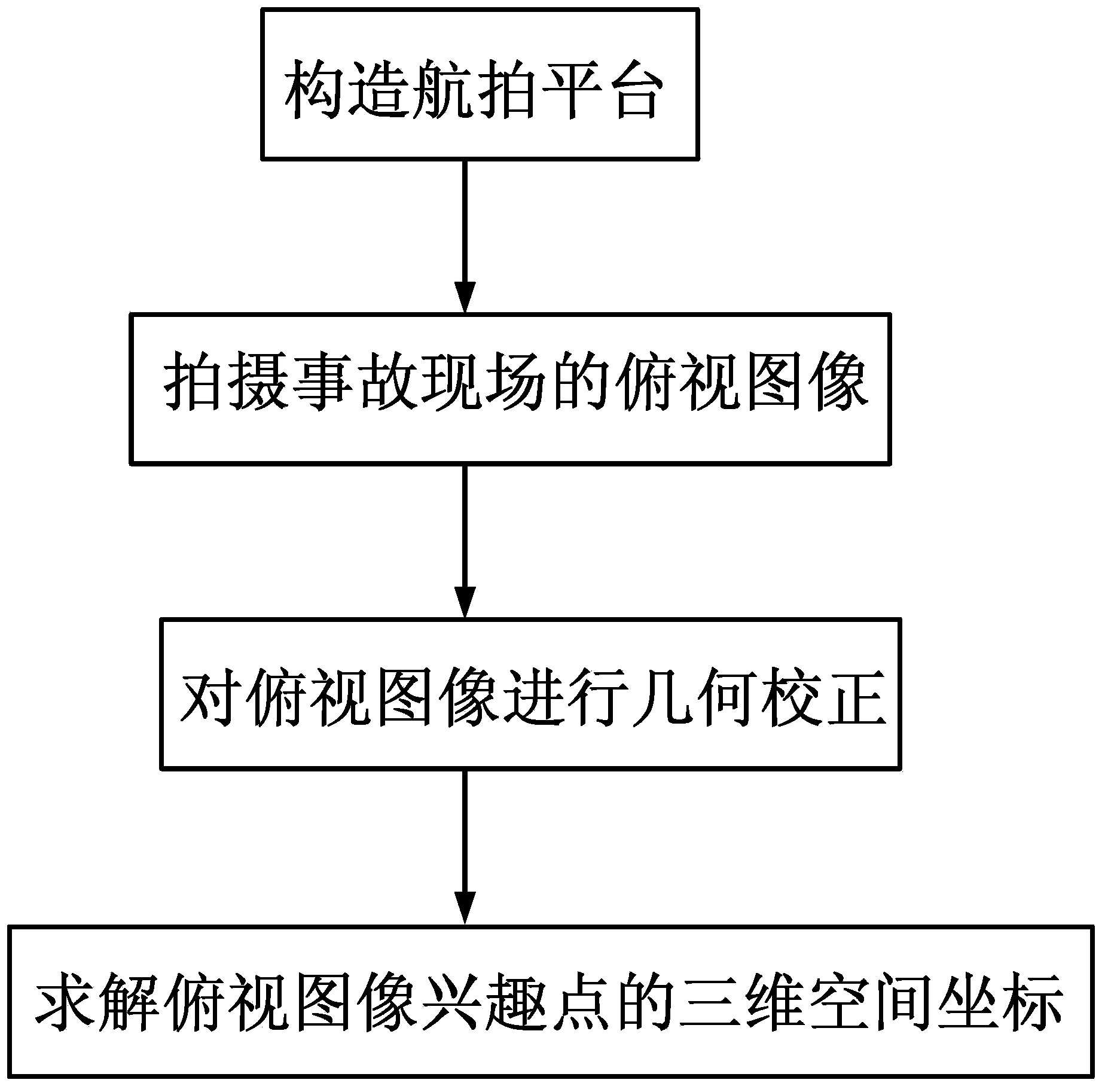
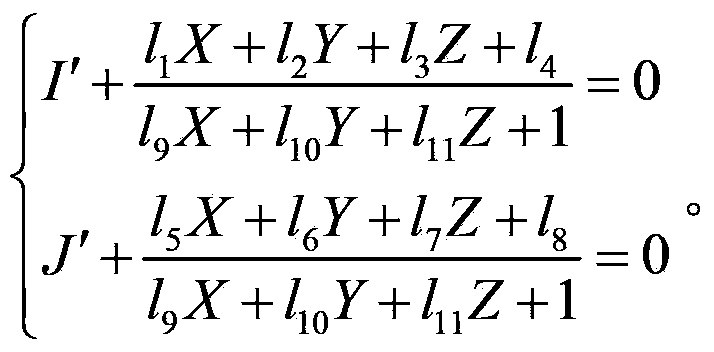
The invention discloses an aerial-image-based determination method of three-dimensional information of a traffic accident scene and belongs to the technical field of information acquisition of traffic accident scenes. Firstly an aerial platform is constructed; then overlooking images of the accident scene are shot; afterwards geometric correction is carried out on the overlooking images; finally more than three overlooking images are selected, and three-dimensional space coordinates of interest points of the overlooking images are solved by applying a direct linear transformation algorithm. The determination method can be used for carrying out accurate longshot measurement, solving the three-dimensional space coordinates of the interest points of the images of the accident scene by utilizing multiple aerial images through three-dimensional direct linear transformation, so as to realize the accurate measurement of the traffic accident scene.

Description

technical field [0001] The invention belongs to the technical field of traffic accident scene information acquisition, in particular to a method for measuring three-dimensional information of a traffic accident scene based on aerial images. Background technique [0002] Aerial images play an important role in traffic accident scene surveys. The two-dimensional equal-scale real scene map obtained through geometric correction and coordinate transformation can efficiently restore the various elements of the accident scene, but a single image can only reflect two-dimensional information. It can accurately measure the image of a surface accurately. In some accidents, the accident elements are not necessarily on the same plane, such as gates, roadsides, and slope protection, and a single aerial image is insufficient to reflect these information. In addition, although the road surface can be approximated as a plane, in some road sections with slope changes, the error introduced by...

Claims


Application Information

Patent Timeline
Patent Type & Authority Applications(China)
IPC IPC(8): G01C11/06G06T7/00
Inventor 苏森尹志勇明建雄蒋建新唐军冯成建
Owner THE THIRD AFFILIATED HOSPITAL OF THIRD MILITARY MEDICAL UNIV OF PLA
Learn More