
Cloud-end navigation device and cloud-end navigation method

A navigation device, cloud technology, applied in directions such as navigation, measurement device, surveying and navigation, etc., can solve problems such as affecting driving dynamics and inability to transmit

Inactive Publication Date: 2014-01-22
KUNDA COMP TECHKUSN +1
View PDF9 Cites 7 Cited by
  • Summary
  • Abstract
  • Description
  • Claims
  • Application Information

AI Technical Summary

Problems solved by technology

For example, the change of traffic signs usually takes between 10 seconds and 1.5 minutes, and the RDS-TMC mechanism cannot convey such information
But changes in traffic signs will affect driving dynamics

Method used


Image

  • Cloud-end navigation device and cloud-end navigation method
  • Cloud-end navigation device and cloud-end navigation method
  • Cloud-end navigation device and cloud-end navigation method

Examples


Embodiment Construction

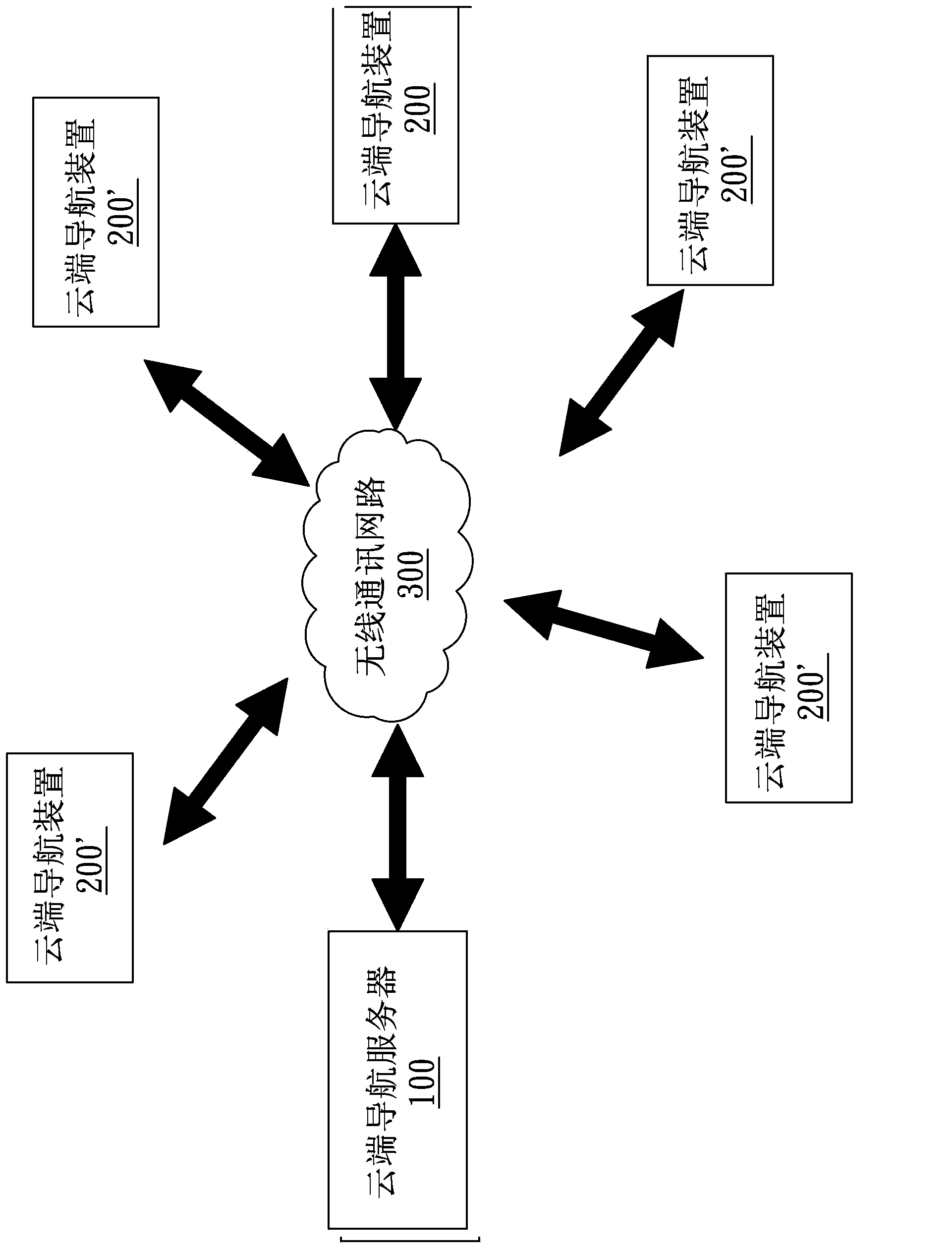
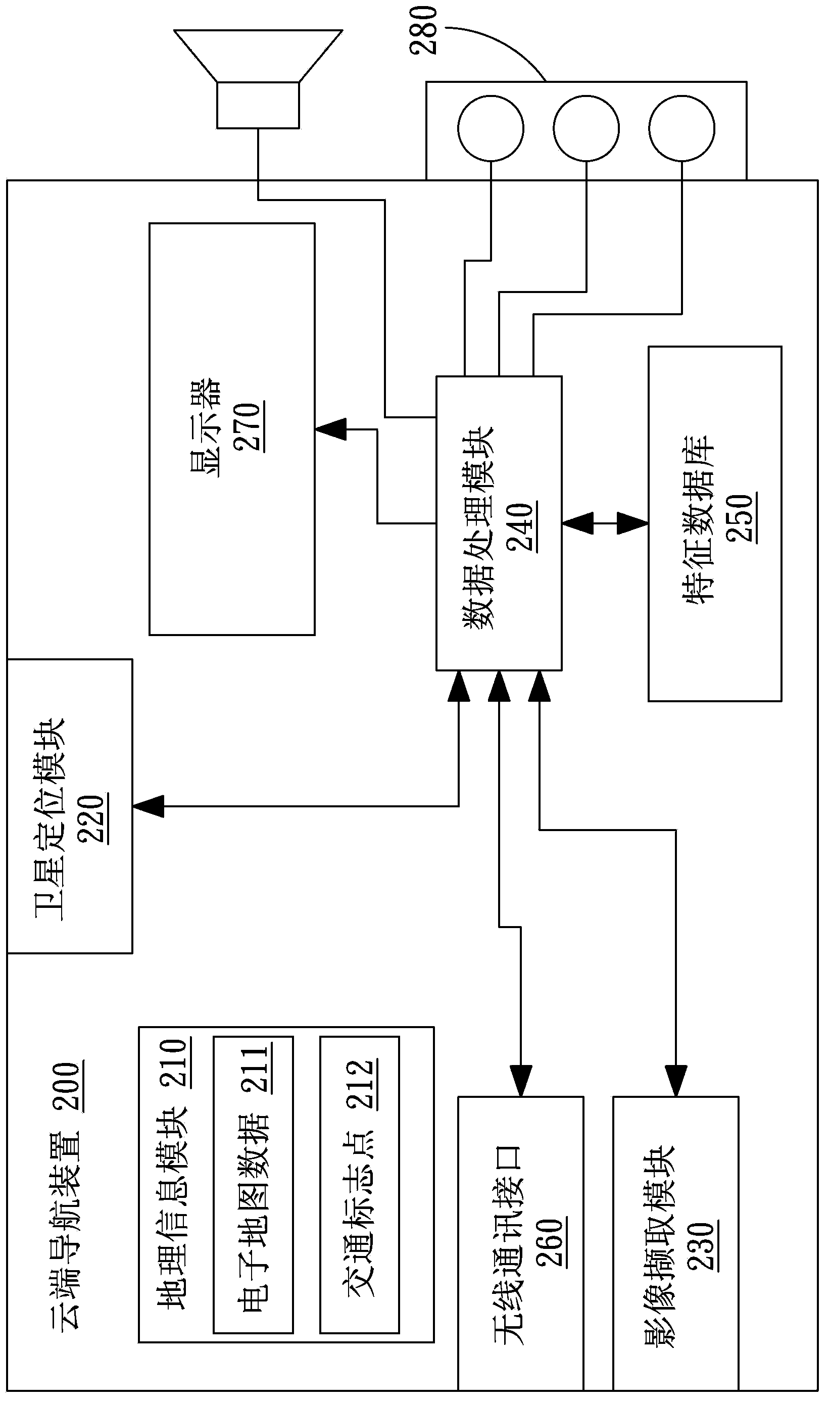
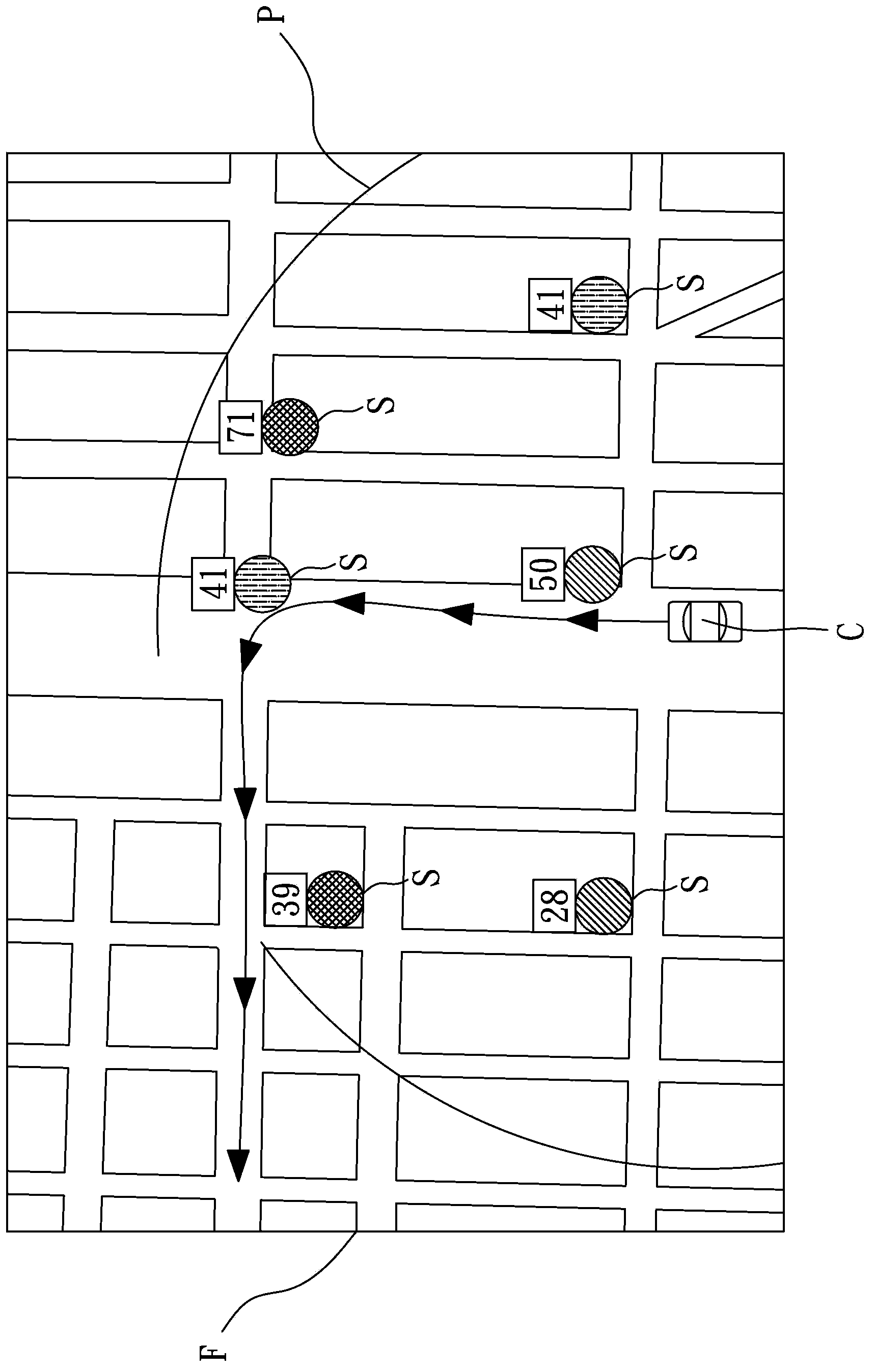
[0025] Please refer to " figure 1 "and" figure 2 ” shows a cloud navigation device 200 disclosed in the embodiment of the present invention, which is used to obtain the traffic sign status of one or several traffic signs S, and transmit it to a cloud navigation server 100 through a wireless communication network 300 . The cloud navigation device 200 obtains other traffic sign states transmitted to the cloud navigation server 100 by other cloud navigation devices 200', and displays them. The cloud navigation device 200 is installed in a vehicle (such as a car) for the driver of the vehicle to obtain the traffic sign status corresponding to the traveling direction.

[0026] Such as" figure 1 ", the cloud navigation server 100 is connected to the wireless communication network 300. The wireless communication network 300 can be a mobile communication network, a wireless Internet or a wireless local area network. A specific application example of wireless Internet or wireless ...


PUM


Abstract

The invention discloses a cloud-end navigation method which is actuated by a plurality of cloud-end navigation devices and a cloud-end navigation server. The method is used for obtaining a traffic sign state of at least one traffic sign. The method comprises the steps of firstly, loading electronic map data and a plurality of traffic sign points; then, getting a current position and picking up a monitored image to analyze whether the monitored image contains the traffic sign or not; if the monitored image contains the traffic sign, obtaining the corresponding traffic sign state, obtaining the corresponding traffic sign points according to the current position, and transmitting the traffic sign state and the traffic sign points to the cloud-end navigation server; finally, obtaining and displaying other traffic sign states by the cloud-end navigation device through the cloud-end navigation server.

Description

【Technical field】 [0001] The present invention relates to a navigation device and a navigation method, in particular to a cloud navigation device and a cloud navigation method. 【Background technique】 [0002] Navigation devices have been widely used in the market, and their functions are becoming more and more powerful. In addition to planning the navigation route according to the starting point / destination and instructing the user to proceed, the existing navigation device considers more parameters to plan the navigation route. Common parameters include avoidance route setting, for example, through system default, user setting, update data download, when planning a navigation route, the navigation device will avoid specific road sections. For example, China Taiwan Patent No. I269051 discloses a navigation system that adjusts route planning based on time characteristics, and can automatically avoid specific road sections at specific times. [0003] Another example is throu...

Claims


Application Information

Patent Timeline
Patent Type & Authority Applications(China)
IPC IPC(8): G01C21/34G01C21/26
CPCG01C21/3694G08G1/09675
Inventor 黄冠华
Owner KUNDA COMP TECHKUSN
Learn More