Web GIS map layer establishing method based on SharpMap

A map and layer technology, applied in the field of geographic information systems, can solve problems such as slow loading speed and high cost of maps, and achieve the effect of solving high costs

Inactive Publication Date: 2014-07-16
JIANGSU JUNHOU TECH CO LTD
View PDF2 Cites 17 Cited by
  • Summary
  • Abstract
  • Description
  • Claims
  • Application Information

AI Technical Summary

Problems solved by technology

[0005] The sharpmap-based WebGIS map loading proposed by the present inven...

Method used


Image

  • Web GIS map layer establishing method based on SharpMap
  • Web GIS map layer establishing method based on SharpMap
  • Web GIS map layer establishing method based on SharpMap

Examples


Embodiment Construction

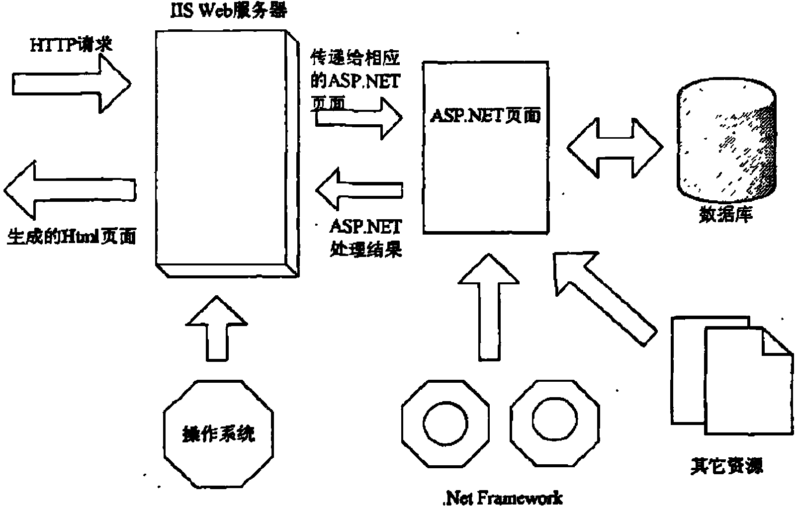
[0009] First, the source code structure of Sharpmap is deeply analyzed. The source code of the SharpMap map engine is open and can be downloaded for free from the Internet. The current stable running version is O.9. From the downloaded source code of SharpMap, we can see that the core source code of SharpMap mainly includes two folders: SharpMap and SharpMap.UI. Among them, the SharpMap project is the main body, which includes 14 namespaces, including MAP, layer, data conversion, coordinates, data, style, geometry, rendering, etc., which contain functions that can realize different functions of the map. The call can extend the function of SharpMap and add many required functions. SharpMap.UI is another folder related to user interface, which contains namespaces such as Forms and Ajax, and it provides the realization of functions related to user interface. These two folders containing the map source code are packaged into d11 files through compilation, stored under the develo...


PUM


Abstract

The invention relates to a system for providing a local mobile geographic information service based on GPS positioning information. The system for providing the local mobile geographic information service based on the GPS positioning information comprises a wireless communication network, a GPS positioning device, a mobile terminal, the Internet and a server. According to the system for providing the local mobile geographic information service based on the GPS positioning information, by analyzing a Web GIS product-Sharpmap map engine of an open source, a function similar to the SharpMap is developed and applied to a vehicle monitoring system, an effective result scheme is provided at the same time to solve the problem that in the prior art, the map loading speed is low, the scheme that a third-party map engine is used is adopted, and the map engine provided by a third party and the local vehicle monitoring system work cooperatively so as to jointly achieve the vehicle positioning function, the trajectory depicting function and other functions.

Description

technical field [0001] The invention relates to a geographic information system, in particular to a SharpMap-based Web GIS map. Background technique [0002] The vehicle monitoring system combines GPS technology, GIS technology and wireless communication technology, these three cutting-edge technologies in the world today, see the attached figure 1 , Remote tracking and monitoring of vehicles can be carried out anytime and anywhere. Among them, GPS technology, GIS technology and wireless communication technology are the core technologies of the vehicle monitoring system, and each technology plays an irreplaceable role in the vehicle monitoring system. As the positioning part of the vehicle monitoring system, GPS (GIobal Positioning System) technology is mainly responsible for the collection of information such as the position of the moving vehicle. GPS positioning technology is a high-precision, all-weather and global system established with the development of modern scienc...

Claims


Application Information

Patent Timeline
IPC IPC(8): G06F17/30
CPCG06F16/29
Inventor 徐静杨洋姚志垒徐森吴素芹许秋艳
Owner JIANGSU JUNHOU TECH CO LTD
Why Eureka
Try Eureka