
Street view generation method and server

A server and street view technology, applied in the direction of instruments, image data processing, structured data retrieval, etc., can solve the problems of low efficiency, long update time of 3D map model, etc., achieve high efficiency, improve operating efficiency, and increase update frequency Effect

Active Publication Date: 2014-09-17
TENCENT TECH (SHENZHEN) CO LTD
View PDF6 Cites 24 Cited by
  • Summary
  • Abstract
  • Description
  • Claims
  • Application Information

AI Technical Summary

Problems solved by technology

[0005] The purpose of the present invention is to provide a street view generation method and server, aiming to solve the technical problems of long time and low efficiency in updating the three-dimensional map model of the scene in the prior art

Method used


Image

  • Street view generation method and server
  • Street view generation method and server
  • Street view generation method and server

Examples


Embodiment Construction

[0021] The following descriptions of the various embodiments refer to the accompanying drawings to illustrate specific embodiments in which the present invention can be practiced.

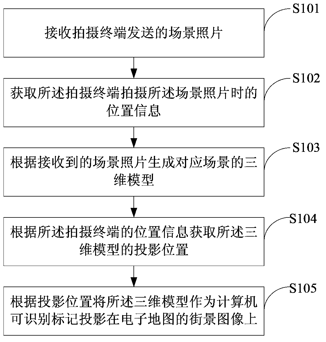
[0022] see figure 1 , figure 1 It is a schematic flow chart of the street view generation method according to the first embodiment of the present invention.

[0023] In step S101, a scene photo sent by a shooting terminal is received.

[0024] In the specific implementation process, after the user takes a scene photo through the shooting terminal and chooses to upload it, the shooting terminal uploads the shot scene photo to the server. For example, after the shooting terminal takes a photo of the scene "Shenzhen Civic Center" and chooses to upload it, the shooting The terminal sends the captured scene photos to the server.

[0025] Wherein the server preferably receives the scene photo sent by the shooting terminal through a wireless method, for example, the wireless method is General Packet Ra...


PUM


Abstract

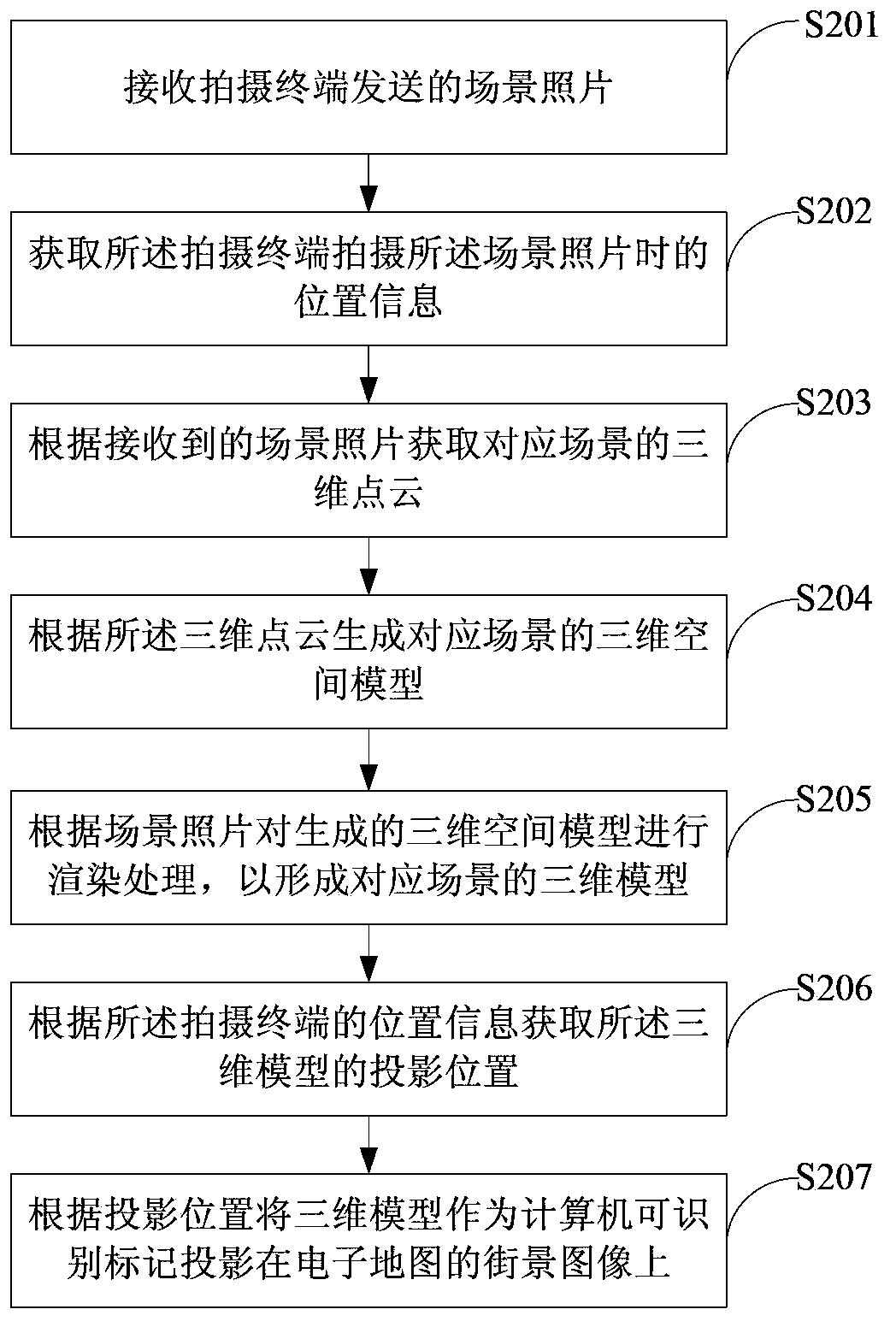
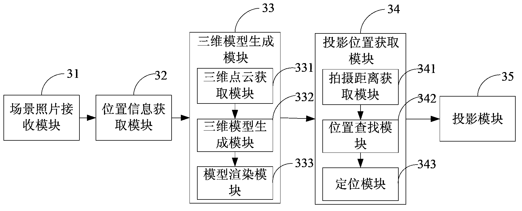
The invention discloses a street view generation method and a server. The method comprises the following steps: receiving a scene photograph sent by a shooting terminal, and acquiring the position information when the scene photograph is shot by the shooting terminal; generating a three-dimensional model corresponding to the scene according to the received scene photograph; acquiring the projection position of the three-dimensional model according to the position information of the shooting terminal; projecting the three-dimensional model onto a street scene picture of an electronic map as a computer identification marking according to the projection position. The street scene picture in the electronic map can be updated in real time according to a scene photograph uploaded by a user, so that the efficiency is high, the update efficiency is high, the resources of the server are greatly saved, and the operating efficiency of the server is improved.

Description

technical field [0001] The invention belongs to the field of electronic maps, and in particular relates to a street view generation method and server. Background technique [0002] With the application of electronic maps more and more widely, users put forward high requirements on the functions of electronic maps. Taking the 3D model of a real building displayed in the street view as an example, this display method has a strong sense of situation, which can make the user have an immersive feeling and can greatly improve the user experience. [0003] The existing technology for generating a 3D model generally generates a 3D model through a sequence of images of a target scene, and then adds the 3D model to the street view. However, the inventors of the present invention have discovered in the course of research that the existing methods of forming street views have the following disadvantages: street views are generally formed based on pictures pre-existing in the network, a...

Claims


Application Information

Patent Timeline
Patent Type & Authority Applications(China)
IPC IPC(8): G06F17/30G06T17/00
CPCG06F16/29G06F16/5866G06T17/05
Inventor 屈孝志
Owner TENCENT TECH (SHENZHEN) CO LTD
Learn More