Method for acquiring noise models of coordinate time series of regional GPS (global positioning system) reference stations
A technology of coordinate time series and noise model, applied in satellite navigation and positioning technology and application field, can solve the problem that the noise model cannot be applied, and achieve the effect of improving the accuracy and improving the research.
- Summary
- Abstract
- Description
- Claims
- Application Information
AI Technical Summary
Problems solved by technology
Method used
Image
Examples
Embodiment Construction
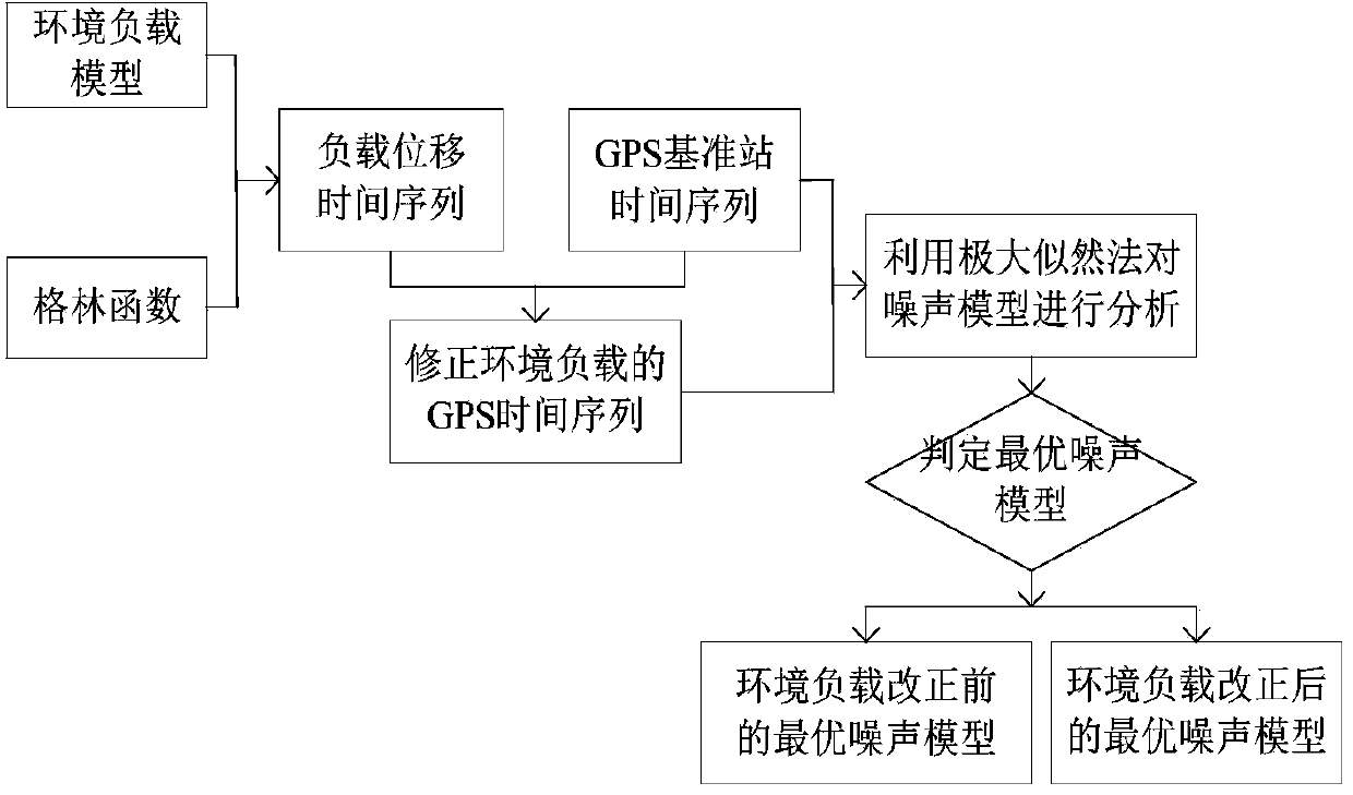
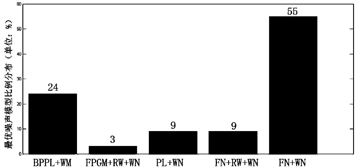
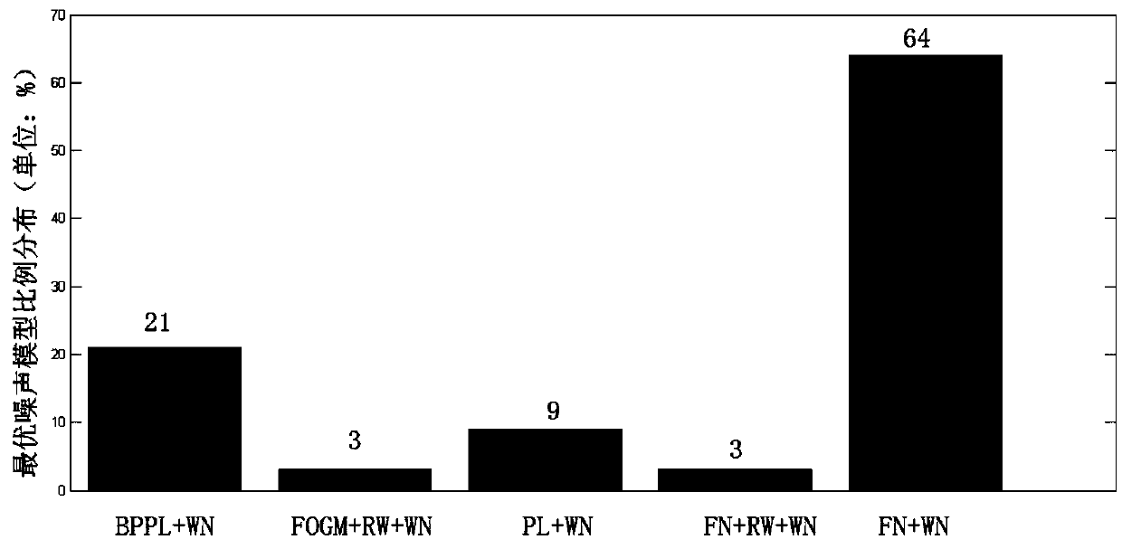
[0035] The technical solutions of the present invention will be described in detail below in conjunction with the accompanying drawings.
[0036] The concrete steps of the construction method of the regional GPS reference station coordinate time series noise model of the present invention are as follows:
[0037] Step 1, data collection.
[0038]Collect the original data of the area to be analyzed respectively, the original data includes the GPS reference station coordinate time series, GPS reference station information and geophysical data in the area to be analyzed, wherein, the GPS reference station information includes receiver information, antenna jump time , earthquake periods, etc. Geophysical data include atmospheric pressure load models, non-tidal ocean load models, and hydrological load models. The hydrological load models are used to reflect changes in surface water storage caused by snow depth and soil moisture. Atmospheric pressure load model, non-tidal ocean loa...
PUM
 Abstract
Description
Claims
Application Information
 - R&D
- Intellectual Property
- Life Sciences
- Materials
- Tech Scout
- Unparalleled Data Quality
- Higher Quality Content
- 60% Fewer Hallucinations
Browse by: Latest US Patents, China's latest patents, Technical Efficacy Thesaurus, Application Domain, Technology Topic, Popular Technical Reports.
© 2025 PatSnap. All rights reserved.Legal|Privacy policy|Modern Slavery Act Transparency Statement|Sitemap|About US| Contact US: help@patsnap.com


