Semi-supervised hyperspectral remote sensing image classification method based on information entropies
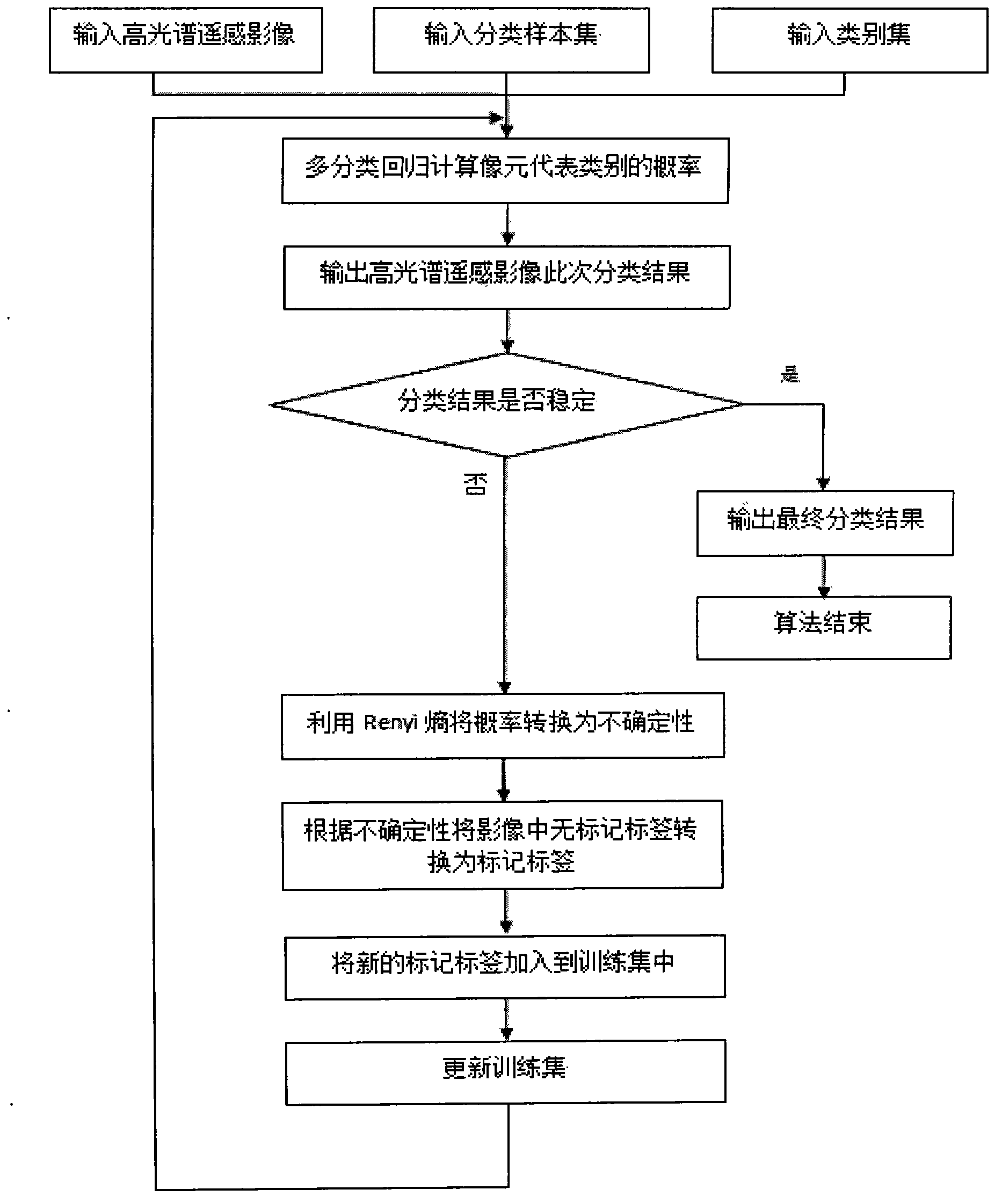
A technology for hyperspectral remote sensing and image classification, applied in the field of hyperspectral remote sensing images, semi-supervised hyperspectral remote sensing image classification based on information entropy, which can solve the problem of insufficient use of unlabeled labels.
- Summary
- Abstract
- Description
- Claims
- Application Information
AI Technical Summary
Problems solved by technology
Method used
Image
Examples
Embodiment 1
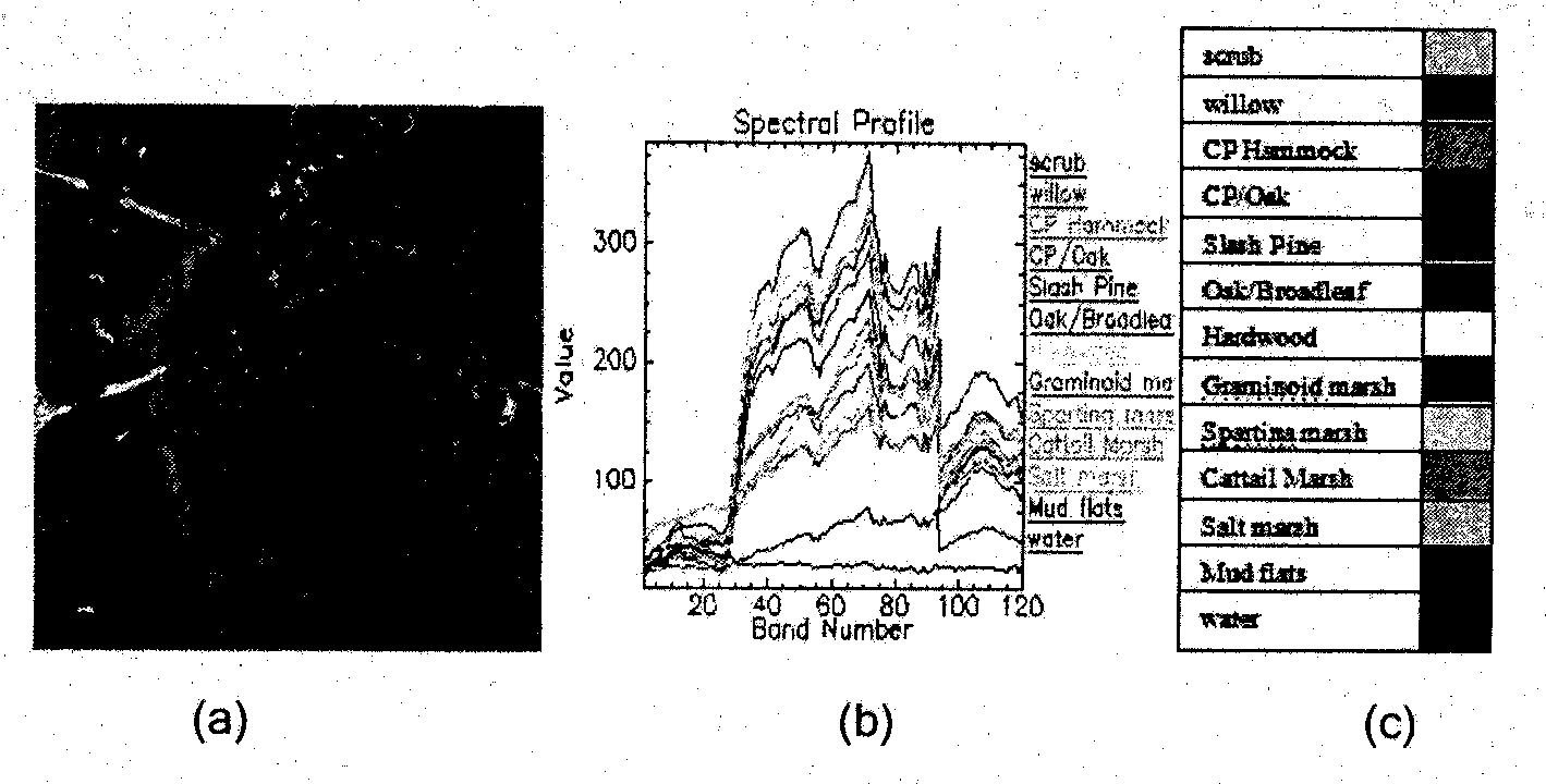
[0048] Embodiment 1: The semi-supervised hyperspectral remote sensing image classification method based on information entropy is the same as the steps of the above-mentioned specific implementation; figure 2 (a) is the hyperspectral remote sensing original image that the present invention uses, and it is the image on March 23rd, 1996 of Florida Kennedy Space Center (KSC) that the airborne imaging spectrometer AVIRIS of National Aeronautics and Space Administration (NASA) obtains, There are a total of 224 bands, the spectral range is 400-2500, the spectral resolution is 10nm, and the spatial resolution is 18m. For the data in the study area, the effects of water vapor absorption and low SNR bands are removed, and a total of 120 bands are selected for analysis. The training data is selected according to the images provided by the Landsat Thematic Mapper (Landsat Thematic Mapper). According to the interpretation of the images, the land cover in this area is divided into 13 major...
PUM
 Abstract
Description
Claims
Application Information
 - R&D
- Intellectual Property
- Life Sciences
- Materials
- Tech Scout
- Unparalleled Data Quality
- Higher Quality Content
- 60% Fewer Hallucinations
Browse by: Latest US Patents, China's latest patents, Technical Efficacy Thesaurus, Application Domain, Technology Topic, Popular Technical Reports.
© 2025 PatSnap. All rights reserved.Legal|Privacy policy|Modern Slavery Act Transparency Statement|Sitemap|About US| Contact US: help@patsnap.com


