Method and system for automatically positioning bicycle stations based on GPS (Global Position System) network

An automatic positioning and bicycle technology, which is applied in the field of life services, can solve problems such as failure to borrow and return bicycles smoothly, failure to automatically identify urban bicycle stations, and inability to truly contribute to urban emission reduction, so as to achieve the effect of convenient rental and return of bicycles

Inactive Publication Date: 2015-03-18
湖州沃武网络科技有限公司
View PDF0 Cites 3 Cited by
  • Summary
  • Abstract
  • Description
  • Claims
  • Application Information

AI Technical Summary

Problems solved by technology

[0003] The purpose of the present invention is to provide a method and system for automatically locating bicycle stations based on GPS network, which can effectively solve the problems in the prior art, e

Method used


Image

  • Method and system for automatically positioning bicycle stations based on GPS (Global Position System) network
  • Method and system for automatically positioning bicycle stations based on GPS (Global Position System) network

Examples


Embodiment 1

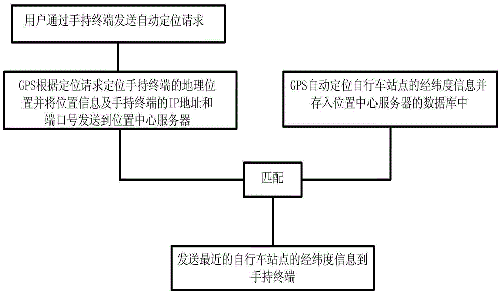
[0019] Embodiment 1. The method for the automatic location bicycle site based on GPS network, as figure 2 As shown, it includes: GPS1 automatically locates the latitude and longitude information of the bicycle site, and stores the latitude and longitude information in the database 4 of the location center server 2; the user sends an automatic positioning request through the handheld terminal 3; GPS1 locates the location of the handheld terminal 3 according to the location request. geographic location information, and the IP address and port number of the geographic location information and the handheld terminal 3 are sent to the location center server 2; Matching is carried out, and the latitude and longitude information of the nearest bicycle site is sent to the handheld terminal 3 . It also includes: identifying whether there is a bicycle at the bicycle site through the image collected by the camera 5 . It also includes: GPS1 tracks the walking path of the handheld termina...

Embodiment 2

[0021] Embodiment 2. The method for the automatic location bicycle site based on GPS network, as figure 2 As shown, it includes: GPS1 automatically locates the latitude and longitude information of the bicycle site, and stores the latitude and longitude information in the database 4 of the location center server 2; the user sends an automatic positioning request through the handheld terminal 3; GPS1 locates the location of the handheld terminal 3 according to the location request. geographic location information, and the IP address and port number of the geographic location information and the handheld terminal 3 are sent to the location center server 2; Matching is carried out, and the latitude and longitude information of the nearest bicycle site is sent to the handheld terminal 3 . Identify said bicycle stations on the map.

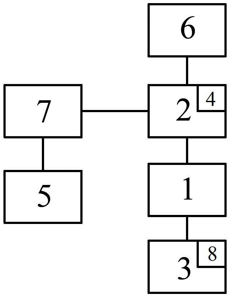
[0022] Realize a kind of system based on GPS network automatic location bicycle station of above-mentioned method, as figure 1 As shown, it include...

Embodiment 3

[0023] Embodiment 3. The method for the automatic location bicycle site based on GPS network, as figure 2 As shown, it includes: GPS1 automatically locates the latitude and longitude information of the bicycle site, and stores the latitude and longitude information in the database 4 of the location center server 2; the user sends an automatic positioning request through the handheld terminal 3; GPS1 locates the location of the handheld terminal 3 according to the location request. geographic location information, and the IP address and port number of the geographic location information and the handheld terminal 3 are sent to the location center server 2; Matching is carried out, and the latitude and longitude information of the nearest bicycle site is sent to the handheld terminal 3 . It also includes: GPS1 tracks the walking path of the handheld terminal 3, and the location center server 2 automatically sends the location of the bicycle stations near the handheld terminal 3 ...


PUM


Abstract

The invention discloses a method and a system for automatically positioning bicycle stations based on a GPS (Global Position System) network. The method comprises the following steps: automatically positioning longitude and latitude information of bicycle stations by GPS1 and storing the longitude and latitude information in a database 4 of a position center server 2; sending an automatic positioning request by a user through a handheld terminal 3; positioning geographic position information by the GPS 1 according to the positioning request and sending the geographic position information and IP address and a port number of the handheld terminal 3 to the position center server 2; matching the geographic position information of the handheld terminal 3 and the longitude and latitude information of bicycle stations by the position center server 2, and sending the longitude and latitude information of nearest bicycle stations to the handheld terminal 3. By virtue of the method, the bicycle stations of cities can be automatically identified; people can conveniently borrow and return vehicles; the purpose of contributing to the cities and reducing the emission of cities really can be achieved.

Description

technical field [0001] The invention relates to a method and system for automatically locating a bicycle station based on a GPS network, belonging to the technical field of life services. Background technique [0002] In order to facilitate people's travel and reduce urban gas emissions, many first-tier cities such as Beijing, Shanghai, Shenzhen, etc. have set up bicycle stations in different streets and alleys. People can rent bicycles after applying for a card. Changing trains at one station greatly facilitates people's lives. However, because the bicycle stations are all randomly set up, especially when people arrive at an unfamiliar street, it is impossible to know whether there is a bicycle rental station nearby, and whether there is a bicycle station near the destination to return the bicycle. Due to the above problems, many people In order to ensure a smooth arrival at the destination, they chose other means of transportation, so to a certain extent, they still did n...

Claims


Application Information

Patent Timeline
IPC IPC(8): G01S19/42G08G1/0968
CPCG01S19/01
Inventor 施新英
Owner 湖州沃武网络科技有限公司
Why Eureka
Try Eureka