Method for creating data index, data searching method and related device
A technology of data indexing and spatial data, applied in the field of geographic information, can solve problems such as inaccurate spatial data, achieve the effect of improving accuracy, increasing query speed, and improving accuracy
- Summary
- Abstract
- Description
- Claims
- Application Information
AI Technical Summary
Problems solved by technology
Method used
Image
Examples
Embodiment 1
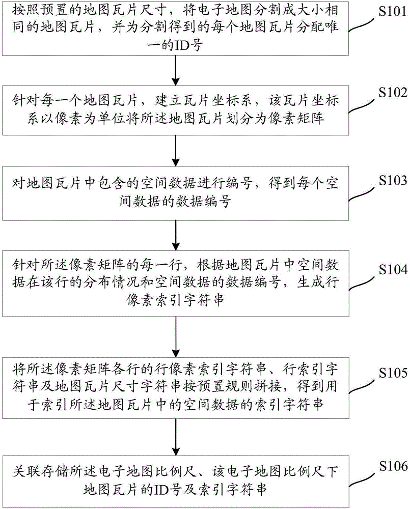
[0059] see figure 1 , which is a flow chart of a method for establishing a data index method according to the present invention. For an electronic map with a fixed scale, the method includes the following steps:
[0060] S101: Divide the electronic map into map tiles of the same size according to the preset map tile size, and assign a unique ID number to each divided map tile.
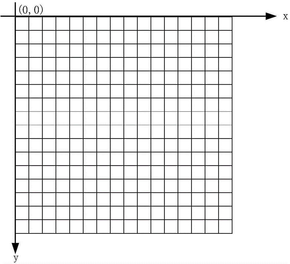
[0061] In the embodiment of the present invention, for electronic maps at different scales, the electronic map at each scale is segmented from a corner of the electronic map according to a specified size (such as 256 pixels × 256 pixels, etc.), and the commonly used order of segmentation is generally as follows: It is said that starting from the upper left corner of the electronic map, it is segmented from top to bottom and from left to right, so as to obtain several rectangular data, which are called map tiles. Since the specified size used for segmenting the electronic map is the same for electronic...
Embodiment 2
[0166] see Figure 9 , which is a method flow chart of a data index query method in the present invention, which is applied to an electronic map. The electronic map is divided into map tiles of the same size according to the preset map tile size, and each map tile is established with A corresponding tile coordinate system, the tile coordinate system divides the map tile into a pixel matrix in units of pixels, and the method includes the following steps:
[0167] S901: Receive a data query request, where the query request includes the latitude and longitude coordinates of the location to be queried and the electronic map scale.
[0168] In the embodiment of the present invention, after the data query request is operated by the user on the electronic interface, the client generates a request according to the user's operation. A data query request for the latitude and longitude coordinates of the clicked position and the scale of the current electronic map.
[0169] S902: Obtai...
Embodiment 3
[0210] On the basis of Embodiment 1 and Embodiment 2, this Embodiment 3 takes an actual application scenario as an example to describe in detail how to establish an index string of a map tile and use the index string to index a map tile. In the process of data query at the location to be queried, the character setting rules are the same as those in Embodiment 1 and Embodiment 2.
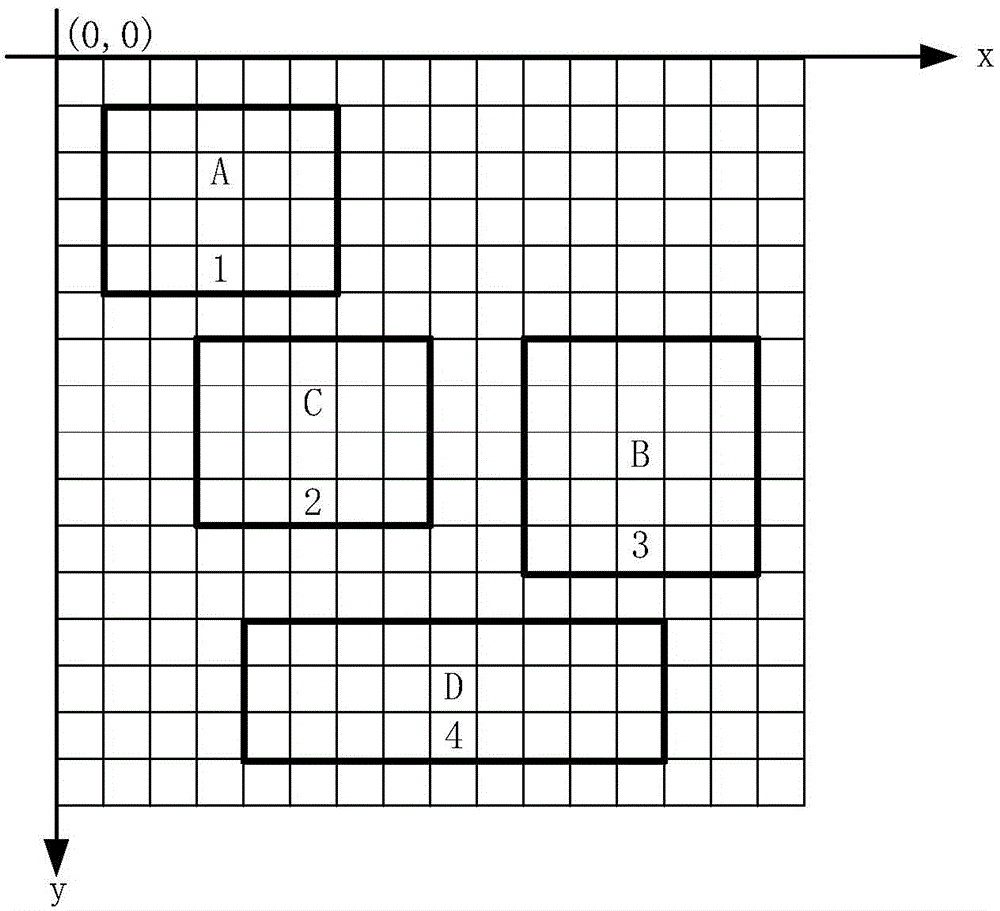
[0211] Preferably, in the embodiment of the present invention, in order to further reduce the length of the index string, when the spatial data distribution of k consecutive rows (k greater than 1) in a map tile is consistent, since the row pixel index string of the k row The same, therefore, when generating the index string, the row pixel index strings corresponding to the k rows are not spliced into the index string, but only the row pixel index strings of one of the k rows are spliced , as long as the row index strings corresponding to the k rows are consistent.
[0212] see Figure 10 , which...
PUM
 Abstract
Description
Claims
Application Information
 - R&D
- Intellectual Property
- Life Sciences
- Materials
- Tech Scout
- Unparalleled Data Quality
- Higher Quality Content
- 60% Fewer Hallucinations
Browse by: Latest US Patents, China's latest patents, Technical Efficacy Thesaurus, Application Domain, Technology Topic, Popular Technical Reports.
© 2025 PatSnap. All rights reserved.Legal|Privacy policy|Modern Slavery Act Transparency Statement|Sitemap|About US| Contact US: help@patsnap.com


