Evaluation method of geometric positioning accuracy of in-orbit satellite images based on multi-source remote sensing data
A geometric positioning and satellite image technology, applied in image analysis, image enhancement, image data processing, etc., can solve various distortions, increase the difficulty of control point extraction, and in-orbit image positioning accuracy errors, etc.
- Summary
- Abstract
- Description
- Claims
- Application Information
AI Technical Summary
Problems solved by technology
Method used
Image
Examples
Embodiment Construction
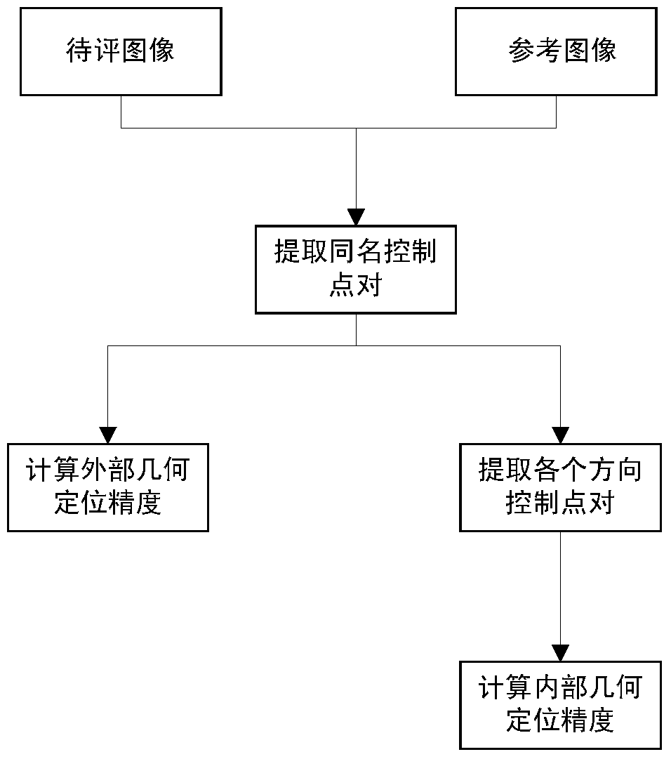
[0091] Concrete steps of the present invention are as follows:
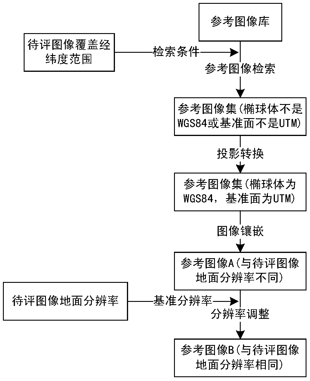
[0092] 1. Construct the reference image corresponding to the image to be evaluated.
[0093] First, the corresponding reference image set is searched according to the latitude and longitude range covered by the image to be evaluated. Since the image to be evaluated and the reference image set have different scales (with different resolutions, ellipsoids, and datums), a projective transformation of the image to be evaluated and the reference image set is required. Finally, the reference image set is stitched into a complete reference image.
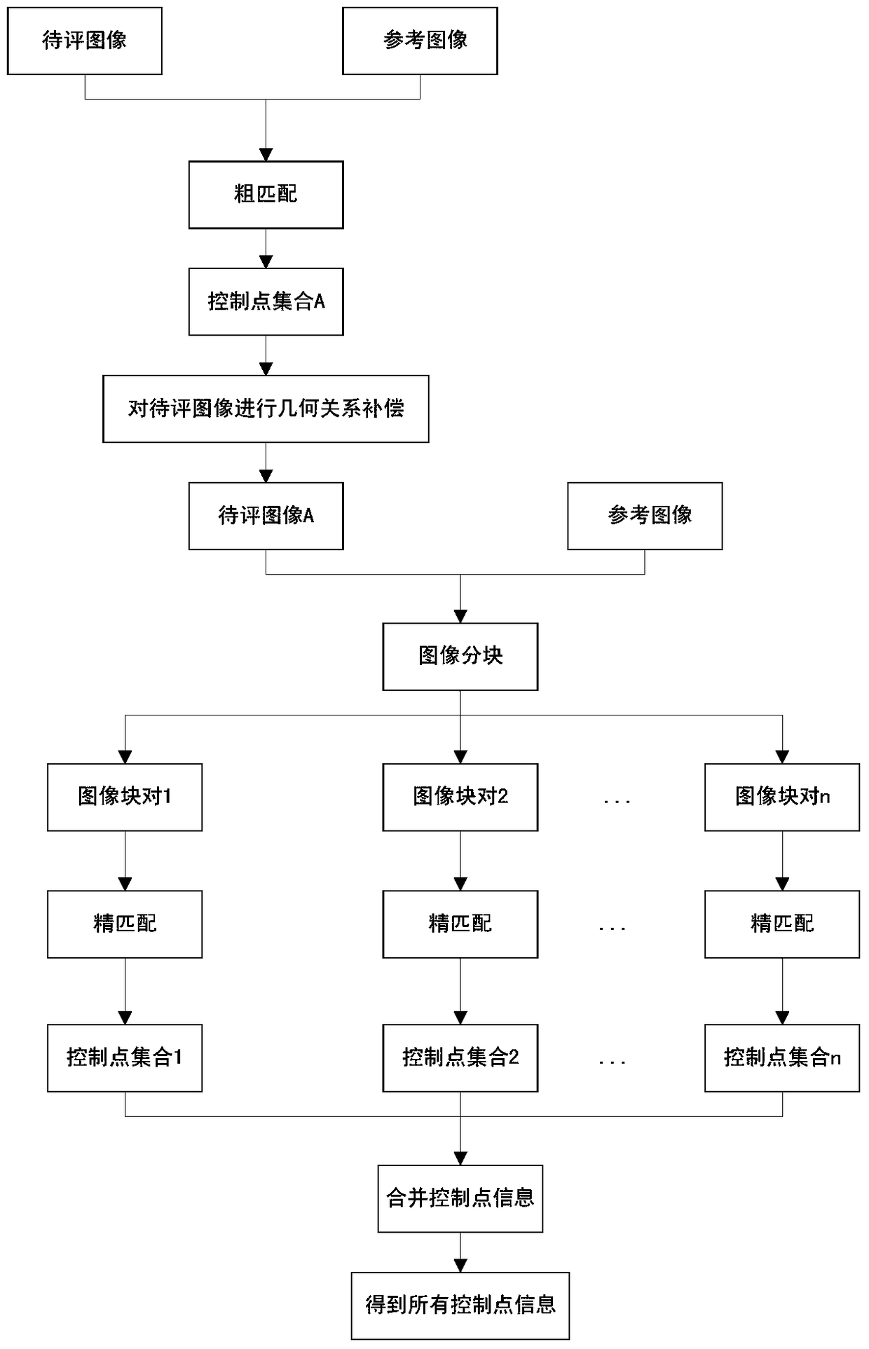
[0094] 2. Coarse matching
[0095] Due to the different imaging models and related parameters of multi-source remote sensing images, it is difficult to directly extract the same-named control point information between the image to be evaluated and the reference image. Therefore, the present invention adds rough matching to the image to be evaluated to perform geometric rel...
PUM
 Abstract
Description
Claims
Application Information
 - R&D
- Intellectual Property
- Life Sciences
- Materials
- Tech Scout
- Unparalleled Data Quality
- Higher Quality Content
- 60% Fewer Hallucinations
Browse by: Latest US Patents, China's latest patents, Technical Efficacy Thesaurus, Application Domain, Technology Topic, Popular Technical Reports.
© 2025 PatSnap. All rights reserved.Legal|Privacy policy|Modern Slavery Act Transparency Statement|Sitemap|About US| Contact US: help@patsnap.com


