Method for aerial photography map splicing based on super-pixels and SIFT

A superpixel and aerial photography technology, applied in the field of geographic remote sensing and image processing, can solve the problems of locally similar feature points prone to mismatch, time-consuming, and reduced stitching efficiency.

Inactive Publication Date: 2015-05-13
TIANJIN UNIV
View PDF1 Cites 13 Cited by
  • Summary
  • Abstract
  • Description
  • Claims
  • Application Information

AI Technical Summary

Problems solved by technology

In addition, aerial maps usually have the characteristics of high resolution and rich similar structures. The former results in a long time-consuming image registration based on SIFT features, and the latter, because SIFT features carry local neighborhood information, makes it relatively similar to locally similar features. Points are prone to mis-matching, so further screening of the extracted matching points is required
When the proportion of exactly matching point pairs is small, the RANSAC algorithm [4] The use of will further reduce splicing efficiency

Method used


Image

  • Method for aerial photography map splicing based on super-pixels and SIFT
  • Method for aerial photography map splicing based on super-pixels and SIFT
  • Method for aerial photography map splicing based on super-pixels and SIFT

Examples


Embodiment Construction

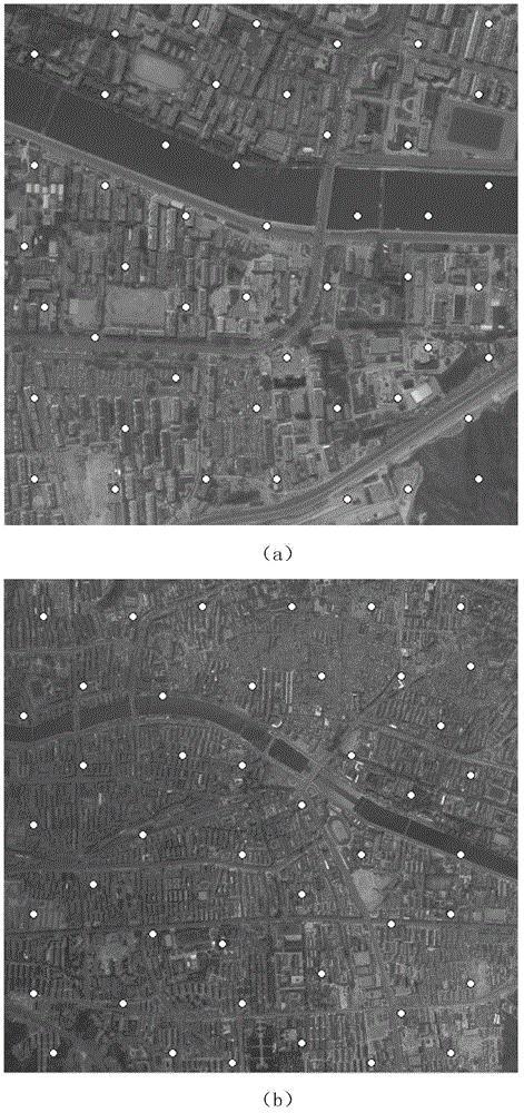
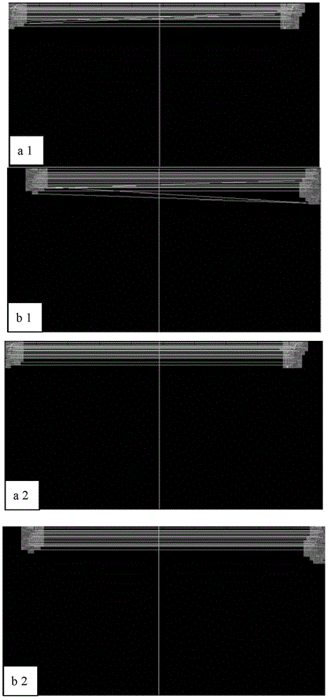
[0055] The invention provides a method for splicing aerial maps based on super-pixel SIFT. The method can realize rapid and efficient splicing of aerial maps, reduce the amount of calculation, improve accuracy, obtain large-field images in time, and provide early warning of natural disasters and Post-disaster rescue has practical significance. The technical solutions of the present invention will be described in further detail below in conjunction with the accompanying drawings and specific embodiments, and the described specific embodiments are only to illustrate the present invention, and are not intended to limit the present invention.

[0056] Such as Figure 4 Shown, a kind of method of the present invention is used for splicing based on superpixel SIFT aerial photography map, comprises the following steps:

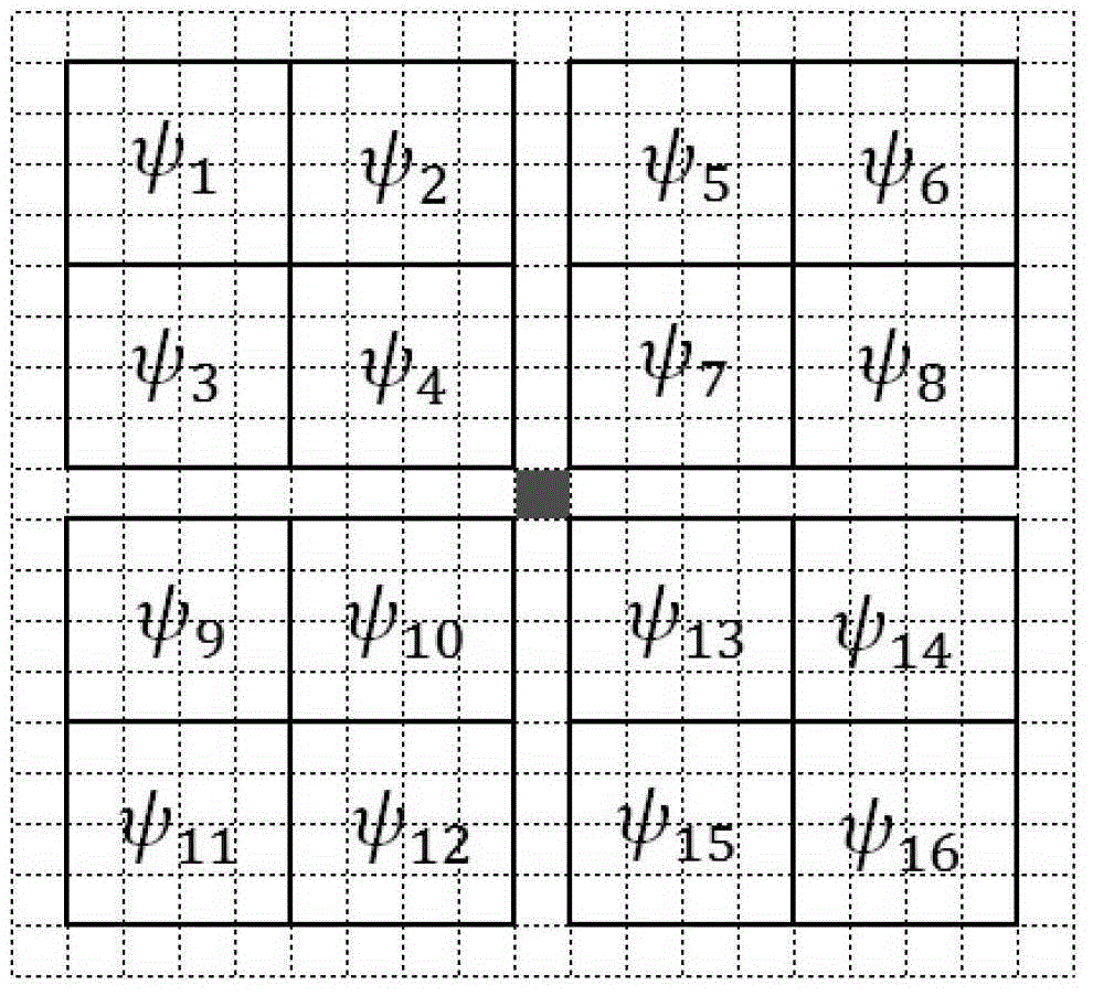
[0057] Step 1. Carry out superpixel adaptive segmentation on the aerial map, see Figure 4 Medium 101; includes:

[0058] 1-1. Initialization: Generate K uniforml...


PUM


Abstract

The invention discloses a method for aerial photography map splicing based on super-pixels and SIFT. The method comprises the steps that (1) super-pixel self-adaptation segmentation is conducted on aerial photography maps; (2) three to ten super-pixel pre-matching pairs are obtained by using the color normalization average value of a plurality of super-pixels obtained in the step (1) as guidance information, SIFT features of the super-pixel pre-matching pairs are extracted, and the super-pixel pre-matching pairs which fail in matching are removed after matching of the SIFT features is conducted; (3) a supervisory mechanism is generated in an on-line mode, and matching point pairs meeting the requirements are obtained; (4) a transformation matrix is calculated through the matching point pairs which are accurately selected in the step (3), images are fused, and image splicing is achieved. The method for aerial photography map splicing based on the super-pixels and SIFT achieves rapid and efficient splicing of the aerial photography maps, and the effectiveness of the method is verified through experiments.

Description

technical field [0001] The invention relates to the fields of geographical remote sensing and image processing, in particular to a method for splicing aerial maps based on superpixel SIFT. Background technique [0002] Aerial maps are captured by drones at high altitudes using high-altitude cameras. Due to the limitation of the flying height of the UAV and the focal length of the camera, it is difficult for a single aerial map to contain all the content of the target. Therefore, aerial map stitching has become a key issue in aerial map processing. [0003] Image mosaic technology is to combine several images with overlapping content into one image with a large viewing angle and wide format. This technology has been developed rapidly as a tool for synthesizing aerial maps. The key technology of image mosaic is registration, which needs to calculate the projective transformation between images according to the consistency of overlapping areas between images. [0004] Method...

Claims


Application Information

Patent Timeline
Patent Type & Authority Applications(China)
IPC IPC(8): G06T3/40G06T5/50
CPCG06T3/4038
Inventor 王萍王港
Owner TIANJIN UNIV
Why Eureka
Try Eureka