
Urban hierarchical regional division method based on vector map data model

A technology of vector map data and regional division method, applied in the field of geographic information system, can solve the problems of low precision, increased computational complexity, loss of road structure and regional geographic information, etc.

Inactive Publication Date: 2016-01-06
HUAZHONG UNIV OF SCI & TECH
View PDF4 Cites 20 Cited by
  • Summary
  • Abstract
  • Description
  • Claims
  • Application Information

AI Technical Summary

Problems solved by technology

However, this method simply provides a solution and does not involve map information. This method loses the original road structure of the city and the geographic information of the region.
Choosing the grid interval size can also create a number of problems: small intervals increase computational complexity; large intervals produce rough boundaries
[0004] For different specific applications, these two models have both advantages and disadvantages. The vector model can well maintain the original topological relationship of the map data, and the results can also be well preserved and utilized, but the vector model needs to choose an appropriate data structure Save and operate, there is a disadvantage of high computational time complexity; the grid model can easily convert map data into image data, and use shape operations to complete area division, but its disadvantage is that the accuracy is not high, and the rasterization The final data loses the original topological information, and it is impossible to use the road level information for iterative calculation, and the calculated data is a picture, which is difficult to modify and operate

Method used


Image

  • Urban hierarchical regional division method based on vector map data model
  • Urban hierarchical regional division method based on vector map data model
  • Urban hierarchical regional division method based on vector map data model

Examples


Embodiment Construction

[0048] In order to make the object, technical solution and advantages of the present invention clearer, the present invention will be further described in detail below in conjunction with the accompanying drawings and embodiments. It should be understood that the specific embodiments described here are only used to explain the present invention, not to limit the present invention. In addition, the technical features involved in the various embodiments of the present invention described below can be combined with each other as long as they do not constitute a conflict with each other.

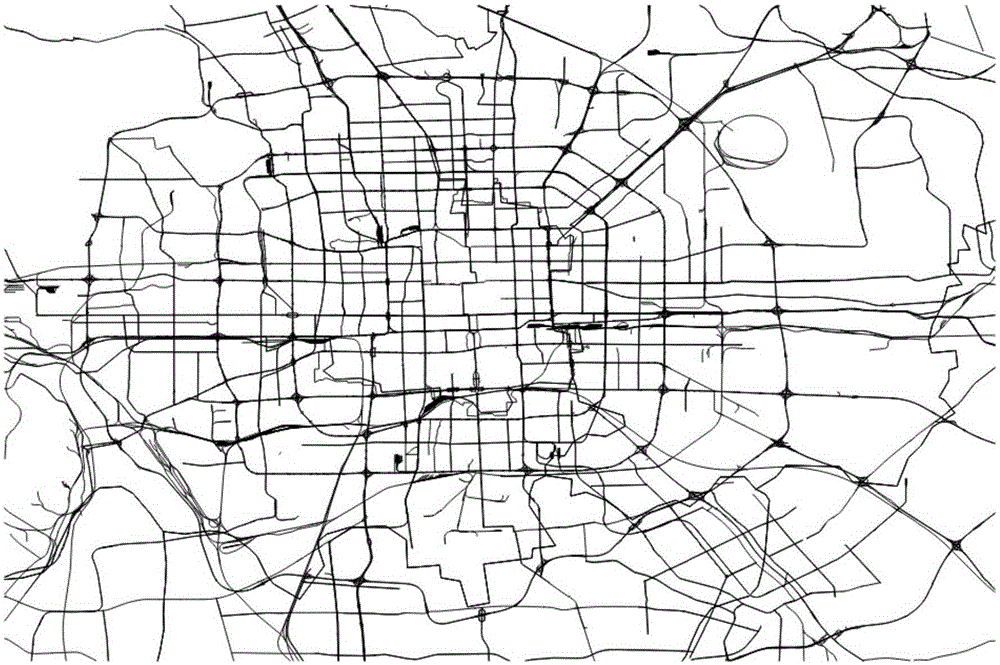
[0049] The present invention hopes to use a pure vector model to divide the map area, and reduce redundant data in the calculation process while maintaining the original road network information. One of the challenges is that we want to maintain the hierarchy of the road map during the zoning process. Take the Beijing road map as an example. Such as figure 1 As shown, the main highways can di...


PUM


Abstract

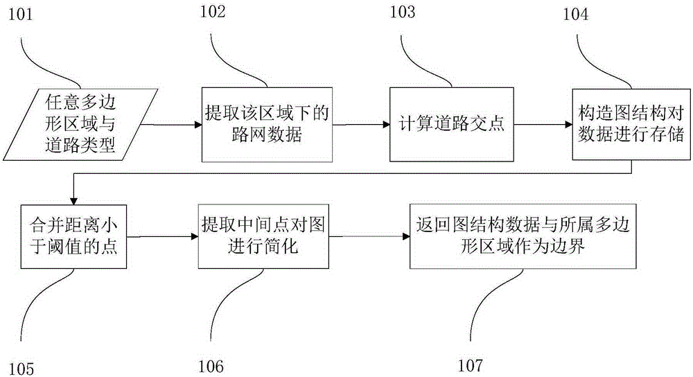
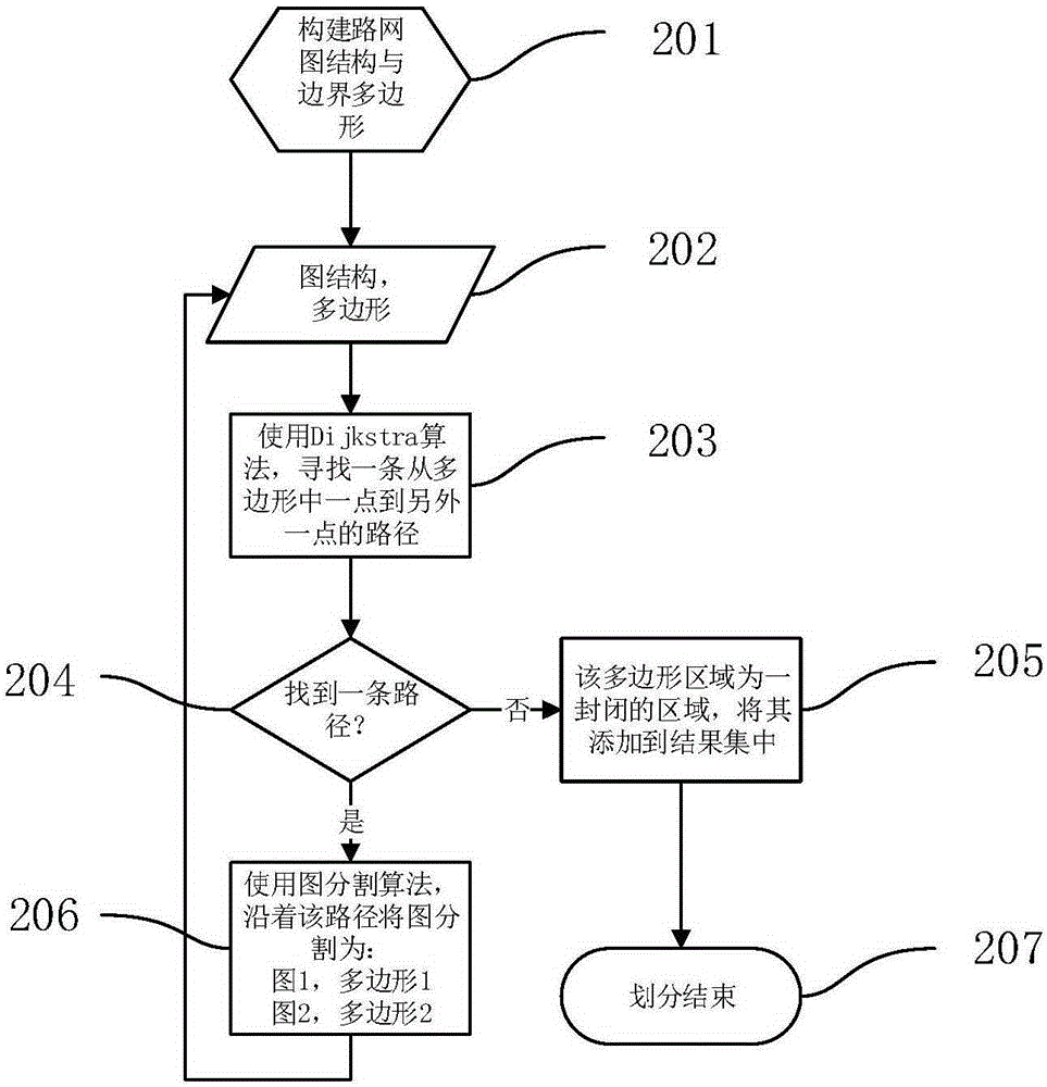
The invention discloses an urban hierarchical regional division method based on a vector map data model. The method comprises the steps that a corresponding road network diagram structure and polygon boundary data are established for a region needing to be divided; a corresponding diagram structure and boundary polygon are established according to the road network diagram structure and the polygon boundary data, a path is searched to divide an original polygon into two parts, and paths are continuously searched in the newly generated polygons to conduct diagram division till all the polygons cannot be divided; a city is divided into primary regions according to primary road data, all the primary regions are traversed, secondary road data under the primary regions are extracted, and secondary regions under the regions are divided out by applying a regional division algorithm, so that a hierarchical structure of urban regions is formed. According to the urban hierarchical regional division method based on the vector map data model, a diagram structure is used for storing vector map data, operations are all based on the vector data, original data of a map can be completely reserved, and the data can be processed in an undistorted mode.

Description

technical field [0001] The invention belongs to the technical field of geographic information systems, and more specifically relates to a method for dividing urban hierarchical regions based on a vector map data model. Background technique [0002] With the rapid development of geographic information system (Geographic Information System, GIS) and location-based services (Location Based Services, LBS), regional analysis is becoming more and more important in many geospatial related applications, such as tourism planning, urban planning, traffic road condition analysis etc. When we analyze the characteristics of these areas in the city, the first thing to do is to divide the whole city into many small areas. In order to make map segmentation easier, the most commonly used method is a grid-based method. This method is to add a fixed grid to the road network. However, this method simply provides a solution and does not involve map information. This method loses the original ...

Claims


Application Information

Patent Timeline
IPC IPC(8): G01C21/32
CPCG01C21/32
Inventor 吴宏伟涂来周婷赵思
Owner HUAZHONG UNIV OF SCI & TECH
Learn More