Virtual node based distributed GEO/LEO mixed network routing method

A virtual node and hybrid network technology, applied in the field of satellite communications, can solve the problems of prolonged queuing delay, and the inability of satellite network routing algorithms to calculate routing in real time.

Active Publication Date: 2016-01-06
HARBIN INST OF TECH
View PDF3 Cites 19 Cited by
  • Summary
  • Abstract
  • Description
  • Claims
  • Application Information

AI Technical Summary

Problems solved by technology

[0007] The purpose of the present invention is to provide a distributed GEO/LEO hybrid network routing method based on virtual nodes in order to solve the proble...

Method used


Image

  • Virtual node based distributed GEO/LEO mixed network routing method
  • Virtual node based distributed GEO/LEO mixed network routing method
  • Virtual node based distributed GEO/LEO mixed network routing method

Examples


specific Embodiment approach 1

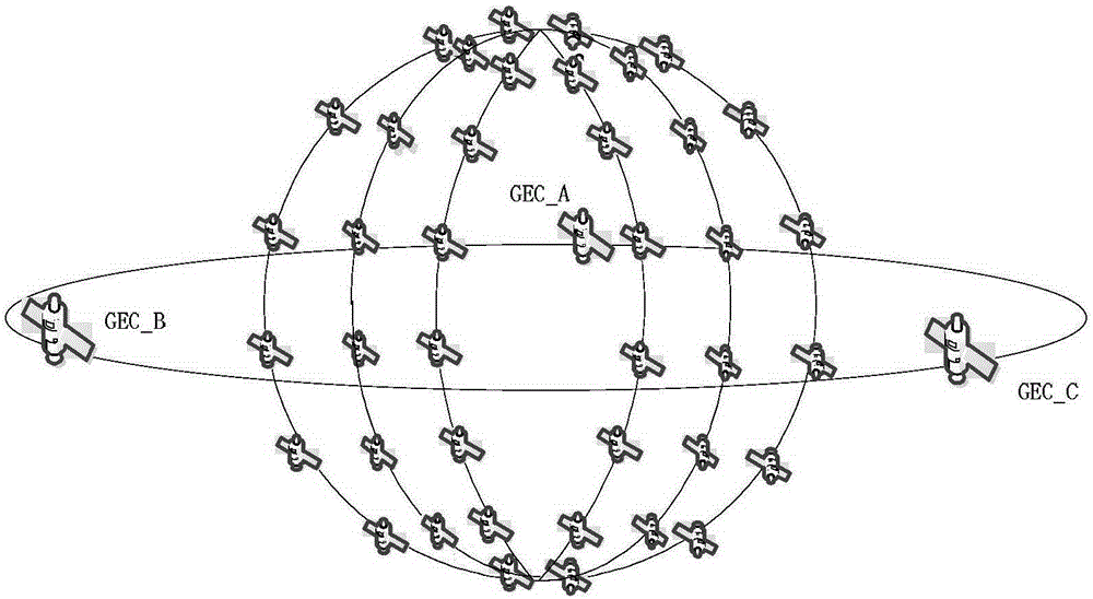
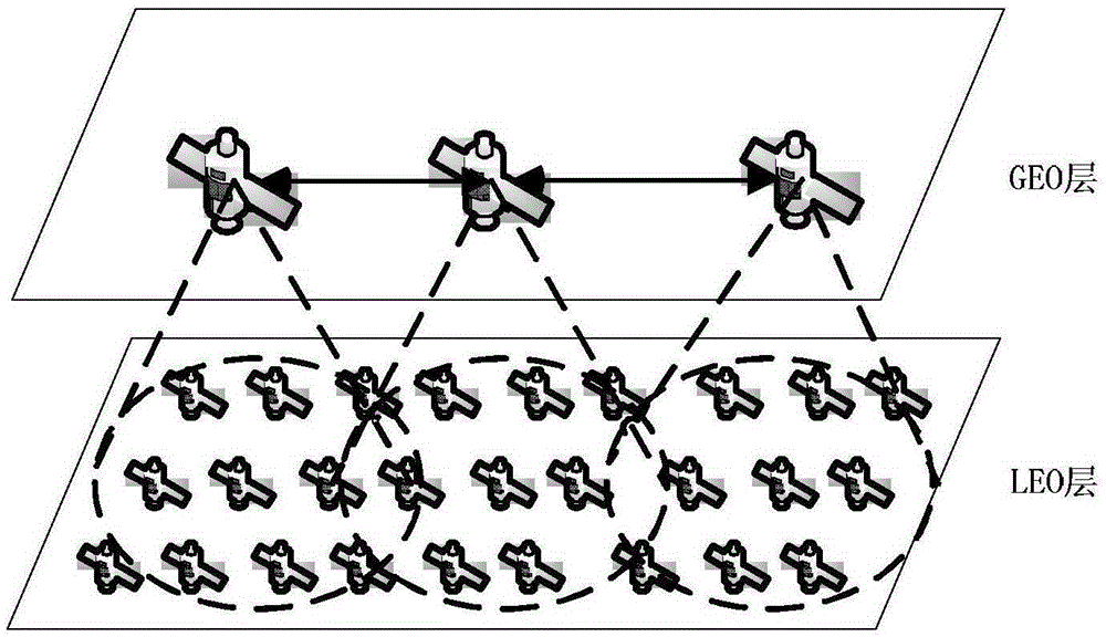
[0041] Specific implementation mode one: as Figure 1~4 As shown, a virtual node-based distributed GEO / LEO hybrid network routing method described in this embodiment uses a two-layer network structure formed by 3 GEOs and 66 LEOs (such as figure 1 ) based on the implementation, the process is:

[0042] Step 1, regional division: divide the earth's surface into 72 logical areas on average according to latitude and longitude, and establish a connection between the LEO layer satellite and the logical area through formula (1), such as Figure 4 ,

[0043]

[0044] Among them, lon m,n 、lat m,n represent the longitude and latitude of the satellite S(m,n) respectively; and lon p,q ,lat p,q Represent the longitude and latitude of the logical area L respectively; N represents the number of orbits of LEO layer satellites, the value is 6, M represents the number of satellites on each orbit of the LEO layer, the value is 11;

[0045] Step 2, satellite group management: Utilize G...


PUM


Abstract

The invention relates to a virtual node based distributed GEO/LEO mixed network routing method, and aims at solving the problem that a present satellite network routing algorithm cannot calculate routes in real time and is too long in delayed time when considering queuing time delay. The earth surface is averagely divided into 72 logical areas according to latitude and longitude, and LEO satellites are associated with the logical areas; the bottom LEO satellites are divided into three groups by a GEO, and each group serves as an LEO family; data is driven and routing is updated; and a routing calculation method is provided. According to different requirements of real-time service and non-real-time service, advantages of GEO and LEO networks are comprehensively utilized to construct a double-layer satellite network, and different layers are used for transmitting different type of packets in the mixed network to prevent the satellites from congestion in the present hop. The virtual node based method can be used to solve the problem that mobility of satellites causes continuous change of topology, and influence of queuing time delay is taken into consideration.

Description

technical field [0001] The invention relates to a distributed GEO / LEO hybrid network routing algorithm based on virtual nodes, which belongs to the field of satellite communication. Background technique [0002] Satellite networks can meet a range of data communication needs, such as commercial, military and personal business. Satellite service can be provided in suburban, rural areas. Provides wide area coverage in remote areas and other places where terrestrial networks are not accessible. Satellite communication also has a unique broadcast mechanism. In view of these unique advantages of satellite communication, there is no doubt that satellite communication will become an indispensable part of the next generation Internet. [0003] There are many application technologies worthy of in-depth study when satellites realize global communication. Among all technologies, the improvement of proprietary and effective routing algorithms is one of the challenges faced by many te...

Claims


Application Information

Patent Timeline
IPC IPC(8): H04W40/02H04W40/22H04W40/24H04W84/06
CPCH04W40/02H04W40/22H04W40/24H04W84/06
Inventor 杨明川冯玺宝谭璐陈建飞袁莞迈邵欣业
Owner HARBIN INST OF TECH
Why Eureka
Try Eureka