Multi-scale road flow visual analysis method based on taxi GPS data

A technology of GPS data and analysis methods, applied in traffic flow detection, traffic control systems of road vehicles, instruments, etc., can solve problems such as rising costs, air pollution, and wasting time

Active Publication Date: 2016-04-13
ZHEJIANG UNIV OF TECH
View PDF4 Cites 18 Cited by
  • Summary
  • Abstract
  • Description
  • Claims
  • Application Information

AI Technical Summary

Problems solved by technology

Traffic congestion causes many negative effects, such as wasted time, rising costs, air pollution, etc.
Over the years, government departments have tried to address these problems, but, sometimes, with only modest success

Method used


Image

  • Multi-scale road flow visual analysis method based on taxi GPS data
  • Multi-scale road flow visual analysis method based on taxi GPS data
  • Multi-scale road flow visual analysis method based on taxi GPS data

Examples


Embodiment Construction

[0033] The following describes in detail in conjunction with the embodiments and the accompanying drawings.

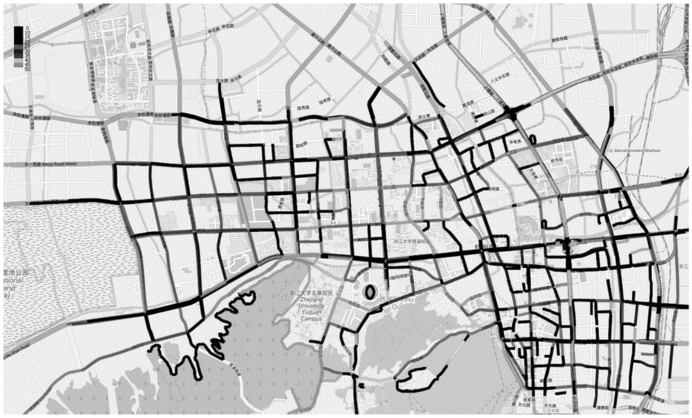
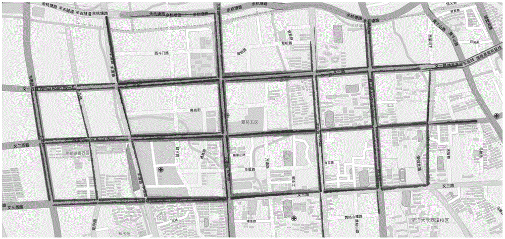
[0034] The design of the present invention uses d3.js to draw the front-end visualization components, mainly including the global view, the selection filter view under different zoom levels, and finally the detailed view arrow diagram after the filter selection, and the data processing is mainly written in java.

[0035] The multi-scale road flow visual analysis method based on taxi GPS data involved in the present invention comprises the following steps:

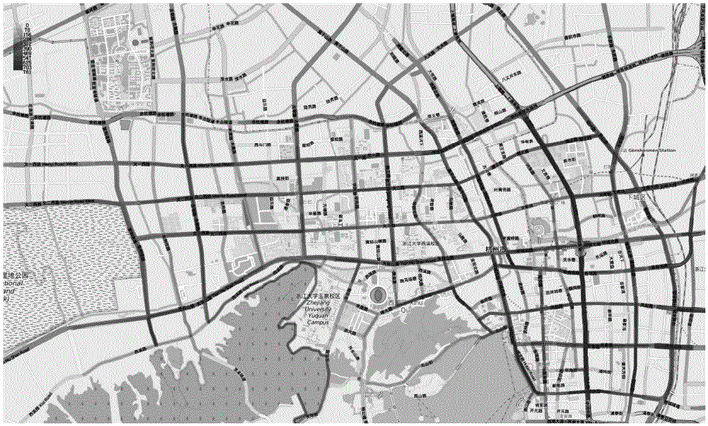
[0036] (1) Overview; first, extract the GPS data of taxis and analyze the road flow information. Considering that the number of taxi GPS points is extremely large, the GPS data points are mapped to road network roads, using the map on OpenStreetMap Data and road network data, the mapping method mainly uses the ST-Matching algorithm based on grid division; calculate the flow and speed information of different roads t...


PUM


Abstract

The invention discloses a multi-scale road flow visual analysis method based on taxi GPS data. The method comprises the following steps: 1, taking an overview, i.e., first of all, extracting GPS data of a taxi, and analyzing road flow information; 2, performing filtering selection from different scales; and 3, performing detail presentation, wherein this step specifically comprises a Road Over View, a road bidirectional Line Chart and a visualization assembly describing a specific road flow speed.

Description

technical field [0001] The invention relates to a visual analysis method for road flow. Background technique [0002] With the development of urbanization and the increase of urban population, modern metropolises are facing serious urban diseases, such as traffic congestion and unsatisfactory urban planning, etc. Traffic congestion causes many negative effects, such as wasted time, rising costs, air pollution and so on. Over the years, government agencies have tried to address these problems, but, sometimes, with only modest success. In recent years, with the rapid advancement and widespread penetration of different sensing technologies, a large amount of data has been successfully collected to record the status of various aspects of the city. This brings new opportunities to solve urban problems and create smart cities based on urban big data analysis. In recent years, more and more cities have tried to improve the communication efficiency of urban roads, so as to allevi...

Claims


Application Information

Patent Timeline
Patent Type & Authority Applications(China)
IPC IPC(8): G08G1/01
CPCG08G1/0104
Inventor 梁荣华刘春辉田亚姜晓睿贡伟
Owner ZHEJIANG UNIV OF TECH
Why Eureka
Try Eureka