Binocular camera-based high-precision visual sense positioning map generation system and method

A binocular camera and map generation technology, applied in the field of map surveying and mapping, can solve the problems of not being able to reflect image features and specific content, not storing image elements, etc., and achieve high-precision results

Inactive Publication Date: 2016-06-15
WUHAN KOTEI TECH CORP
View PDF7 Cites 68 Cited by
  • Summary
  • Abstract
  • Description
  • Claims
  • Application Information

AI Technical Summary

Problems solved by technology

[0003] However, at present, the high-precision map does not store the image elements directly related to the image, but only stores the marking information of road elements such as lane lines and

Method used


Image

  • Binocular camera-based high-precision visual sense positioning map generation system and method
  • Binocular camera-based high-precision visual sense positioning map generation system and method
  • Binocular camera-based high-precision visual sense positioning map generation system and method

Examples


Embodiment Construction

[0024] In order to make the objectives, technical solutions and advantages of the present invention clearer, the present invention will be described in further detail below in conjunction with the accompanying drawings and embodiments. It should be understood that the specific embodiments described here are only used to explain the present invention and are not intended to limit the invention.

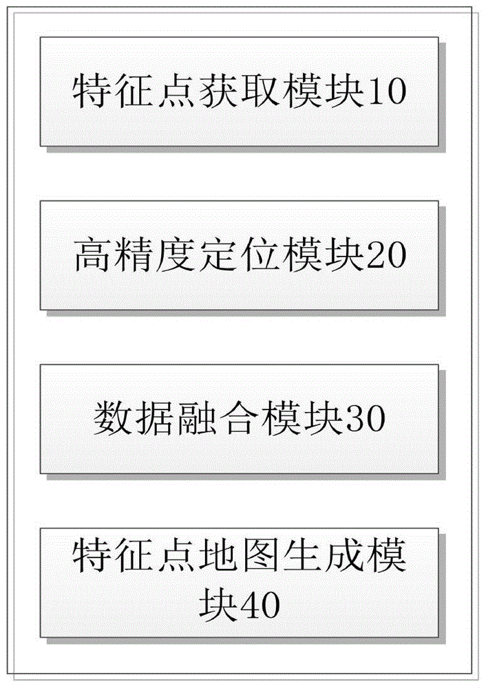
[0025] Such as figure 1 As shown, the embodiment of the present invention provides a high-precision visual positioning map generation system based on a binocular camera, and the high-precision visual positioning map generation system based on a binocular camera includes the following modules:

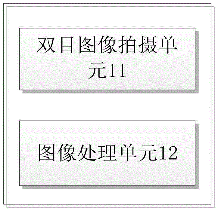
[0026] Feature point acquisition module 10: used to collect image data along the road using a binocular camera, extract and match feature points on the image, and obtain the spatial positional relationship of visual feature points relative to the camera;

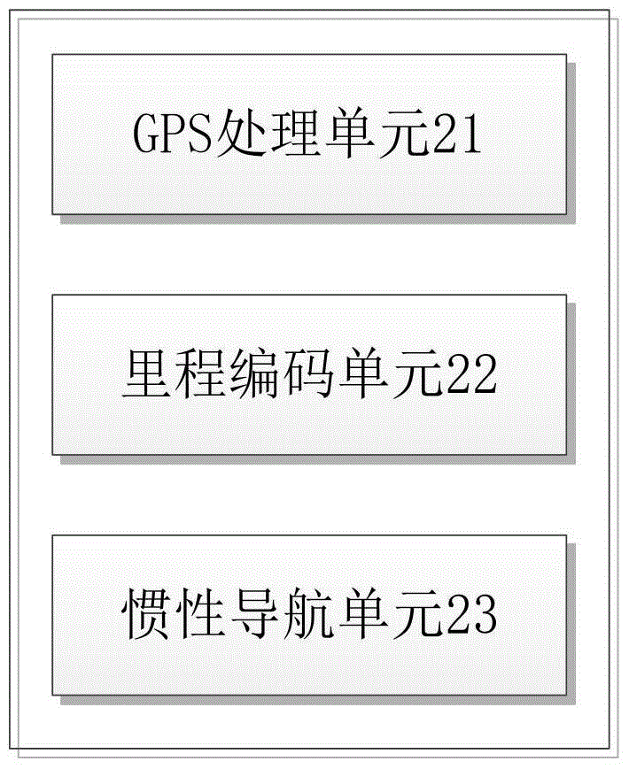
[0027] High-precision positioning modu...


PUM


Abstract

The invention provides a binocular camera-based high-precision visual sense positioning map generation system and method. An image acquisition module obtains binocular images, characteristic points of the binocular images are extracted and matched, positioning of relative positions of visual sense characteristic points is carried out by a binocular positioning method, spatial position relationships of the visual sense characteristic points relative to the camera are obtained, latitude and longitude coordinates of visual sense characteristic points are calculated combined with high-precision GPS information, visual sense characteristic points which are uploaded from different intelligent vehicles are analyzed, and finally the visual sense characteristic point map with reliability and stability is obtained. Compared with prior art, image characteristic essential factors are added based on the high precision map, so that vehicles can be positioned by directly using image characteristics, and the positioning precision of the vehicles is high.

Description

technical field [0001] The invention relates to the field of map surveying and mapping, in particular to a high-precision visual positioning map generation system and method based on a binocular camera. Background technique [0002] With the rapid development of Advanced Driver Assistance System (ADAS, Advanced Drive Assistants System) and intelligent driving technology, high-precision maps, as an important part of them, have also received more and more attention and applications. Compared with traditional maps, high-precision maps can provide centimeter-level precision data, more detailed road information, and richer map elements. [0003] However, at present, the high-precision map does not store the image elements directly related to the image, but only stores the marking information of road elements such as lane lines and road markings indirectly extracted from the image, and these marking information can only represent semantics, and cannot reflect the information in th...

Claims


Application Information

Patent Timeline
IPC IPC(8): G01C21/32
CPCG01C21/32
Inventor 苏晓聪辛梓朱敦尧
Owner WUHAN KOTEI TECH CORP
Why Eureka
Try Eureka