Ground reference-free low altitude triangulation method based on GNSS/MEMS positioning and directioning

A technology of triangulation, positioning and orientation, which is applied in the directions of measuring devices, photogrammetry/video metrology, surveying and navigation, etc., and can solve the problems of short battery life, large lateral overlap, and susceptibility to airflow, etc. problems, to achieve the effect of increasing the maximum flight area, reducing side overlap, and improving work efficiency

Active Publication Date: 2016-08-31
WUHAN GEOSUN NAVIGATION TECH CO LTD
View PDF3 Cites 12 Cited by
  • Summary
  • Abstract
  • Description
  • Claims
  • Application Information

AI Technical Summary

Benefits of technology

This patented technology improves upon existing methods that use multiple sensors or external devices like radar systems to measure altitudes accurately over large distances while avoiding physical contact between them. It suggests developing an improved way to determine three dimensions (longitudinal, lateral) from two different sources - one uses geomagnetic signals and another uses satellite navigation signal strength measurements. By integrating these techniques into the aircraft itself instead of relying solely on its own capabilities, this new approach allows for more accurate 3D location measurement under difficult terrains conditions.

Problems solved by technology

Technological Problem: Current methods for measuring altitudes involve expensive equipment such as drones or monopods equipped with multiple lenses, making them less efficient at capturing smaller areas like urban environments due to their lack of flexibility and range limitations. Additionally, current methods require manual operation, leading to longer processing times and reduced efficiency when analyzing large areas where there may have many connections point within each section.

Method used


Image

  • Ground reference-free low altitude triangulation method based on GNSS/MEMS positioning and directioning
  • Ground reference-free low altitude triangulation method based on GNSS/MEMS positioning and directioning
  • Ground reference-free low altitude triangulation method based on GNSS/MEMS positioning and directioning

Examples


Embodiment 1

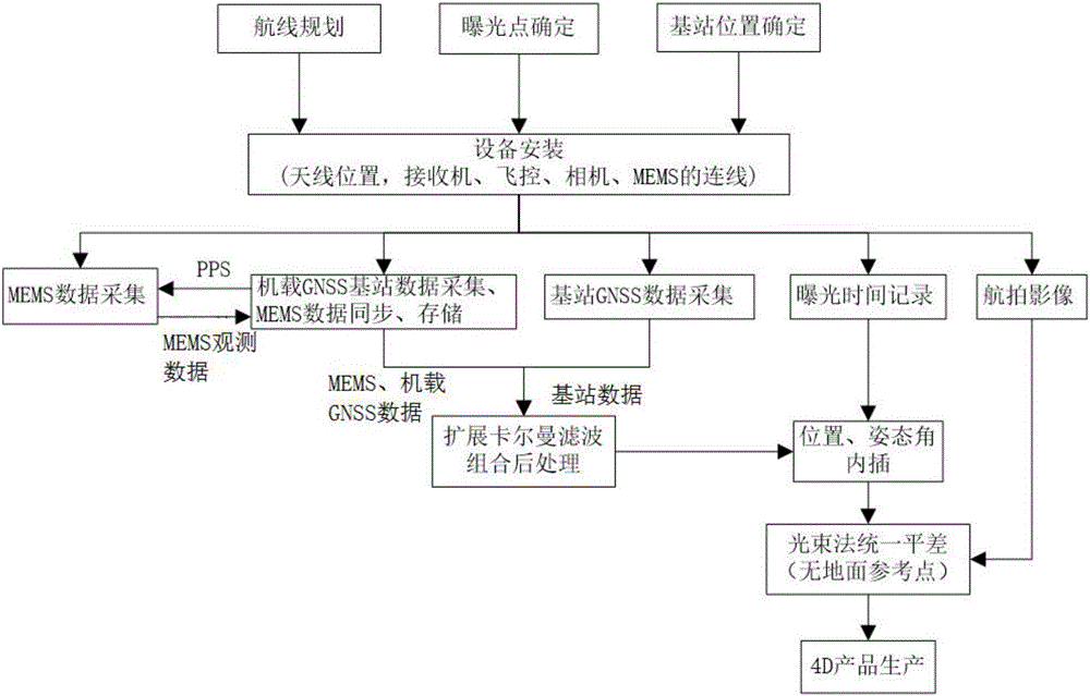
[0030] In the embodiment of the present invention, a low-altitude triangulation method based on GNSS / MEMS positioning and orientation without ground reference, the technical steps adopted include:

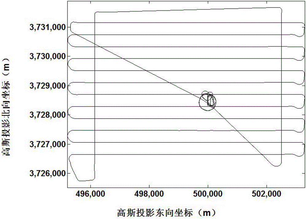
[0031] (1) According to the geographical parameters of the area to be surveyed and mapped, including location, shape, area, etc., draw the flight belt, exposure point location, etc. in the ground flight control system, and select the appropriate GNSS base station location.

[0032] In order to reduce the layout of image control points in the survey area, it is usually necessary to add several routes approximately perpendicular to the mapping route, that is, the frame route. Its main function is to play the role of elevation control points at both ends of the basic route, and to correct the coordinate system drift error of the GNSS camera station through the ground control scheme of the four-corner level height control point plus 2 vertical frame routes. On the basis of ensuring acc...


PUM


Abstract

The invention discloses a ground reference-free low altitude triangulation method based on GNSS/MEMS positioning and directioning. The method comprises combining GNSS and MEMS chips to obtain a combined chip module for synchronously acquiring and storing receiver data of a GNSS satellite and data transmitted through a MEMS sensor, carrying out post-observation processing and feedback compensation to obtain high precision position information and attitude angle information, acquiring a mapping coordinate system position through coordinate transforming software in a measurement zone, carrying out eccentricity correction and eccentric angle correction through the position information and attitude angle information as data of starting count, providing elements of exterior orientation for aerophotogrammetry and carrying out low altitude triangulation without ground control. The ground reference-free low altitude triangulation method reduces flight side overlap, improves work efficiency, reduces a cost, reduces outdoor work person workload in unmanned plane plotting and solves the problem that the existing unmanned plane plotting cannot guarantee a plotting precision through arrangement of a ground control point in an area with rough topography.

Description


Claims


Application Information

Patent Timeline
Owner WUHAN GEOSUN NAVIGATION TECH CO LTD
Why Eureka
Try Eureka