Time-optimal route planning method based on improved level set algorithm
A route planning, time-optimized technology, applied in computing, structured data retrieval, prediction, etc., can solve problems such as unsatisfactory effect and limited application scope, and achieve the effect of high planning accuracy, fast speed and strong practicability
- Summary
- Abstract
- Description
- Claims
- Application Information
AI Technical Summary
Problems solved by technology
Method used
Image
Examples
Embodiment Construction
[0027] The following examples illustrate the present invention further.
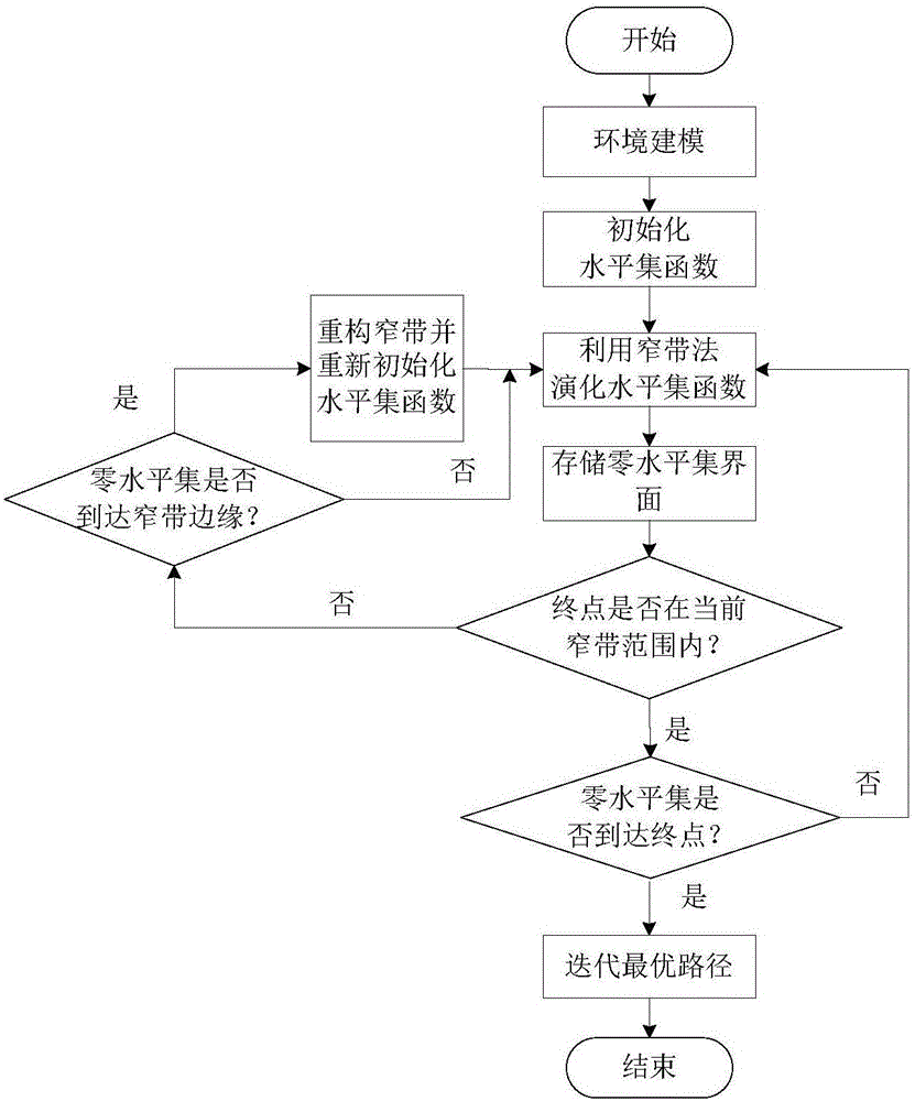
[0028] The present invention is an AUV three-dimensional path planning method considering the influence of ocean currents. It mainly includes key contents such as environment modeling, level set modeling, reinitializing level set functions, and obtaining the optimal path. For the specific implementation process, see figure 1 , including the following:
[0029] Step 1. Construct 3D route planning environment space based on electronic chart and ocean current information
[0030] In order to truly simulate the navigation environment of underwater AUVs, the real environment of AUV navigation is modeled. In the three-dimensional space, establish a three-dimensional space coordinate system with the vertex in the lower left corner as the coordinate origin, the direction of increasing longitude as the positive direction of the X-axis, the direction of increasing latitude as the positive direction of the Y-axis,...
PUM
 Abstract
Description
Claims
Application Information
 - R&D
- Intellectual Property
- Life Sciences
- Materials
- Tech Scout
- Unparalleled Data Quality
- Higher Quality Content
- 60% Fewer Hallucinations
Browse by: Latest US Patents, China's latest patents, Technical Efficacy Thesaurus, Application Domain, Technology Topic, Popular Technical Reports.
© 2025 PatSnap. All rights reserved.Legal|Privacy policy|Modern Slavery Act Transparency Statement|Sitemap|About US| Contact US: help@patsnap.com


