Three-dimensional pipe model establishment lofting method and device for geography information system
A technology of geographic information system and three-dimensional pipe, which is applied in the field of building and setting out three-dimensional pipe model of geographic information system to achieve the effect of saving manpower and material cost, facilitating data maintenance and occupying less resources.
- Summary
- Abstract
- Description
- Claims
- Application Information
AI Technical Summary
Problems solved by technology
Method used
Image

Examples
Embodiment Construction
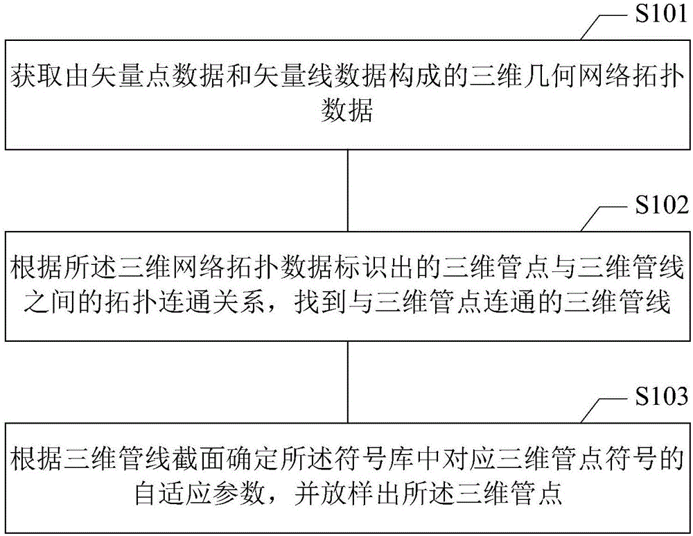
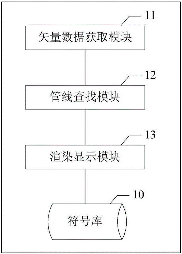
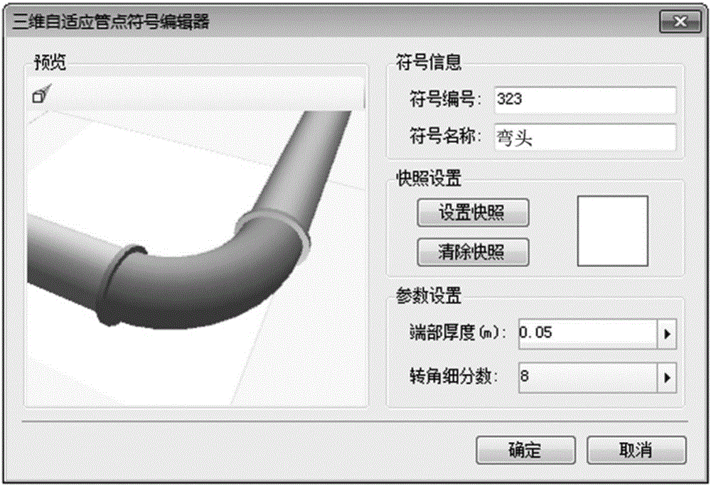
[0028] In order to make the above objects, features and advantages of the present application more obvious and understandable, the present application will be further described in detail below in conjunction with the accompanying drawings and specific implementation methods.
[0029] In the description of the present application, it should be understood that the terms "first" and "second" are used for description purposes only, and cannot be interpreted as indicating or implying relative importance or implicitly indicating the quantity of indicated technical features. Thus, a feature defined as "first" and "second" may explicitly or implicitly include one or more of these features. "Plurality" means two or more, unless otherwise clearly and specifically defined. The terms "including", "comprising" and similar terms should be understood as open-ended terms, ie "including / comprising but not limited to". The term "based on" is "based at least in part on". The term "an embodimen...
PUM
 Abstract
Description
Claims
Application Information