Route planning method and system applied to plant protection of unmanned aerial vehicle

A technology of unmanned aerial vehicles and routes, applied in the direction of navigation calculation tools, etc., can solve the problems that the efficiency and quality of route planning are affected by human factors, and cannot realize batch automation processing, etc., so as to improve the efficiency and quality of route planning, and the number of return routes little effect

Inactive Publication Date: 2017-05-17
北京艾森博航空科技股份有限公司
View PDF5 Cites 18 Cited by
  • Summary
  • Abstract
  • Description
  • Claims
  • Application Information

AI Technical Summary

Problems solved by technology

However, the main disadvantage of this route planning method is that the starting edge of the route needs to be manually specifi

Method used


Image

  • Route planning method and system applied to plant protection of unmanned aerial vehicle
  • Route planning method and system applied to plant protection of unmanned aerial vehicle
  • Route planning method and system applied to plant protection of unmanned aerial vehicle

Examples


Example Embodiment

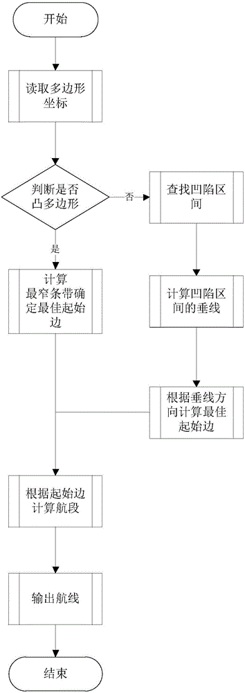
[0048] The present invention will be described below in conjunction with the drawings and specific embodiments. It should be understood that the specific embodiments described here are only used to explain the present invention, but not to limit the present invention.

[0049] According to an embodiment of the present invention, a route planning method applied to UAV plant protection is provided.
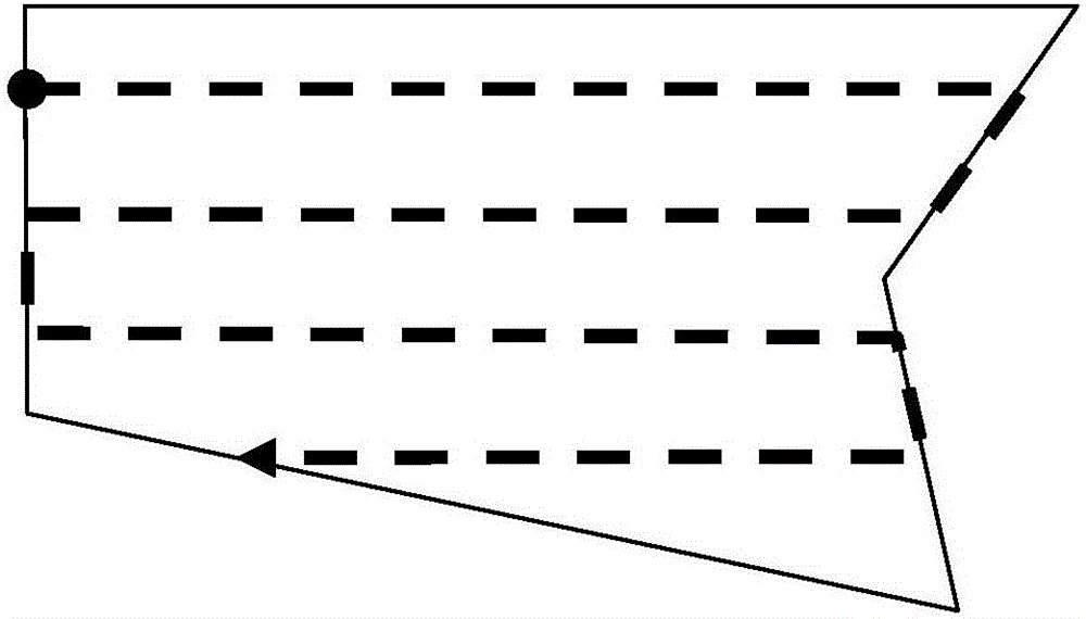
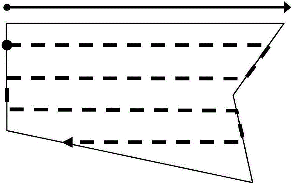
[0050] In summary, the method includes: judging whether the plot polygon is a convex polygon; if it is a convex polygon, calculating the narrowest strip of the convex polygon to determine the starting edge; otherwise, based on the vertical line of the concave interval of the plot polygon The direction and the length of each side of the plot polygon determine the starting side (hereinafter also referred to as the best starting side); the route is calculated based on the starting side (hereinafter also referred to as the best route).

[0051] Combine below image 3 , To describe in detail t...


PUM


Abstract

The invention relates to a route planning method and a route planning system which are applied to plant protection of an unmanned aerial vehicle. The method comprises the steps of judging whether the polygon of a plot is a convex polygon; calculating the narrowest strip of the convex polygon so as to determine a starting edge if the polygon of the plot is the convex polygon; otherwise, determining the starting edge according to the perpendicular direction of the sunk interval of the polygon of the plot and the length of each edge of the polygon of the plot; calculating a route according to the starting edge. According to the route planning method and the route planning system, the optimal starting edge and the optimal route can be automatically calculated according to the shape of the plot, so that the route planning efficiency and quality are increased; in addition, the actual demand of a concave polygon is considered in a route planning process, so that the route is prevented from passing through the boundary of the plot so as not to pass through exterior areas of the plot.

Description

technical field [0001] The present invention relates to the field of UAV plant protection, more specifically, to a route planning method and system applied to UAV plant protection. Background technique [0002] UAV plant protection is the use of UAVs for agricultural, forestry and plant protection operations. The operation usually uses an autonomous flight mode (that is, the UAV automatically flies according to the set route) or the driver controls the UAV flight through the remote control. For autonomous flight modes, route planning is an important preparatory step before operations. Route planning refers to the computer software system calculating a reasonable route covering the entire plot based on the coordinates of the farmland plot (usually the plane projection coordinates of the plot). The route is usually composed of multiple flight segments that turn back and forth within the plot, such as figure 1 (It should be noted that land parcels are usually represented in t...

Claims


Application Information

Patent Timeline
IPC IPC(8): G01C21/20
CPCG01C21/20
Inventor 于雷易刘阳锋梁志生
Owner 北京艾森博航空科技股份有限公司
Why Eureka
Try Eureka