Street view image based three-dimensional measurement algorithm for geographical location and height of target object

A technology of geographic location and target object, which is applied in the field of three-dimensional measurement of the geographic location and height of the target object based on street view pictures, and can solve the problem that the street view map cannot obtain information such as actual geographic location and height.

Active Publication Date: 2017-06-30
NANJING POLAGIS TECH CO LTD +1
View PDF5 Cites 13 Cited by
  • Summary
  • Abstract
  • Description
  • Claims
  • Application Information

AI Technical Summary

Problems solved by technology

[0006] The present invention aims to solve the problem that the existing street view map cannot realize the acquisition of information such as the actual geographic location and height of the target object in the street view picture

Method used


Image

  • Street view image based three-dimensional measurement algorithm for geographical location and height of target object
  • Street view image based three-dimensional measurement algorithm for geographical location and height of target object
  • Street view image based three-dimensional measurement algorithm for geographical location and height of target object

Examples


Embodiment 1

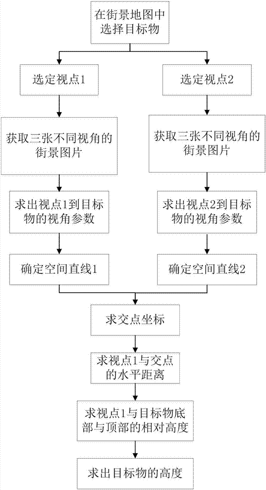
[0060] This embodiment takes Google's street view map as an example to further describe the technical solution of the present invention. Such as figure 1 Shown, flow process of the present invention comprises the following steps:

[0061] Step 1: In the street view map, select the viewpoint that contains the target object to be measured within the range of two viewing angles;

[0062] Step 2: Obtain the latitude and longitude of the selected two viewpoints;

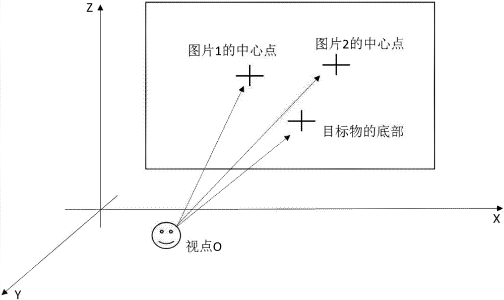
[0063] Step 3: Obtain three street view images with different perspectives under two viewpoints, namely street view image 1, street view image 2 and street view image 3, where street view image 1 is the reference image, street view image 2 is different from street view image 1 in horizontal angle, The pitch angle is the same, the horizontal angle of Street View image 3 is the same as that of Street View image 1, but the pitch angle is different;

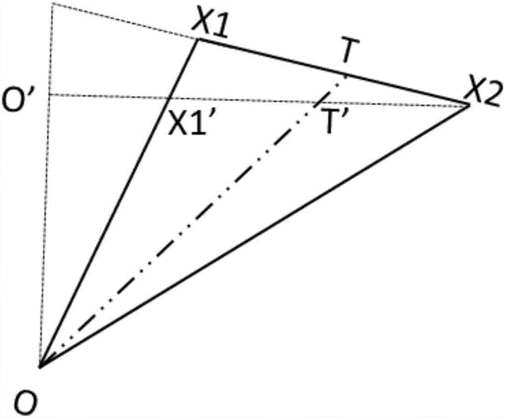
[0064] Step 4: Calculate the viewing angle from the two viewpoints to a ...


PUM


Abstract

The invention relates to a street view image based three-dimensional measurement algorithm for geographical location and height of a target object. The algorithm comprises the following steps: a target object is selected firstly in a street view map, two proper viewpoints are selected according to the target object, and longitudes and latitudes of the two viewpoints are obtained; three street view images at different view angles are obtained respectively under the two viewpoints; the horizontal angle and the pitch angle of the target object under the viewpoints are calculated according to the three street view images; two spatial straight lines are determined according to the longitudes and latitudes of the viewpoints and the view angle from each viewpoint to the bottom of the target object, fronts of the two straight lines intersect, the intersection point of the two straight lines is solved, and the intersection point is the geographical location of the target object; then the actual height of the target object is solved on the basis of the longitudes and the latitudes of the viewpoints, obtained longitude and latitude of the target object as well as the pitch angle from each viewpoint to the top and the bottom of the target object. The existing street view resources are used effectively, and further application of the existing street view resources to smart city, intelligent transportation and other aspects is facilitated.

Description

technical field [0001] The present invention relates to the fields of street view map, electronic cartography, photogrammetry, GIS, Web service, computer graphics, etc. Its purpose is to realize the direct measurement of the actual geographical position of the target object in the street view map on the basis of the existing street view map resources . It specifically involves Http requests, the determination of spatial straight lines in the polar coordinate system, and the intersection of front and so on. Background technique [0002] Street View is a reality map service. Provide users with a city, street or other environment with a street panorama of 360° in the horizontal direction and 180° in the vertical direction, so that the user can view the different positions of the street on the ground of the selected city and the scenery on both sides. It is a three-dimensional virtual display technology that uses multiple cameras to collect multi-angle images of the real scene...

Claims


Application Information

Patent Timeline
Patent Type & Authority Applications(China)
IPC IPC(8): G01C11/08
CPCG01C11/08
Inventor 周良辰闾征远闾国年
Owner NANJING POLAGIS TECH CO LTD
Why Eureka
Try Eureka