Flight-line design method with single-lens oblique photography, system and aerial photography method

A technology of oblique photography and circuit design, which is applied in the field of aerial photogrammetry, can solve the problems of poor imaging quality, low safety, and low efficiency, and achieve the effect of improving efficiency, avoiding loopholes in aerial photography, and lowering the threshold of oblique photography

Inactive Publication Date: 2017-10-20
南宁市勘测设计院集团有限公司
View PDF6 Cites 22 Cited by
  • Summary
  • Abstract
  • Description
  • Claims
  • Application Information

AI Technical Summary

Problems solved by technology

Large fixed-wing UAVs are mostly gasoline-powered aircraft, which are not safe to operate in urban areas
Multi-rotor UAVs have high safety, but low efficiency. Generally, they are equipped with five QX1 lens cameras, and the image quality is poor.

Method used


Image

  • Flight-line design method with single-lens oblique photography, system and aerial photography method
  • Flight-line design method with single-lens oblique photography, system and aerial photography method
  • Flight-line design method with single-lens oblique photography, system and aerial photography method

Examples


Embodiment Construction

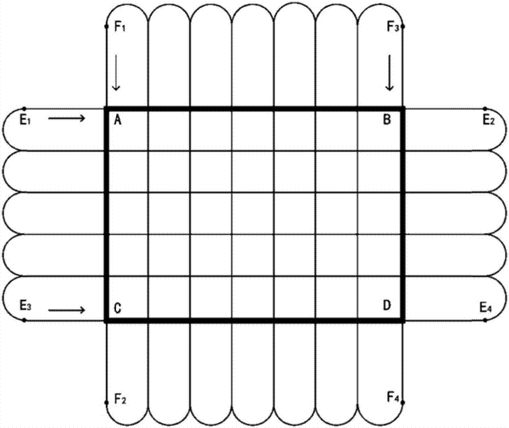
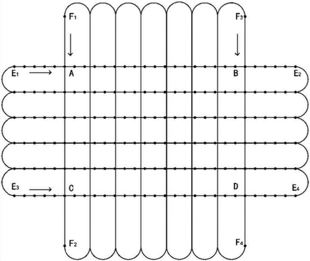
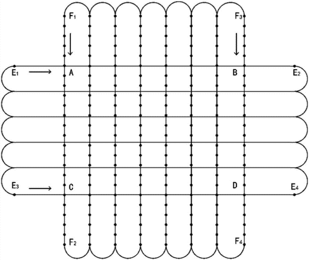
[0029] The flight range of the present invention is a rectangular area with a length of 1.4km and a width of 1.0km.

[0030] Technical requirements: ground resolution 0.05m, course overlap 70%, side overlap 50%.

[0031] The installation of the camera lens of the present invention should be towards the direction of the nose of the aircraft; the installation angle of the camera is 45°.

[0032] Let the relative flight height be H, the focal length be f, the pixel size be P, the ground resolution be G, the photographic scale be 1 / M, W be the width of the CCD size of the digital camera, V be the height of the CCD size of the digital camera, S W is the number of pixels corresponding to W, S V is the corresponding number of pixels on V, W 影像 is the image width, V 影像 is the image height, A is the heading overlap, D is the side overlap, L 基 is the length of the photographic baseline, L 间 is the route interval, N is the number of sub-regional routes, L 分区宽度 is the width of the a...


PUM


Abstract

The invention discloses a flight-line design method with single-lens oblique photography, a system and an aerial photography method. The flight-line design method comprises the following steps: obtaining the aerial range and the technical requirements; installing a single-lens camera, calculating aerial parameters, and carrying out flight-line design according to the aerial parameters. The flight-line design method, the system and the aerial photography method disclosed by the invention can be used for popularizing oblique photography of an unmanned aerial vehicle, and have the advantages that the threshold of the oblique photography is lowered and the efficiency of the oblique photography of the unmanned aerial vehicle is improved.

Description

technical field [0001] The invention relates to the field of aerial photogrammetry, in particular to a single-lens oblique photography aerial flight route design method, system and aerial photography method. Background technique [0002] Oblique photography technology is a high-tech developed in the field of international surveying and mapping in recent years. It overturns the previous limitation that orthophotos can only be taken from a vertical angle. Collect images from five different angles including four tilts. [0003] In recent years, the drone industry has developed rapidly, especially light and small drones, which are widely used in aerial photography, surveying and mapping, agricultural plant protection, power inspection, disaster relief, news reports and other fields. At present, the mainstream of oblique photography is to use manned drones, large fixed-wing drones, and multi-rotor drones equipped with 5 cameras. The efficiency of manned aircraft is high, and it...

Claims


Application Information

Patent Timeline
Patent Type & Authority Applications(China)
IPC IPC(8): G01C21/20G01C11/00
CPCG01C21/20G01C11/00
Inventor 胡震天陈启华陶美斌张伟坤王昊周晓琴刘燕芳王明金
Owner 南宁市勘测设计院集团有限公司
Why Eureka
Try Eureka