Trip segment identification method based on GPS trajectory data

An identification method and trajectory data technology, applied in the field of computer identification, can solve the problems of GPS signal error, the method is not practical, lack of methods for determining and removing false endpoints, etc., to achieve accurate identification results, simple algorithms, and rich algorithm systems. Effect

Inactive Publication Date: 2017-11-07
SHANGHAI JIAO TONG UNIV
View PDF7 Cites 9 Cited by
  • Summary
  • Abstract
  • Description
  • Claims
  • Application Information

AI Technical Summary

Problems solved by technology

[0005] 1) Since there may be errors in the GPS signal, the existing method directly uses the speed value in the GPS recorded data for correlation calculation, and there will be a large deviation;
[0006] 2) Lack of perfect raw data cleaning and preprocessing methods, such as identification and removal of signal drift points;
[0007] 3) Af

Method used


Image

  • Trip segment identification method based on GPS trajectory data
  • Trip segment identification method based on GPS trajectory data
  • Trip segment identification method based on GPS trajectory data

Examples


Embodiment Construction

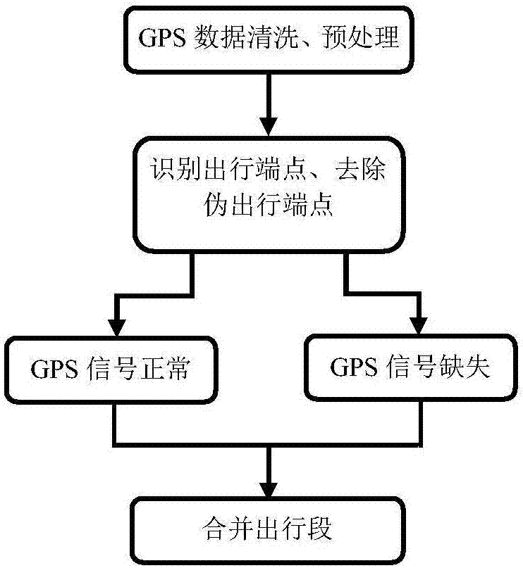
[0032] The following is a detailed description of the embodiments of the present invention. This embodiment is carried out based on the technical solution of the present invention, and provides detailed implementation methods and specific operation processes.

[0033] 1. Data cleaning and preprocessing

[0034] The collected GPS trajectory data generally includes: user number, positioning time, longitude, latitude, altitude, speed, direction and number of positioning satellites.

[0035] According to the user number, GPS data is assigned to each person's daily travel in chronological order.

[0036] Perform data cleaning and preprocessing according to the following rules:

[0037] 1. Remove track points with less than 4 positioning satellites;

[0038] 2. Remove track points with an altitude greater than 200 meters (Shanghai area);

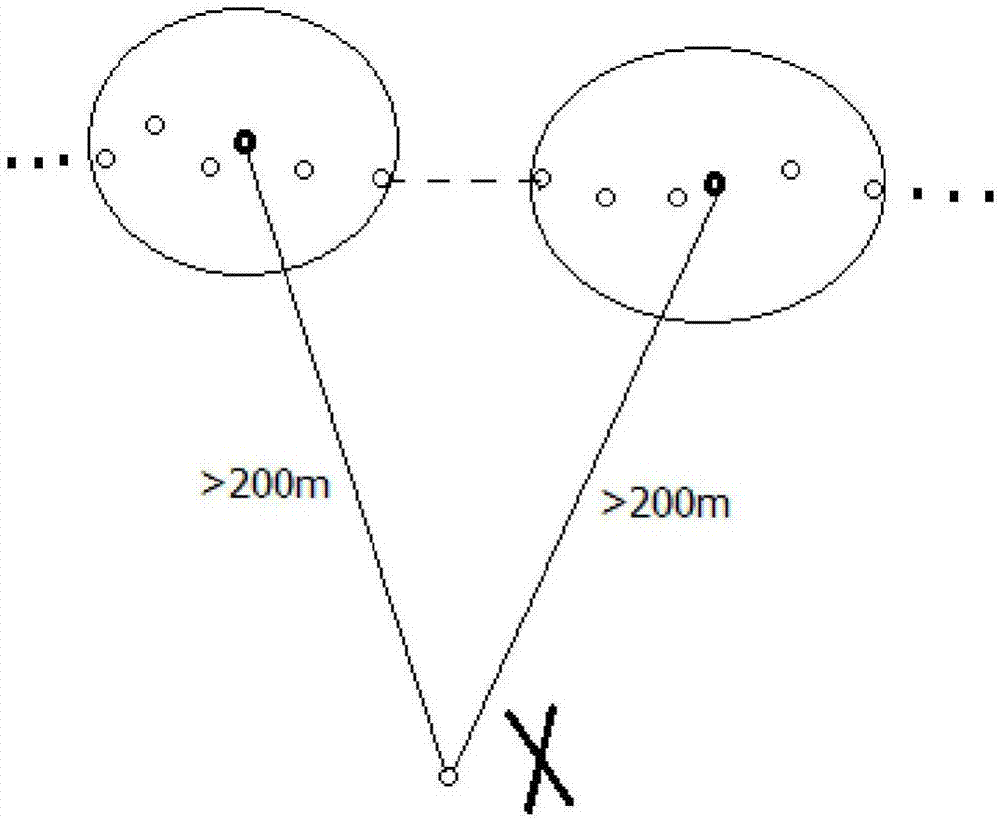
[0039] 3. Identification and elimination of signal drift points: the distance between this point and the center of the previous 5 points excee...


PUM


Abstract

The invention discloses a trip segment identification method based on GPS trajectory data. The method mainly includes the following steps of data cleaning and preprocessing, identification of trip endpoints, removal of false trip endpoints and merging of trip segments. On the basis of integrated advantages of the rule method and the clustering method, the method provides data cleaning and preprocessing processes, noise generated during the identification of trip endpoints and the merging of trip segments are effectively removed, the algorithm is simple and effective and the identification result is accurate and reliable. The distance between adjacent intervals of a trajectory point and the time difference are used for calculating the instantaneous velocity of the point, and the product of the velocity and the time is used for obtaining the trip distance. The method is suitable for trip segment identification based on the GPS trajectory data, GPS trajectory data mining algorithm systems are enriched, and a theoretical support is provided for large-scale travel investigation and promotion based on smart phones.

Description

technical field [0001] The invention relates to computer identification technology, in particular to a method for identifying travel segments based on GPS trajectory data. Background technique [0002] Traditional resident travel surveys generally use face-to-face interviews, paper questionnaires, emails, and telephone calls. These methods require respondents to fill in detailed travel characteristics, and they are filled in after the trip for a day or longer. The burden on the applicant is relatively large, and there are large errors in the data filled in. For example, 1) Travelers usually approximate the travel time as 5 minutes, 10 minutes or even 15 minutes, etc., and do not provide information such as the actual travel route; Between 20%-30%, these limit the accuracy of travel data. [0003] In recent years, with the rapid popularization of smart phones, the development of GPS positioning technology has made it possible to conduct travel surveys based on mobile phone ...

Claims


Application Information

Patent Timeline
IPC IPC(8): G06F17/30G06K9/62G01S19/42
CPCG06F16/215G06F16/2465G06F16/29G01S19/421G06F18/23213
Inventor 汪宝高林杰隽志才
Owner SHANGHAI JIAO TONG UNIV
Why Eureka
Try Eureka